Enable Location

We need your location to show you interesting places around you

Discover nearby places

Find interesting locations and hidden gems around you

Precise directions

Get accurate directions and distances to places

Your location is never shared with other users. It's only used when you tap the location button.

Givat ha-Radar

Log in to your account

Start exploring — it's free

Trusted by 63,611 travelers worldwide

Continue with Google
Continue with Apple
or

We will send you a code to connect

By continuing, you accept our Terms and Conditions and our Privacy Policy

Check your inbox

We've sent a pincode in your inbox. Please enter the code below.

Givat ha-Radar
Discussion Reviews 1 Photos
5.8k Popularity

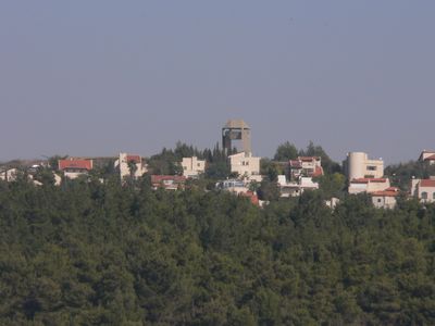
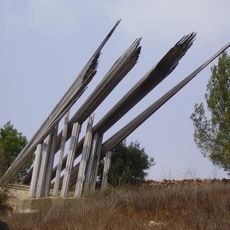
Givat ha-Radar, Summit in Jerusalem hills, Israel

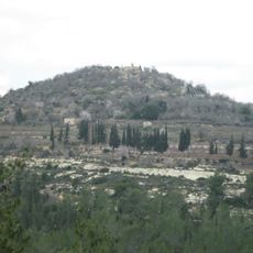
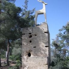
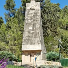
Givat ha-Radar is a summit in the Jerusalem hills at 880 meters elevation with an observation tower designed by architects Aryeh and Eldad Sharon. A two-kilometer trail connects the peak to Maale HaHamisha Forest and continues to Kiryat Anavim Military Cemetery.

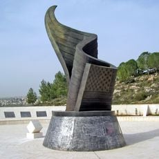
During the 1948 War of Independence, the Harel Brigade attempted to capture this strategically important hill, which was later secured during the 1967 Six Day War. These conflicts shaped the site's lasting historical importance in the region.

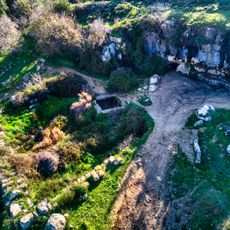
The site preserves military vehicles and tanks from the Jerusalem battles, keeping alive memories of the Harel Brigade's role in the region. These machines sit at the base of the observation tower, serving as tangible reminders of what happened here.

The walk to the summit is moderate and mostly on established paths, though the elevation should be kept in mind. Early morning or late afternoon visits offer the most comfortable temperatures and clearest views across the surrounding hills.

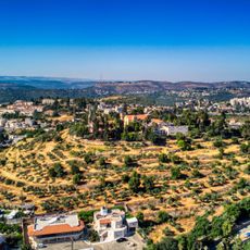
From the summit, visitors enjoy expansive views across the Jerusalem mountains that are especially rewarding on clear days. This panoramic perspective helps travelers understand the landscape and why this location held such strategic value.

The community of curious travelers

AroundUs brings together thousands of curated places, local tips, and hidden gems, enriched daily by 60,000 contributors worldwide.

Start exploring
Elevation above the sea
880 m
Part of
Jerusalem hills
GPS coordinates
31.82453,35.13022
Latest update
December 10, 2025 16:23
Reviews
Share your experience

No review yet

Discussions
Start a discussion...

No discussion yet

« Givat ha-Radar - Summit in Jerusalem hills, Israel » is provided by Around Us (aroundus.com). Images and texts are derived from Wikimedia project under a Creative Commons license. You are allowed to copy, distribute, and modify copies of this page, under the conditions set by the license, as long as this note is clearly visible.

Discover hidden gems everywhere you go!

From secret cafés to breathtaking viewpoints, skip the crowded tourist spots and find places that match your style. Our app makes it easy with voice search, smart filtering, route optimization, and insider tips from travelers worldwide. Download now for the complete mobile experience.

Around Us App Screenshot

A unique approach to discovering new places

Le Figaro

All the places worth exploring

France Info

A tailor-made excursion in just a few clicks

20 Minutes

Around Us
Travel Guide & Maps
Download

Send to your phone

QR Code
1

Open the camera app on your mobile.

2

Point at the QR code with your camera. A notification will appear.

3

Tap the notification to open the link.