Enable Location

We need your location to show you interesting places around you

Discover nearby places

Find interesting locations and hidden gems around you

Precise directions

Get accurate directions and distances to places

Your location is never shared with other users. It's only used when you tap the location button.

Brennisteinsalda

Log in to your account

Start exploring — it's free

Trusted by 62,366 travelers worldwide

Continue with Google
Continue with Apple
or

We will send you a code to connect

By continuing, you accept our Terms and Conditions and our Privacy Policy

Check your inbox

We've sent a pincode in your inbox. Please enter the code below.

Brennisteinsalda

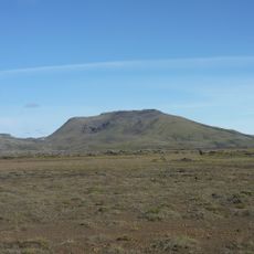
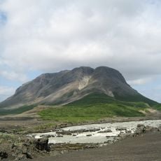
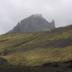
Brennisteinsalda, Volcanic peak in Landmannalaugar, Iceland

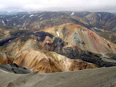
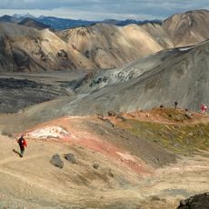
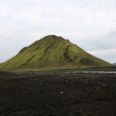
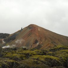
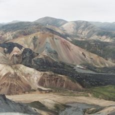
Brennisteinsalda is an 855-meter volcanic peak in Landmannalaugar with slopes displaying red, green, black, and yellow colors created by iron and sulfur mineral deposits. These hues come from layers of colored lava visible from different angles as you walk around the mountain.

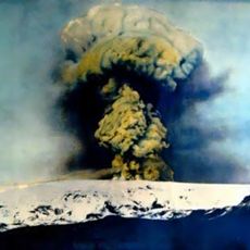
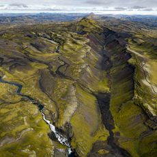
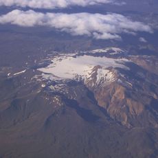
The volcano is part of Iceland's southern region and experienced its most recent eruption in 1961, which altered the surrounding landscape. This volcanic activity shaped the geological features visible today.

The name Brennisteinsalda comes from Icelandic words meaning sulfur wave, reflecting the sulfur-rich deposits that cover the mountain's surface.

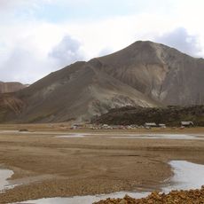
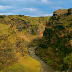
The Laugavegur hiking trail provides access to the mountain, with marked paths leading you through the colored rhyolite hills and geothermal areas. The routes are clearly marked and easy to follow, even though the terrain is uneven in places.

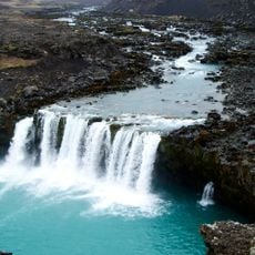
In front of the mountain stretches an obsidian lava field that creates a sharp contrast with the multicolored slopes and steam-emitting vents. This smooth black rock tells of an older volcanic phase and forms a striking geological composition.

The community of curious travelers

AroundUs brings together thousands of curated places, local tips, and hidden gems, enriched daily by 60,000 contributors worldwide.

Start exploring
GPS coordinates
63.98091,-19.09554
Latest update
December 12, 2025 16:42
« Brennisteinsalda - Volcanic peak in Landmannalaugar, Iceland » is provided by Around Us (aroundus.com). Images and texts are derived from Wikimedia project under a Creative Commons license. You are allowed to copy, distribute, and modify copies of this page, under the conditions set by the license, as long as this note is clearly visible.

Discover hidden gems everywhere you go!

From secret cafés to breathtaking viewpoints, skip the crowded tourist spots and find places that match your style. Our app makes it easy with voice search, smart filtering, route optimization, and insider tips from travelers worldwide. Download now for the complete mobile experience.

Around Us App Screenshot

A unique approach to discovering new places

Le Figaro

All the places worth exploring

France Info

A tailor-made excursion in just a few clicks

20 Minutes

Around Us
Travel Guide & Maps
Download

Send to your phone

QR Code
1

Open the camera app on your mobile.

2

Point at the QR code with your camera. A notification will appear.

3

Tap the notification to open the link.