Chest opened
+${chestReward.xp} XP
Explorer
NOUVEAU ×${chestReward.collectible.quantity}
tapez pour fermer
Chest locked

Open chests in the app

Around Us is built for your phone — chests unlock when you walk, explore and capture nearby places.

Enable Location

We need your location to show you interesting places around you

Discover nearby places

Find interesting locations and hidden gems around you

Precise directions

Get accurate directions and distances to places

Your location is never shared with other users. It's only used when you tap the location button.

Neryungri

Log in to your account

Start exploring — it's free

Trusted by 72,883 travelers worldwide

Continue with Google
Continue with Apple
or

We will send you a code to connect

By continuing, you accept our Terms and Conditions and our Privacy Policy

Check your inbox

We've sent a pincode in your inbox. Please enter the code below.

Neryungri
Discussion Reviews 1 Photos
129k Popularity

Neryungri, Industrial town in Sakha Republic, Russia

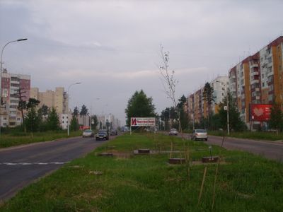
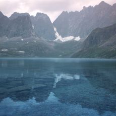
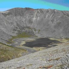
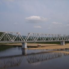
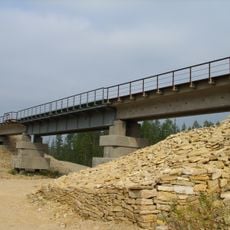
Neryungri sits high on a plateau in eastern Russia, where winters last many months and summer arrives late. The town spreads across terrain covered by taiga forest, with low-rise buildings arranged along straight roads.

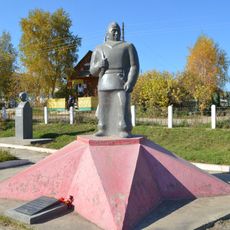
Coal deposits discovered in the early 1970s prompted the construction of this settlement, which became a town by 1975. Miners and their families arrived from other Soviet regions to work in the new industrial zone.

Russian workers and Yakut families share the streets and public spaces of this industrial settlement, where both languages are spoken. The mix reflects how resource extraction brought together people from different parts of the country in the second half of the 20th century.

Visitors arrive by train on the Amur-Yakutsk line or by road via the Lena Highway, and a local airport serves the area from a site to the north. Warm clothing is necessary year-round, as temperatures drop sharply even in the brief summer months.

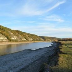
The name comes from the Evenki word nyuruungra, which referred to a river where grayling once swam in large numbers. This fish was an important food source for indigenous groups before coal mining reshaped the area.

The community of curious travelers

AroundUs brings together thousands of curated places, local tips, and hidden gems, enriched daily by 60,000 contributors worldwide.

Start exploring
Inception
1975
Elevation above the sea
850 m
GPS coordinates
56.65833,124.72500
Latest update
December 12, 2025 22:00
Around this place
Lena Pillars
Russian Federation

Lena Pillars

517.8 km
Chara Sands
Russian Federation

Chara Sands

401.7 km
Zeya Dam
Russian Federation

Zeya Dam

360.8 km
Highland of Aldan
Russian Federation

Highland of Aldan

104.8 km
Olyokma Nature Reserve
Russian Federation

Olyokma Nature Reserve

266.5 km
Zeya Nature Reserve
Russian Federation

Zeya Nature Reserve

343.7 km
Vitim Nature Reserve
Russian Federation

Vitim Nature Reserve

484.4 km
Lake Bolshoye Toko
Russian Federation

Lake Bolshoye Toko

385.7 km
Pik BAM
Russian Federation

Pik BAM

436.6 km
Kodar National Park
Russian Federation

Kodar National Park

437.2 km
Russian Federation

Сиреневый Камень

386.1 km
Russian Federation

Aku Volcano

450.2 km
Udokan Plateau
Russian Federation

Udokan Plateau

429.6 km
Buotama
Russian Federation

Buotama

479.3 km
Tokinsko-Stanovoy National Park
Russian Federation

Tokinsko-Stanovoy National Park

353.6 km
Памятник воинам-землякам, погибшим в годы Великой Отечественной войны (Томмот)
Russian Federation

Памятник воинам-землякам, погибшим в годы Великой Отечественной войны (Томмот)

273.7 km
Мемориал Славы (Нерюнгри)
Russian Federation

Мемориал Славы (Нерюнгри)

1.4 km
Памятник И. Н. Кульбертинову (Олёкминск)
Russian Federation

Памятник И. Н. Кульбертинову (Олёкминск)

483.4 km
Ягодний (Амурська область)
Russian Federation

Ягодний (Амурська область)

344.2 km
Orthodox church of the New Martyrs and Confessors of Russia in Aldan
Russian Federation

Orthodox church of the New Martyrs and Confessors of Russia in Aldan

221.3 km
Road bridge over Aldan River in Tommot
Russian Federation

Road bridge over Aldan River in Tommot

272.8 km
Gora Burgalenzha
Russian Federation

Gora Burgalenzha

499.4 km
Railway bridge through Amga river in Verkhnyaya Amga
Russian Federation

Railway bridge through Amga river in Verkhnyaya Amga

361.4 km
Railway bridge through Aldan river in Tommot
Russian Federation

Railway bridge through Aldan river in Tommot

273 km
Railway bridge through Lyutenge river
Russian Federation

Railway bridge through Lyutenge river

541.1 km
Gora Yuzhnyy Krest
Russian Federation

Gora Yuzhnyy Krest

490.8 km
Road bridge over Amga River in Verkhnyaya Amga
Russian Federation

Road bridge over Amga River in Verkhnyaya Amga

361.2 km
Rail bridge over Ulu river
Russian Federation

Rail bridge over Ulu river

436.2 km
Show the full map
Reviews
Share your experience

No review yet

Discussions
Start a discussion...

No discussion yet

« Neryungri - Industrial town in Sakha Republic, Russia » is provided by Around Us (aroundus.com). Images and texts are derived from Wikimedia project under a Creative Commons license. You are allowed to copy, distribute, and modify copies of this page, under the conditions set by the license, as long as this note is clearly visible.

Discover hidden gems everywhere you go!

From secret cafés to breathtaking viewpoints, skip the crowded tourist spots and find places that match your style. Our app makes it easy with voice search, smart filtering, route optimization, and insider tips from travelers worldwide. Download now for the complete mobile experience.

Around Us App Screenshot

A unique approach to discovering new places

Le Figaro

All the places worth exploring

France Info

A tailor-made excursion in just a few clicks

20 Minutes

Around Us
Travel Guide & Maps
Download

Send to your phone

QR Code
1

Open the camera app on your mobile.

2

Point at the QR code with your camera. A notification will appear.

3

Tap the notification to open the link.