·

Enable Location

We need your location to show you interesting places around you

Discover nearby places

Find interesting locations and hidden gems around you

Precise directions

Get accurate directions and distances to places

Your location is never shared with other users. It's only used when you tap the location button.

Kazbekovsky District

Log in to your account

Start exploring — it's free

Trusted by 62,658 travelers worldwide

Continue with Google
Continue with Apple
or

We will send you a code to connect

By continuing, you accept our Terms and Conditions and our Privacy Policy

Check your inbox

We've sent a pincode in your inbox. Please enter the code below.

Kazbekovsky District

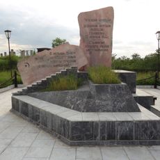
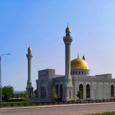
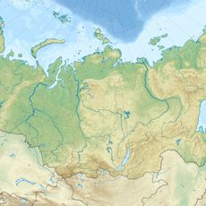
Kazbekovsky District, Municipal district in Dagestan, Russia.

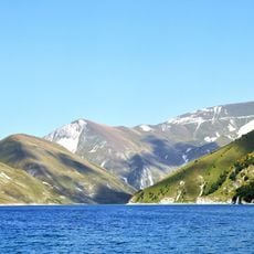
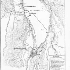
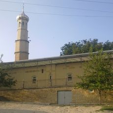
Kazbekovsky District is a municipal district in Dagestan spread across forested foothills with elevations ranging from 500 to 1900 meters. It comprises fifteen rural settlements and one urban center, Dylym, which serves as the administrative hub.

The district was established as an administrative entity in 1928 and remained part of the Dagestan Autonomous Soviet Socialist Republic until 1991. This institutional framework shaped its development throughout the Soviet period.

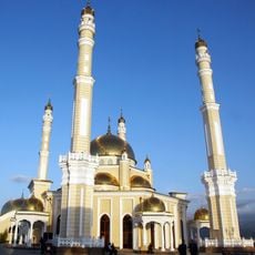
Several ethnic groups live across the settlements, each maintaining their own languages and traditions in daily life. This cultural mix shapes how communities in the district interact and celebrate together.

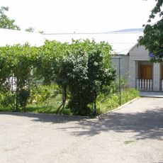
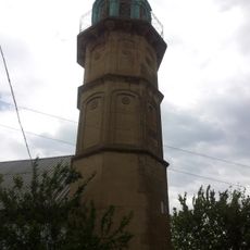
Dylym serves as the main hub for administrative services and information about the area. The hilly to mountainous terrain means roads vary in condition, so visitors should prepare for different elevations and driving conditions when exploring settlements.

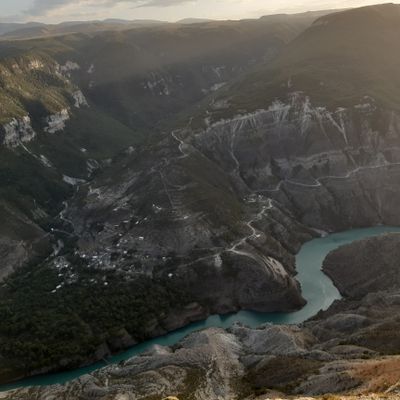
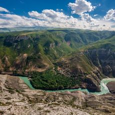
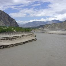
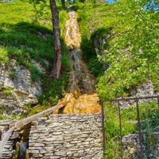
The Aktash River flows through the district from southeast to northwest, carving out the mountainous landscape. This natural waterway is vital to local farming and the region's ecological balance.

The community of curious travelers

AroundUs brings together thousands of curated places, local tips, and hidden gems, enriched daily by 60,000 contributors worldwide.

Start exploring
Location
Inception
1928
Capital city
Dylym
GPS coordinates
43.07139,46.63167
Latest update
December 7, 2025 20:46
Around this place
Sulak Canyon
Russian Federation

Sulak Canyon

17.4 km
Kezenoyam
Russian Federation

Kezenoyam

50.9 km
Chirkey Dam
Russian Federation

Chirkey Dam

22.1 km
Chirkey Reservoir
Russian Federation

Chirkey Reservoir

23.6 km
Gimry tower
Russian Federation

Gimry tower

41.2 km
Church of the Theotokos of the Sign
Russian Federation

Church of the Theotokos of the Sign

19.8 km
Irganai Reservoir
Russian Federation

Irganai Reservoir

49 km
Fortress of the Holy Cross
Russian Federation

Fortress of the Holy Cross

53 km
Хой (башня)
Russian Federation

Хой (башня)

54 km
Preobragenskaya Fortres
Russian Federation

Preobragenskaya Fortres

57.6 km
Kurchaloy Mosque
Russian Federation

Kurchaloy Mosque

46.3 km
Monument to the Victims of Stalinism Chechens Akkin
Russian Federation

Monument to the Victims of Stalinism Chechens Akkin

14.9 km
Geldegan Mosque
Russian Federation

Geldegan Mosque

50.7 km
Oyskhara Mosque
Russian Federation

Oyskhara Mosque

38.1 km
Gerzel-aul
Russian Federation

Gerzel-aul

26.3 km
Евгеньевское укрепление
Russian Federation

Евгеньевское укрепление

26 km
Харачойский водопад
Russian Federation

Харачойский водопад

42.8 km
Айдамиров Абузаран Литературин-мемориалан музей
Russian Federation

Айдамиров Абузаран Литературин-мемориалан музей

23.8 km
Avtury Mosque
Russian Federation

Avtury Mosque

52.1 km
Мемориальный комплекс участникам ВОВ
Russian Federation

Мемориальный комплекс участникам ВОВ

14.8 km
Крепость Ведено
Russian Federation

Крепость Ведено

44.9 km
Mayrtup Cuma Mosque
Russian Federation

Mayrtup Cuma Mosque

43.8 km
Yurd-Aux məscidi
Russian Federation

Yurd-Aux məscidi

5.3 km
Canta-Aukh
Russian Federation

Canta-Aukh

17.4 km
Benoy Mosque
Russian Federation

Benoy Mosque

26.7 km
Аквапарк
Russian Federation

Аквапарк

54 km
Старинные мечети (Эндирей)
Russian Federation

Старинные мечети (Эндирей)

10.6 km
Здание вокзала на ж\д станции (Кумторкала)
Russian Federation

Здание вокзала на ж\д станции (Кумторкала)

49.9 km
Show the full map
« Kazbekovsky District - Municipal district in Dagestan, Russia » is provided by Around Us (aroundus.com). Images and texts are derived from Wikimedia project under a Creative Commons license. You are allowed to copy, distribute, and modify copies of this page, under the conditions set by the license, as long as this note is clearly visible.

Discover hidden gems everywhere you go!

From secret cafés to breathtaking viewpoints, skip the crowded tourist spots and find places that match your style. Our app makes it easy with voice search, smart filtering, route optimization, and insider tips from travelers worldwide. Download now for the complete mobile experience.

Around Us App Screenshot

A unique approach to discovering new places

Le Figaro

All the places worth exploring

France Info

A tailor-made excursion in just a few clicks

20 Minutes

Around Us
Travel Guide & Maps
Download

Send to your phone

QR Code
1

Open the camera app on your mobile.

2

Point at the QR code with your camera. A notification will appear.

3

Tap the notification to open the link.