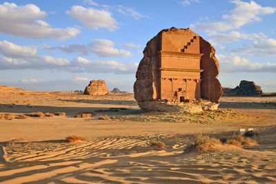
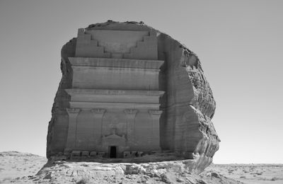
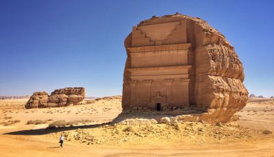
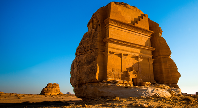
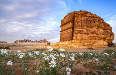
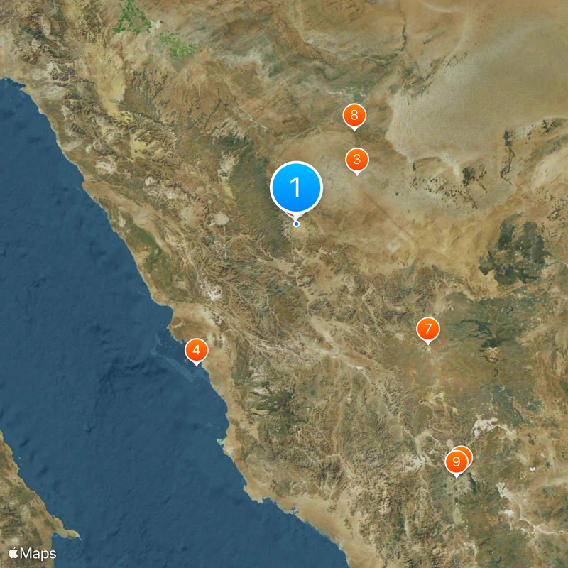
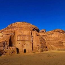
Qasr al-Farid, Nabataean rock-cut tomb in Al Ula, Saudi Arabia.
The monument rises as an isolated sandstone formation measuring 16 meters in height with a facade displaying four Corinthian columns, decorated capitals, and geometric friezes. Above the entrance sit relief elements including a triangular pediment with elaborate carvings. The structure stands alone in the desert landscape and shows Nabataean architectural style with influences of Hellenistic proportions and Arabian ornamentation in its carved details.
Nabataean stonemasons began work on this tomb in the first century after Christ, following their characteristic method of cutting from top to bottom into massive rock. Construction was abandoned for unknown reasons, possibly due to political changes following Roman annexation of the Nabataean Kingdom in 106. The unfinished work remained preserved in the desert across centuries.
This burial monument embodies Nabataean funerary architecture through capitals, pediments, and ornate stonework that document religious and social importance of the elite class. The monumental structure demonstrates technical skill and aesthetic ideals of a trading culture that bridged Mediterranean and Arabian traditions. Such rock-cut graves served as eternal resting places for wealthy families and manifested their status in Nabataean society across generations.
Visitors must register in advance at Al-Ula Winter Park visitor center and book tours through authorized operators. The site lies several kilometers outside the main archaeological zone and requires motorized transport across desert terrain. Tours operate primarily between October and April when temperatures are more moderate. Photography is permitted, but direct touching of carved surfaces is prohibited to protect the ancient sandstone.
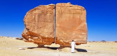
The lower section displays rough chisel marks and unworked surfaces where craftsmen laid down their tools and never returned. These visible work traces document Nabataean stone working methods and reveal that teams worked simultaneously from multiple sides. Geological analysis of tool marks allows researchers to identify iron implements used and reconstruct work sequences interrupted nearly two millennia ago.
The community of curious travelers
AroundUs brings together thousands of curated places, local tips, and hidden gems, enriched daily by 60,000 contributors worldwide.