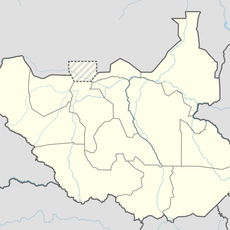
Kidepo Valley National Park, national park in Uganda
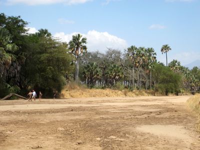
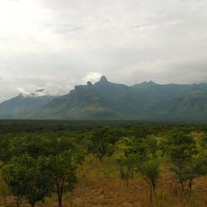
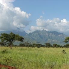
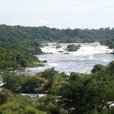
Kidepo Valley National Park is a large protected area in northeastern Uganda with vast plains, gentle hills, and deep valleys surrounded by mountains. The terrain ranges from about 3,000 feet (900 meters) to over 9,000 feet (2,750 meters) in elevation and supports hundreds of animal and bird species.
The reserve was established in the late 1950s as a game reserve to protect wildlife threatened by hunting and farming activities. It was later elevated to national park status and has served as a sanctuary for numerous species ever since.
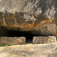
The Ik people inhabit the mountain regions and maintain traditional ways of life that visitors can experience by visiting their villages. These encounters reveal daily customs and practices of a community that has inhabited this land for generations.
Visiting is best during the dry seasons from December to March and July to August, when animals gather at water sources and are easier to observe. Travelers can join guided safaris and walks led by experienced rangers to ensure safety and optimal wildlife viewing opportunities.
The park is home to animal species rarely or never found in other protected areas of Uganda, such as African wild dogs and striped hyenas. These specialized predators have adapted to the park's rugged terrain and offer unique viewing opportunities for visitors.
Location: Northern Region
Inception: 1958
GPS coordinates: 3.93000,33.80694
Latest update: December 8, 2025 15:02
Uganda sits at the heart of East Africa, where dense tropical forests meet open savanna and the Nile River begins its long journey north. The landscape rises from the shores of Lake Victoria through rolling green hills to mountain ranges that touch over 5,000 meters, high enough to hold glaciers just kilometers from the equator. National parks protect rare mountain gorillas in the mist-covered highlands of Bwindi and Mgahinga, while chimpanzees move through the canopy of Kibale Forest. The Murchison Falls compress the full force of the Nile into a narrow gorge, and Lake Bunyonyi spreads across dozens of small islands where villages perch on terraced hillsides. Kampala, the capital, climbs across seven hills in the center of the country, where markets, temples, and modern buildings share space in a city of one and a half million people. To the east, Jinja marks the place where the White Nile leaves Lake Victoria, now a base for rafting and boat trips. Entebbe rests on a peninsula jutting into the lake, quieter than the capital, with old botanical gardens and tree-lined streets. Between these cities and the parks, travelers find royal tombs, ancient rock art, and small trading towns that connect the country from the wetlands of the west to the drier plains near Kenya.
Lira
214.1 km
Lomekwi
226.9 km
Koobi Fora
264.4 km
Central Island
253.7 km
Bandingilo National Park
238.3 km
Sibiloi National Park
281.6 km
Lothagam North Pillar Site
228.8 km
Namoratunga
228.8 km
Mount Moroto
189.7 km
Mount Kadam
261.3 km
Nimule National Park
208.1 km
Baker's Fort
194.2 km
Juba Nile Bridge
263.5 km
St. Theresa Cathedral, Juba
264.5 km
Lapurr Sandstone
225.1 km
St. Joseph's Cathedral, Gulu
215.7 km
Kinyeti
99.6 km
Karuma Falls
256.6 km
Juba Game Reserve
270.1 km
Vale Inferior do Omo
258.6 km
Juba Bridge
263.5 km
Karamoja Regional Museum
184.7 km
Nyero Rock Paintings
273.7 km
Agu
122.1 km
Sauro Rocks
120.4 km
Atalochulo
222.5 km
Donyiro Cliff
228.5 kmVisited this place? Tap the stars to rate it and share your experience / photos with the community! Try now! You can cancel it anytime.
Discover hidden gems everywhere you go!
From secret cafés to breathtaking viewpoints, skip the crowded tourist spots and find places that match your style. Our app makes it easy with voice search, smart filtering, route optimization, and insider tips from travelers worldwide. Download now for the complete mobile experience.
A unique approach to discovering new places❞
— Le Figaro
All the places worth exploring❞
— France Info
A tailor-made excursion in just a few clicks❞
— 20 Minutes