Enable Location

We need your location to show you interesting places around you

Discover nearby places

Find interesting locations and hidden gems around you

Precise directions

Get accurate directions and distances to places

Your location is never shared with other users. It's only used when you tap the location button.

Peñuelas

Log in to your account

Start exploring — it's free

Trusted by 61,569 travelers worldwide

Continue with Google
Continue with Apple
or

We will send you a code to connect

By continuing, you accept our Terms and Conditions and our Privacy Policy

Check your inbox

We've sent a pincode in your inbox. Please enter the code below.

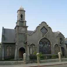
Peñuelas, Municipality in southern Puerto Rico.

Description

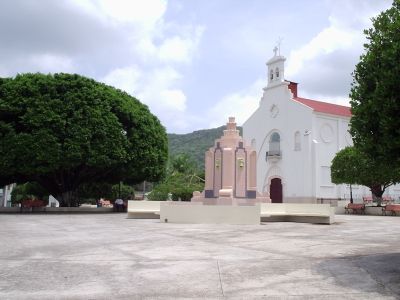
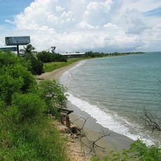
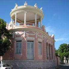
Peñuelas is a municipality in southern Puerto Rico that spreads across terrain rising from Caribbean shores toward inland mountain ranges, organized into 13 administrative districts. The landscape varies from coastal lowlands to elevated interior valleys and hills.

History

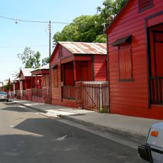
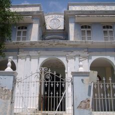
Diego de Alvarado founded the municipality in 1793 after workers from nearby coastal areas had relocated inland into more fertile valleys for better agricultural conditions. This shift inland shaped the settlement's early growth and structure.

Culture

Peñuelas hosts an annual festival in May dedicated to the güiro, a traditional percussion instrument that local artisans craft and musicians perform throughout the year. The town holds special importance as a center for this musical tradition across Puerto Rico.

Practical

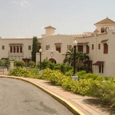
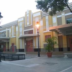
The municipality maintains administrative services from a central district location that provides access to basic municipal functions and information. Exploring the region works best with personal transportation to move between coastal and inland areas at your own pace.

Did you know?

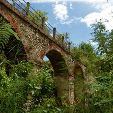
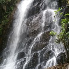
The area contains several natural caves and underground pools, including a notable cavern with a subterranean stream flowing through limestone passages. These geological formations represent rare examples of karst landscapes on the island.

Location
Inception
1793
Capital city
Peñuelas
Elevation above the sea
58 m
Shares border with
Adjuntas, Guayanilla, Ponce
GPS coordinates
18.05917,-66.72250
Latest update
December 7, 2025 19:31

AroundUs brings together thousands of curated places, local tips, and hidden gems, enriched daily by 60,000 contributors worldwide. Discover all places nearby (Puerto Rico).

Around this place
Castillo Serrallés
United States of America

Castillo Serrallés

11.8 km
Tibes Indigenous Ceremonial Center
United States of America

Tibes Indigenous Ceremonial Center

10.8 km
Hacienda Buena Vista
United States of America

Hacienda Buena Vista

7.7 km
El Tuque
United States of America

El Tuque

10.8 km
Cruceta del Vigía
United States of America

Cruceta del Vigía

11.7 km
Plaza del Mercado de Ponce
United States of America

Plaza del Mercado de Ponce

12.6 km
Portugués Dam
United States of America

Portugués Dam

9.5 km
Calle 25 de Enero
United States of America

Calle 25 de Enero

11.7 km
Ponce Ramada Hotel
United States of America

Ponce Ramada Hotel

12.6 km
Román Baldorioty de Castro National Pantheon
United States of America

Román Baldorioty de Castro National Pantheon

12.1 km
Wiechers–Villaronga House
United States of America

Wiechers–Villaronga House

12.4 km
Museo Castillo Serrallés
United States of America

Museo Castillo Serrallés

11.8 km
Estadio Francisco Montaner
United States of America

Estadio Francisco Montaner

11.5 km
Museo Hacienda Buena Vista
United States of America

Museo Hacienda Buena Vista

7.7 km
Casa Vives
United States of America

Casa Vives

12.6 km
Parque del Retiro
United States of America

Parque del Retiro

11.5 km
Museo de la Arquitectura Ponceña
United States of America

Museo de la Arquitectura Ponceña

12.4 km
Antiguo Hospital Tricoche
United States of America

Antiguo Hospital Tricoche

12.3 km
San Vicente de Paul Catholic Cemetery
Puerto Rico

San Vicente de Paul Catholic Cemetery

10.5 km
First United Methodist Church of Ponce
United States of America

First United Methodist Church of Ponce

12.4 km
Acueducto de Ponce
Puerto Rico

Acueducto de Ponce

12.2 km
Centro Español de Ponce
United States of America

Centro Español de Ponce

12.5 km
United States of America

Monte Guilarte

10.4 km
Subirá House
United States of America

Subirá House

12.4 km
Monumento a los heroes de El Polvorín
United States of America

Monumento a los heroes de El Polvorín

10.8 km
Rosaly–Batiz House
United States of America

Rosaly–Batiz House

12.1 km
Luis A. Ferré United States Courthouse and Post Office Building
United States of America

Luis A. Ferré United States Courthouse and Post Office Building

12.5 km
La Soplaera Waterfall
Puerto Rico

La Soplaera Waterfall

4.4 km
Show the full map
« Peñuelas - Municipality in southern Puerto Rico » is provided by Around Us (aroundus.com). Images and texts are derived from Wikimedia project under a Creative Commons license. You are allowed to copy, distribute, and modify copies of this page, under the conditions set by the license, as long as this note is clearly visible.

Discover hidden gems everywhere you go!

From secret cafés to breathtaking viewpoints, skip the crowded tourist spots and find places that match your style. Our app makes it easy with voice search, smart filtering, route optimization, and insider tips from travelers worldwide. Download now for the complete mobile experience.

Around Us App Screenshot

A unique approach to discovering new places

Le Figaro

All the places worth exploring

France Info

A tailor-made excursion in just a few clicks

20 Minutes

Around Us
Travel Guide & Maps
Download

Send to your phone

QR Code
1

Open the camera app on your mobile.

2

Point at the QR code with your camera. A notification will appear.

3

Tap the notification to open the link.