Enable Location

We need your location to show you interesting places around you

Discover nearby places

Find interesting locations and hidden gems around you

Precise directions

Get accurate directions and distances to places

Your location is never shared with other users. It's only used when you tap the location button.

Deerfield

Log in to your account

Start exploring — it's free

Trusted by 61,919 travelers worldwide

Continue with Google
Continue with Apple
or

We will send you a code to connect

By continuing, you accept our Terms and Conditions and our Privacy Policy

Check your inbox

We've sent a pincode in your inbox. Please enter the code below.

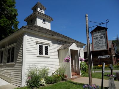
Deerfield, Colonial settlement in Franklin County, Massachusetts.

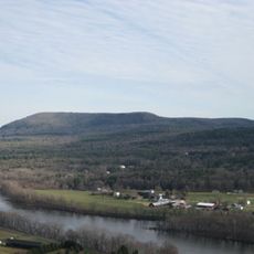
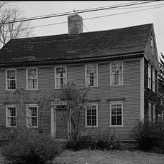
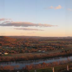
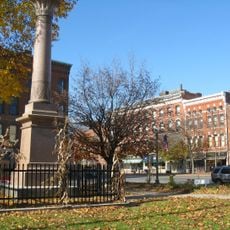
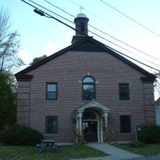
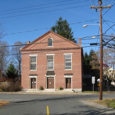
Deerfield is a historic town in Franklin County, Massachusetts, situated along the Deerfield River with meadows surrounding its settled areas. The streets are lined with buildings from the 1700s that reflect how colonial settlements were organized and built.

The settlement was founded in 1673 as a frontier outpost facing indigenous attacks and armed conflicts during its early decades. These incidents shaped how the community developed and how residents organized their defenses.

The town displays colonial-era furnishings, textiles, and handcrafted objects within restored houses that show how residents lived daily during the 1700s. These items reflect the skills and tastes of families who built this community.

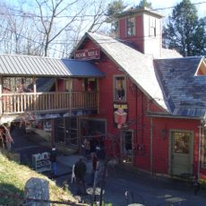
The site is easy to walk through since the main houses and museums are arranged along a single street. Plan time for indoor visits, as most buildings require guided tours to view their interiors and collections.

The Memorial Hall Museum holds one of the oldest collections of local objects, including tools made by indigenous peoples and everyday household items from colonial times. These objects reveal both the material culture of settlers and the peoples who inhabited the area before them.

The community of curious travelers

AroundUs brings together thousands of curated places, local tips, and hidden gems, enriched daily by 60,000 contributors worldwide.

Start exploring
Location
Inception
1673
Elevation above the sea
46 m
GPS coordinates
42.54500,-72.60444
Latest update
December 20, 2025 12:42
Around this place
Buttonball Tree
United States of America

Buttonball Tree

8.7 km
Sugarloaf Mountain
United States of America

Sugarloaf Mountain

8.4 km
Mount Toby
United States of America

Mount Toby

8.4 km
Historic Deerfield
United States of America

Historic Deerfield

224 m
Bookmill
United States of America

Bookmill

5.6 km
Mount Sugarloaf State Reservation
United States of America

Mount Sugarloaf State Reservation

8.4 km
Canalside Rail Trail Bridge
United States of America

Canalside Rail Trail Bridge

4.5 km
Sunderland Bridge
United States of America

Sunderland Bridge

8.8 km
Bardwell's Ferry Bridge
United States of America

Bardwell's Ferry Bridge

6.2 km
General Pierce Bridge
United States of America

General Pierce Bridge

4.4 km
Dedic Site
United States of America

Dedic Site

1.2 km
Pocumtuck Ridge Trail
United States of America

Pocumtuck Ridge Trail

2.6 km
Main Street Historic District
United States of America

Main Street Historic District

4.7 km
Franklin County Fairgrounds
United States of America

Franklin County Fairgrounds

3.8 km
Springfield Terminal railroad bridge, Deerfield
United States of America

Springfield Terminal railroad bridge, Deerfield

4.4 km
Conway Center Historic District
United States of America

Conway Center Historic District

8.6 km
Robert Frost Trail
United States of America

Robert Frost Trail

8.4 km
United States of America

Conway Hills Wildlife Sanctuary

7.5 km
Montague Center Historic District
United States of America

Montague Center Historic District

5.8 km
United States of America

Roaring Brook Reservoir

9.7 km
United States of America

Old Deerfield Village Historic District

372 m
Mount Toby Fire Tower
United States of America

Mount Toby Fire Tower

8.4 km
Montague City Covered Bridge
United States of America

Montague City Covered Bridge

4.5 km
Newton Street School
United States of America

Newton Street School

4.6 km
United States of America

Greenfield Energy Park

4.6 km
United States of America

Historic Deerfield Walking Tour

198 m
United States of America

Mike's Maze

9.5 km
Greenfield Money Tree
United States of America

Greenfield Money Tree

4.9 km
Show the full map
« Deerfield - Colonial settlement in Franklin County, Massachusetts » is provided by Around Us (aroundus.com). Images and texts are derived from Wikimedia project under a Creative Commons license. You are allowed to copy, distribute, and modify copies of this page, under the conditions set by the license, as long as this note is clearly visible.

Discover hidden gems everywhere you go!

From secret cafés to breathtaking viewpoints, skip the crowded tourist spots and find places that match your style. Our app makes it easy with voice search, smart filtering, route optimization, and insider tips from travelers worldwide. Download now for the complete mobile experience.

Around Us App Screenshot

A unique approach to discovering new places

Le Figaro

All the places worth exploring

France Info

A tailor-made excursion in just a few clicks

20 Minutes

Around Us
Travel Guide & Maps
Download

Send to your phone

QR Code
1

Open the camera app on your mobile.

2

Point at the QR code with your camera. A notification will appear.

3

Tap the notification to open the link.