Chest opened
+${chestReward.xp} XP
Explorer
NOUVEAU ×${chestReward.collectible.quantity}
tapez pour fermer
Chest locked

Open chests in the app

Around Us is built for your phone — chests unlock when you walk, explore and capture nearby places.

Enable Location

We need your location to show you interesting places around you

Discover nearby places

Find interesting locations and hidden gems around you

Precise directions

Get accurate directions and distances to places

Your location is never shared with other users. It's only used when you tap the location button.

French Broad River

Log in to your account

Start exploring — it's free

Trusted by 72,931 travelers worldwide

Continue with Google
Continue with Apple
or

We will send you a code to connect

By continuing, you accept our Terms and Conditions and our Privacy Policy

Check your inbox

We've sent a pincode in your inbox. Please enter the code below.

French Broad River
Discussion Reviews 1 Photos
48.2k Popularity

French Broad River, River in Western North Carolina and Eastern Tennessee, US.

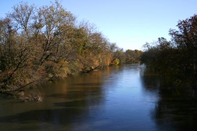
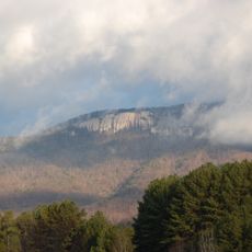
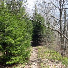
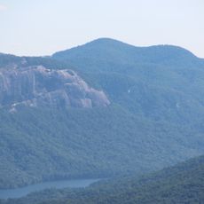
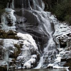
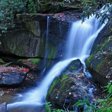
The French Broad River flows for about 220 miles from Rosman, North Carolina, through the Appalachian Mountains until it meets the Holston River near Knoxville, Tennessee. The waterway passes through mountain terrain, forests, and open areas as it receives water from tributary streams along the way.

This waterway was a vital trade route for the Cherokee and early European settlers, connecting communities across the southern Appalachian region. The river's importance for transport and commerce shaped how the area developed from Native American times through early colonial settlement.

The Cherokee gave this river different names for its sections, marking important travel routes and places where communities lived. These names show how closely the local people were connected to the water that shaped their world.

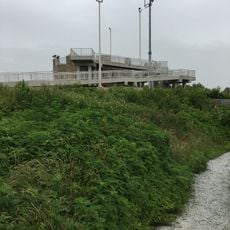
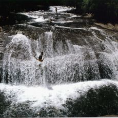
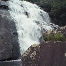
The river has many spots where you can launch a kayak, fish, or paddle, with official put-in points along the state trail section. Wearing shoes with good grip helps when exploring the banks and rocky areas, especially after rain when surfaces can get slippery.

This river flows northward, which is unusual compared to most eastern US waterways. This opposite direction reveals the complex geology and topography of the Appalachian region.

The community of curious travelers

AroundUs brings together thousands of curated places, local tips, and hidden gems, enriched daily by 60,000 contributors worldwide.

Start exploring
Location
Location
Location
Location
Location
Location
Location
GPS coordinates
35.14260,-82.83870
Latest update
December 14, 2025 19:15
Around this place
Sassafras Mountain
United States of America

Sassafras Mountain

10.3 km
Table Rock State Park
United States of America

Table Rock State Park

17 km
Art Loeb Trail
United States of America

Art Loeb Trail

15.3 km
Gorges State Park
United States of America

Gorges State Park

11 km
Turtleback Falls
United States of America

Turtleback Falls

12.9 km
Rainbow Falls
United States of America

Rainbow Falls

13 km
United States of America

Pisgah Astronomical Research Institute

7 km
Pinnacle Mountain
United States of America

Pinnacle Mountain

15 km
Raven Cliff Falls
United States of America

Raven Cliff Falls

16.7 km
Courthouse Falls
United States of America

Courthouse Falls

15.2 km
Connestee Falls and Batson Creek Falls
United States of America

Connestee Falls and Batson Creek Falls

10 km
Eastatoe Falls
United States of America

Eastatoe Falls

4 km
Cedar Rock Falls
United States of America

Cedar Rock Falls

15.5 km
E. M. Backus Lodge
United States of America

E. M. Backus Lodge

14.6 km
Silvermont
United States of America

Silvermont

13.8 km
St. Philip's Episcopal Church
United States of America

St. Philip's Episcopal Church

14 km
Hillmont
United States of America

Hillmont

10.4 km
Lake Toxaway Methodist Church
United States of America

Lake Toxaway Methodist Church

8.6 km
Charles E. Orr House
United States of America

Charles E. Orr House

14 km
Flem Galloway House
United States of America

Flem Galloway House

2.8 km
Godfrey-Barnette House
United States of America

Godfrey-Barnette House

13.1 km
Royal and Louise Morrow House
United States of America

Royal and Louise Morrow House

13.8 km
Transylvania County Courthouse
United States of America

Transylvania County Courthouse

13.9 km
William H. Grogan House
United States of America

William H. Grogan House

14.3 km
Main Street Historic District
United States of America

Main Street Historic District

13.8 km
Hanckel-Barclay House
United States of America

Hanckel-Barclay House

11.4 km
Max and Claire Brombacher House
United States of America

Max and Claire Brombacher House

13.6 km
William Breese, Jr., House
United States of America

William Breese, Jr., House

14 km
Show the full map
Reviews
Share your experience

No review yet

Discussions
Start a discussion...

No discussion yet

« French Broad River - River in Western North Carolina and Eastern Tennessee, US » is provided by Around Us (aroundus.com). Images and texts are derived from Wikimedia project under a Creative Commons license. You are allowed to copy, distribute, and modify copies of this page, under the conditions set by the license, as long as this note is clearly visible.

Discover hidden gems everywhere you go!

From secret cafés to breathtaking viewpoints, skip the crowded tourist spots and find places that match your style. Our app makes it easy with voice search, smart filtering, route optimization, and insider tips from travelers worldwide. Download now for the complete mobile experience.

Around Us App Screenshot

A unique approach to discovering new places

Le Figaro

All the places worth exploring

France Info

A tailor-made excursion in just a few clicks

20 Minutes

Around Us
Travel Guide & Maps
Download

Send to your phone

QR Code
1

Open the camera app on your mobile.

2

Point at the QR code with your camera. A notification will appear.

3

Tap the notification to open the link.