·

Enable Location

We need your location to show you interesting places around you

Discover nearby places

Find interesting locations and hidden gems around you

Precise directions

Get accurate directions and distances to places

Your location is never shared with other users. It's only used when you tap the location button.

Greene County

Log in to your account

Start exploring — it's free

Trusted by 62,747 travelers worldwide

Continue with Google
Continue with Apple
or

We will send you a code to connect

By continuing, you accept our Terms and Conditions and our Privacy Policy

Check your inbox

We've sent a pincode in your inbox. Please enter the code below.

Greene County, Administrative county in northeastern Tennessee, United States

Greene County is an administrative division spanning valleys and hills between the Appalachian Mountains in northeastern Tennessee. The landscape consists of farmland, forests, and several small towns linked by scenic routes throughout the region.

Established in 1783, the county was named after General Nathaniel Greene, a commander of the Continental Army during the American Revolutionary War. The area briefly formed part of the State of Franklin, an unofficial territory that sought statehood in 1784.

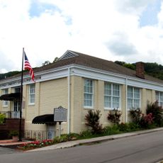
The county preserves multiple historical landmarks, including sites connected to Andrew Johnson, the 17th President of the United States who began his career there.

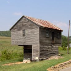
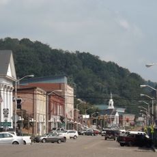
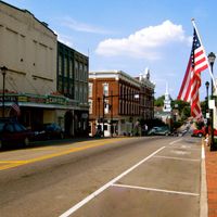
Greeneville serves as the county seat, providing government services, hospitals, and schools for residents throughout the region. The town offers lodging and shops, with easy access via major highways.

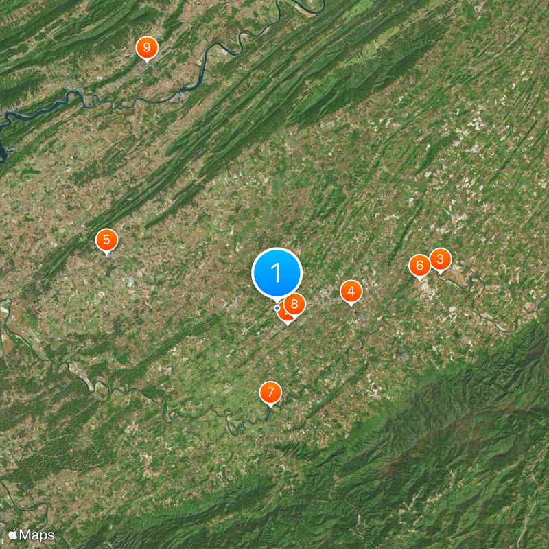
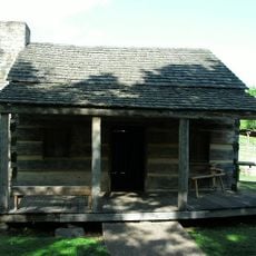
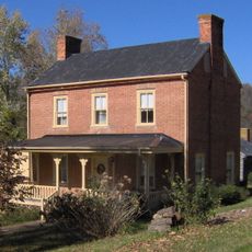
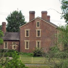
Several early buildings and sites in the region preserve traces of the State of Franklin era, offering visitors direct evidence of this brief but important local chapter. These remnants provide a tangible connection to a forgotten episode of early American history.

The community of curious travelers

AroundUs brings together thousands of curated places, local tips, and hidden gems, enriched daily by 60,000 contributors worldwide.

Start exploring
Location
Inception
April 18, 1783
Capital city
Greeneville
Shares border with
Hawkins County, Washington County, Unicoi County, Madison County, Cocke County, Hamblen County
GPS coordinates
36.17000,-82.85000
Latest update
December 20, 2025 11:22
Around this place
Andrew Johnson National Cemetery
United States of America

Andrew Johnson National Cemetery

2 km
Davy Crockett Birthplace State Park
United States of America

Davy Crockett Birthplace State Park

17.8 km
United States of America

President Andrew Johnson Museum and Library

7.9 km
United States of America

Volunteer Speedway

19.2 km
Earnest Farms Historic District
United States of America

Earnest Farms Historic District

15.5 km
United States of America

Davy Crockett Lake

10.4 km
Greeneville Historic District
United States of America

Greeneville Historic District

2.1 km
Rogersville Historic District
United States of America

Rogersville Historic District

29.9 km
Hawkins County Courthouse
United States of America

Hawkins County Courthouse

29.8 km
Swaggerty Blockhouse
United States of America

Swaggerty Blockhouse

26.5 km
United States of America

Overton Lodge

30.3 km
Bulls Gap Historic District
United States of America

Bulls Gap Historic District

23.2 km
Conway Bridge
United States of America

Conway Bridge

25.3 km
Maden Hall Farm
United States of America

Maden Hall Farm

7.2 km
Price Public Elementary School
United States of America

Price Public Elementary School

30.2 km
St. Marks Presbyterian Church
United States of America

St. Marks Presbyterian Church

30.2 km
Thomas Telford House
United States of America

Thomas Telford House

22.4 km
Gate City Historic District
United States of America

Gate City Historic District

28.4 km
Waterfall on West Prong Hickey Fork
United States of America

Waterfall on West Prong Hickey Fork

22.8 km
Hale Springs Inn
United States of America

Hale Springs Inn

29.9 km
United States of America

Princess Theatre

1.9 km
United States of America

Tusculum College Historic District

8 km
United States of America

Palace Theater

1.7 km
United States of America

Whiterock Cliff

20.8 km
United States of America

Blackstack Cliffs

20.3 km
United States of America

AMC Classic Towne Crossing 8

1.1 km
United States of America

Baxter Cliff

21 km
United States of America

The Cliffs

29.2 km
Show the full map
Administrative divisions
« Greene County - Administrative county in northeastern Tennessee, United States » is provided by Around Us (aroundus.com). Images and texts are derived from Wikimedia project under a Creative Commons license. You are allowed to copy, distribute, and modify copies of this page, under the conditions set by the license, as long as this note is clearly visible.

Discover hidden gems everywhere you go!

From secret cafés to breathtaking viewpoints, skip the crowded tourist spots and find places that match your style. Our app makes it easy with voice search, smart filtering, route optimization, and insider tips from travelers worldwide. Download now for the complete mobile experience.

Around Us App Screenshot

A unique approach to discovering new places

Le Figaro

All the places worth exploring

France Info

A tailor-made excursion in just a few clicks

20 Minutes

Around Us
Travel Guide & Maps
Download

Send to your phone

QR Code
1

Open the camera app on your mobile.

2

Point at the QR code with your camera. A notification will appear.

3

Tap the notification to open the link.