Chest opened
+${chestReward.xp} XP
Explorer
NOUVEAU ×${chestReward.collectible.quantity}
tapez pour fermer
Chest locked

Open chests in the app

Around Us is built for your phone — chests unlock when you walk, explore and capture nearby places.

Enable Location

We need your location to show you interesting places around you

Discover nearby places

Find interesting locations and hidden gems around you

Precise directions

Get accurate directions and distances to places

Your location is never shared with other users. It's only used when you tap the location button.

Renovo

Log in to your account

Start exploring — it's free

Trusted by 72,882 travelers worldwide

Continue with Google
Continue with Apple
or

We will send you a code to connect

By continuing, you accept our Terms and Conditions and our Privacy Policy

Check your inbox

We've sent a pincode in your inbox. Please enter the code below.

Discussion Reviews 1 Photos
14.1k Popularity

Renovo, Administrative division in Clinton County, Pennsylvania, United States.

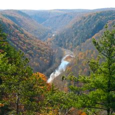
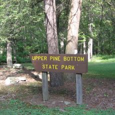
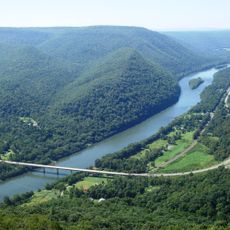
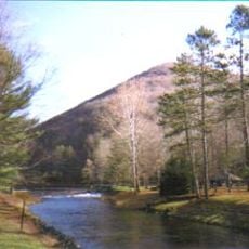
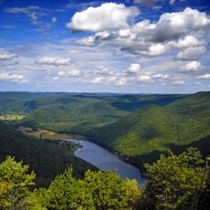
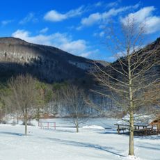
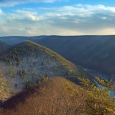
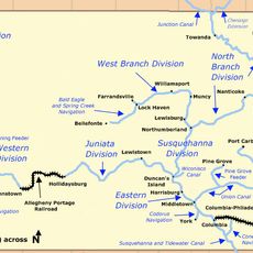
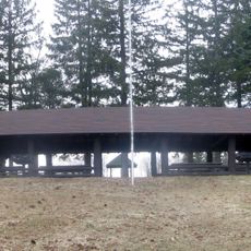
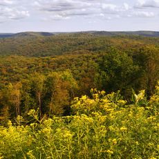
Renovo sits along the West Branch Susquehanna River in northwestern Pennsylvania, a small borough surrounded by state parks and forests of the Pennsylvania Wilds. The town is accessible by Pennsylvania Route 120 and offers easy access to hiking trails and natural areas throughout the region.

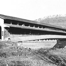
The Philadelphia and Erie Railroad founded Renovo in 1860 as a midpoint between major cities, establishing large maintenance shops that anchored the local economy for decades. Industrial changes and the decline of rail operations transformed the town significantly.

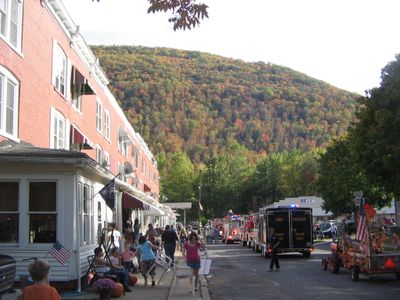
The Flaming Foliage Festival each October draws the community together with a parade, craft vendors, and celebrations centered on the fall colors that blanket the region.

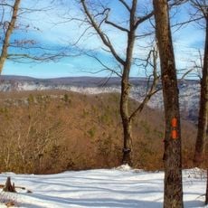
Visitors should use Pennsylvania Route 120 to reach the town and check local resources for current trail conditions and park access information. Fall months offer the best conditions for outdoor activities, while park exploration and river access remain popular year-round.

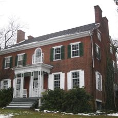
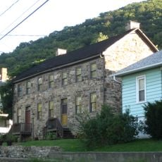
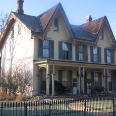
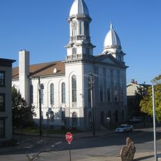
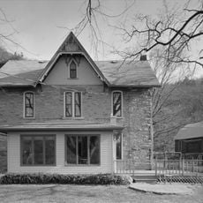
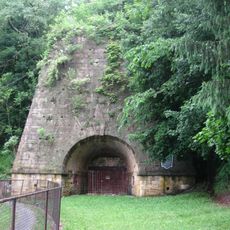
The town experienced rapid growth during the railroad era, transforming from a simple station stop into a busy rail center with extensive workshops and infrastructure. Several period buildings and former workshop sites still stand today, revealing traces of this now-vanished industrial chapter.

The community of curious travelers

AroundUs brings together thousands of curated places, local tips, and hidden gems, enriched daily by 60,000 contributors worldwide.

Start exploring
GPS coordinates
41.32646,-77.75082
Latest update
December 7, 2025 20:23
Around this place
Cherry Springs State Park
United States of America

Cherry Springs State Park

37.9 km
Pine Creek Gorge
United States of America

Pine Creek Gorge

36 km
Bald Eagle State Park
United States of America

Bald Eagle State Park

34 km
Upper Pine Bottom State Park
United States of America

Upper Pine Bottom State Park

27.6 km
Hyner View State Park
United States of America

Hyner View State Park

10.6 km
Ole Bull State Park
United States of America

Ole Bull State Park

23.6 km
Black Forest Trail
United States of America

Black Forest Trail

29.3 km
Sproul State Forest
United States of America

Sproul State Forest

191 m
Kettle Creek State Park
United States of America

Kettle Creek State Park

16.4 km
Little Pine State Park
United States of America

Little Pine State Park

33.2 km
Sinnemahoning State Park
United States of America

Sinnemahoning State Park

28.4 km
Hammersley Wild Area
United States of America

Hammersley Wild Area

23.4 km
Hyner Run State Park
United States of America

Hyner Run State Park

10.5 km
Golden Eagle Trail
United States of America

Golden Eagle Trail

23.6 km
Piper Aviation Museum
United States of America

Piper Aviation Museum

34.6 km
Bald Eagle and Spring Creek Navigation
United States of America

Bald Eagle and Spring Creek Navigation

35.6 km
Forrest H. Duttlinger Natural Area
United States of America

Forrest H. Duttlinger Natural Area

19.3 km
Christian Bechdel II House
United States of America

Christian Bechdel II House

32.2 km
Nathan Harvey House
United States of America

Nathan Harvey House

32.8 km
Heisey House
United States of America

Heisey House

33.5 km
Water Street District
United States of America

Water Street District

32.8 km
Bridge in Brown Township
United States of America

Bridge in Brown Township

27.7 km
Isaac A. Packer Farm
United States of America

Isaac A. Packer Farm

29.5 km
Farrandsville Iron Furnace
United States of America

Farrandsville Iron Furnace

26 km
Cherry Springs Picnic Pavilion
United States of America

Cherry Springs Picnic Pavilion

37.8 km
Susquehannock State Forest
United States of America

Susquehannock State Forest

36.4 km
Roxy Theatre
United States of America

Roxy Theatre

33.4 km
Jay Street Bridge
United States of America

Jay Street Bridge

33.2 km
Show the full map
Reviews
Share your experience

No review yet

Discussions
Start a discussion...

No discussion yet

« Renovo - Administrative division in Clinton County, Pennsylvania, United States » is provided by Around Us (aroundus.com). Images and texts are derived from Wikimedia project under a Creative Commons license. You are allowed to copy, distribute, and modify copies of this page, under the conditions set by the license, as long as this note is clearly visible.

Discover hidden gems everywhere you go!

From secret cafés to breathtaking viewpoints, skip the crowded tourist spots and find places that match your style. Our app makes it easy with voice search, smart filtering, route optimization, and insider tips from travelers worldwide. Download now for the complete mobile experience.

Around Us App Screenshot

A unique approach to discovering new places

Le Figaro

All the places worth exploring

France Info

A tailor-made excursion in just a few clicks

20 Minutes

Around Us
Travel Guide & Maps
Download

Send to your phone

QR Code
1

Open the camera app on your mobile.

2

Point at the QR code with your camera. A notification will appear.

3

Tap the notification to open the link.