Enable Location

We need your location to show you interesting places around you

Discover nearby places

Find interesting locations and hidden gems around you

Precise directions

Get accurate directions and distances to places

Your location is never shared with other users. It's only used when you tap the location button.

Natural Bridge

Log in to your account

Start exploring — it's free

Trusted by 61,910 travelers worldwide

Continue with Google
Continue with Apple
or

We will send you a code to connect

By continuing, you accept our Terms and Conditions and our Privacy Policy

Check your inbox

We've sent a pincode in your inbox. Please enter the code below.

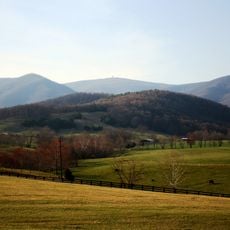
Natural Bridge, Natural limestone arch in Rockbridge County, US.

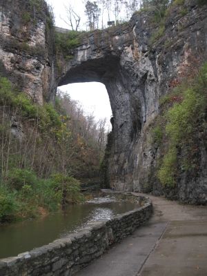
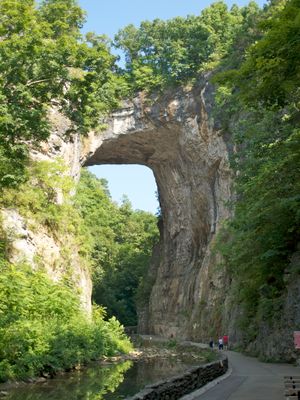
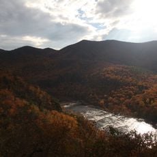
Natural Bridge is a limestone arch rising 65 meters (215 feet) above Cedar Creek with a span of 27 meters (90 feet), crossing a deep gorge in Rockbridge County. The arch forms part of the public road that passes over it, and visitors can walk both above and below through the valley.

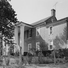
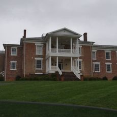
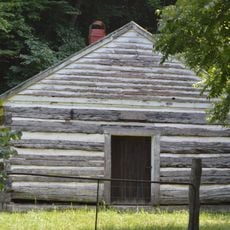
Jefferson purchased the property from King George III in 1774 for 20 shillings and built a log cabin for guests wishing to view the formation. The site later became a popular travel destination before eventually passing into the ownership of the state of Virginia.

The Monacan people call this formation the "Bridge of Hell" in their language and regard it as a sacred site recalling an important victory over enemy tribes. Visitors today find interpretive signs along the path that tell of the spiritual importance this place holds for the original inhabitants of this region.

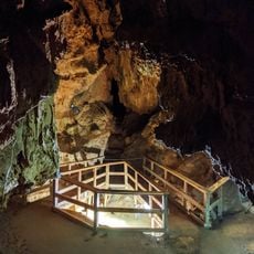
The parking area is located near the entrance, from where paths lead down to the creek bed where you can stand directly beneath the arch. Walks range from 30 minutes to several hours, depending on whether you go only to the formation or continue onward to the waterfalls.

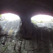
A stone discovered in 1927 bears the initials G. W. and surveyor marks, suggesting Washington may have measured the formation in 1750. The markings are located roughly 7 meters (23 feet) above ground level and remain visible on the rock face to this day.

The community of curious travelers

AroundUs brings together thousands of curated places, local tips, and hidden gems, enriched daily by 60,000 contributors worldwide.

Start exploring
GPS coordinates
37.62750,-79.54530
Latest update
December 12, 2025 18:07
Natural stone arches and rock holes

Geological forces have carved openings, arches, and caves into rock formations across continents through millions of years of erosion. Water, wind, and weathering have shaped these natural structures from various rock types, creating landmarks that reveal the Earth's ongoing transformation. The...

« Natural Bridge - Natural limestone arch in Rockbridge County, US » is provided by Around Us (aroundus.com). Images and texts are derived from Wikimedia project under a Creative Commons license. You are allowed to copy, distribute, and modify copies of this page, under the conditions set by the license, as long as this note is clearly visible.

Discover hidden gems everywhere you go!

From secret cafés to breathtaking viewpoints, skip the crowded tourist spots and find places that match your style. Our app makes it easy with voice search, smart filtering, route optimization, and insider tips from travelers worldwide. Download now for the complete mobile experience.

Around Us App Screenshot

A unique approach to discovering new places

Le Figaro

All the places worth exploring

France Info

A tailor-made excursion in just a few clicks

20 Minutes

Around Us
Travel Guide & Maps
Download

Send to your phone

QR Code
1

Open the camera app on your mobile.

2

Point at the QR code with your camera. A notification will appear.

3

Tap the notification to open the link.