Chest opened
+${chestReward.xp} XP
Explorer
NOUVEAU ×${chestReward.collectible.quantity}
tapez pour fermer
Chest locked

Open chests in the app

Around Us is built for your phone — chests unlock when you walk, explore and capture nearby places.

Enable Location

We need your location to show you interesting places around you

Discover nearby places

Find interesting locations and hidden gems around you

Precise directions

Get accurate directions and distances to places

Your location is never shared with other users. It's only used when you tap the location button.

Log in to your account

Start exploring — it's free

Trusted by 72,886 travelers worldwide

Continue with Google
Continue with Apple
or

We will send you a code to connect

By continuing, you accept our Terms and Conditions and our Privacy Policy

Check your inbox

We've sent a pincode in your inbox. Please enter the code below.

Discussion Reviews Photo
12.4k Popularity

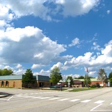
Fairfield Glade, Census-designated place in Cumberland County, Tennessee.

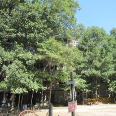
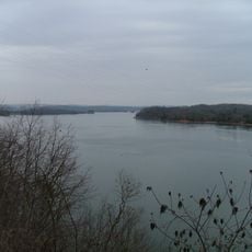
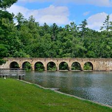
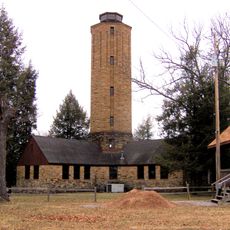
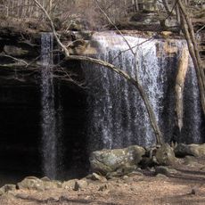
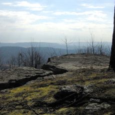
Fairfield Glade is a planned residential community on the Cumberland Plateau in Tennessee, spread across ridges and valleys with the Catoosa Wildlife Management Area and Daddys Creek valley nearby. The community offers five golf courses, eleven fishing lakes with two marinas, multiple swimming pools, tennis courts, and a community center with indoor facilities.

The community emerged in the 1960s as a planned residential development on the plateau. Over the following decades, it grew into a substantial residential area.

The community is shaped by retirees who actively participate in local clubs and social gatherings centered on outdoor pastimes and recreational activities. The focus on arts, crafts, and sports reflects how residents organize their daily social lives.

The location sits at a higher elevation, so visitors should prepare for seasonal weather variations throughout the year. Recreation facilities are spread across the community, so it helps to plan which activities you want to explore in advance.

The elevation of about 2,000 feet (610 m) creates distinct seasonal weather patterns and offers residents diverse outdoor opportunities year-round. This combination of mountainous terrain with organized recreational facilities makes the area a distinctive living environment.

The community of curious travelers

AroundUs brings together thousands of curated places, local tips, and hidden gems, enriched daily by 60,000 contributors worldwide.

Start exploring
Elevation above the sea
636 m
GPS coordinates
35.99444,-84.88500
Latest update
December 7, 2025 20:45
Around this place
Horace Burgess's Treehouse
United States of America

Horace Burgess's Treehouse

9.9 km
Watts Bar Lake
United States of America

Watts Bar Lake

42.6 km
Cumberland Mountain State Park
United States of America

Cumberland Mountain State Park

14.5 km
Ozone Falls State Natural Area
United States of America

Ozone Falls State Natural Area

14.4 km
Cumberland Homesteads
United States of America

Cumberland Homesteads

13.2 km
Ozone Falls
United States of America

Ozone Falls

14.2 km
Scott's Gulf
United States of America

Scott's Gulf

41.3 km
Fort Southwest Point
United States of America

Fort Southwest Point

35.4 km
Palace Theater
United States of America

Palace Theater

13.7 km
American Temperance University
United States of America

American Temperance University

30.8 km
Cornstalk Heights
United States of America

Cornstalk Heights

31.2 km
Tamke-Allan Observatory
United States of America

Tamke-Allan Observatory

30.1 km
Roane County Courthouse
United States of America

Roane County Courthouse

36 km
Post Oak Springs Christian Church
United States of America

Post Oak Springs Christian Church

26.3 km
Cumberland County Courthouse
United States of America

Cumberland County Courthouse

13.8 km
Col. Gideon Morgan House
United States of America

Col. Gideon Morgan House

35.9 km
Allardt Presbyterian Church
United States of America

Allardt Presbyterian Church

43.1 km
Pioneer Hall
United States of America

Pioneer Hall

27.9 km
Crossville Model Railroad Club
United States of America

Crossville Model Railroad Club

12.1 km
Lone Mountain State Forest
United States of America

Lone Mountain State Forest

31.2 km
Obed Wild and Scenic River Visitor Center
United States of America

Obed Wild and Scenic River Visitor Center

28.6 km
United States of America

Lilly Bluff Overlook

19.2 km
Bellview School
United States of America

Bellview School

38.3 km
United States of America

Head of the Sequatchie River

24.8 km
United States of America

Virgin Falls Trailhead

39.1 km

Art Guild at Fairfield Glade

671 m
United States of America

Work of art

36 km
United States of America

Martha's Pretty Point

41.4 km
Show the full map
Reviews
Share your experience

No review yet

Discussions
Start a discussion...

No discussion yet

« Fairfield Glade - Census-designated place in Cumberland County, Tennessee » is provided by Around Us (aroundus.com). Images and texts are derived from Wikimedia project under a Creative Commons license. You are allowed to copy, distribute, and modify copies of this page, under the conditions set by the license, as long as this note is clearly visible.

Discover hidden gems everywhere you go!

From secret cafés to breathtaking viewpoints, skip the crowded tourist spots and find places that match your style. Our app makes it easy with voice search, smart filtering, route optimization, and insider tips from travelers worldwide. Download now for the complete mobile experience.

Around Us App Screenshot

A unique approach to discovering new places

Le Figaro

All the places worth exploring

France Info

A tailor-made excursion in just a few clicks

20 Minutes

Around Us
Travel Guide & Maps
Download

Send to your phone

QR Code
1

Open the camera app on your mobile.

2

Point at the QR code with your camera. A notification will appear.

3

Tap the notification to open the link.