Chest opened
+${chestReward.xp} XP
Explorer
NOUVEAU ×${chestReward.collectible.quantity}
tapez pour fermer
Chest locked

Open chests in the app

Around Us is built for your phone — chests unlock when you walk, explore and capture nearby places.

Enable Location

We need your location to show you interesting places around you

Discover nearby places

Find interesting locations and hidden gems around you

Precise directions

Get accurate directions and distances to places

Your location is never shared with other users. It's only used when you tap the location button.

Hatteras

Log in to your account

Start exploring — it's free

Trusted by 72,880 travelers worldwide

Continue with Google
Continue with Apple
or

We will send you a code to connect

By continuing, you accept our Terms and Conditions and our Privacy Policy

Check your inbox

We've sent a pincode in your inbox. Please enter the code below.

Discussion Reviews 1 Photos
19.8k Popularity

Hatteras, human settlement in North Carolina, United States of America

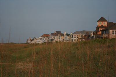
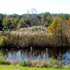
Hatteras is a small village on the western tip of Hatteras Island in North Carolina, situated between Pamlico Sound and the Atlantic Ocean. Simple homes and moored boats characterize the settlement, with fishing and water-based activities serving as the primary occupations for residents.

The area was founded by the Hatteras Indians who engaged in fishing and hunting, and the village takes its name from them. European settlers arrived in the 1700s, and during the Civil War, two forts were constructed that saw early Union military success and helped establish coastal control.

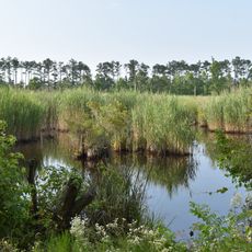
The village takes its name from the Hatteras Indians who first lived here, and this heritage shapes local identity today. You will see the connection to the sea in everyday life, with fishing boats, maritime traditions, and water-based activities woven into how residents spend their days.

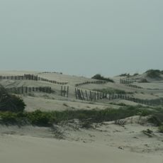
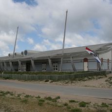
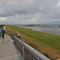
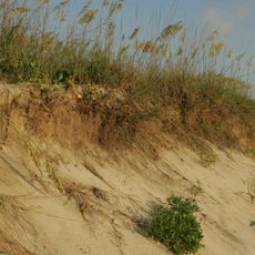
The village is small and easy to navigate on foot with simple, straightforward streets. A small airport and ferry service to Ocracoke Island provide access options, and the beaches are wide and uncrowded, making them good for walking and observing the landscape.

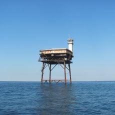
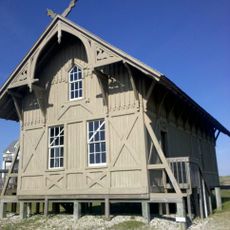
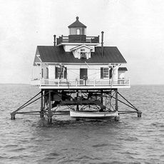
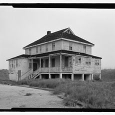
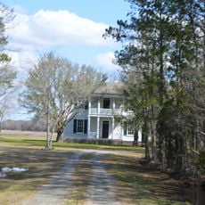
The area is sometimes called the Graveyard of the Atlantic due to numerous shipwrecks that occurred nearby, reflecting the hazardous nature of this coastal location. The Ballance House, built around 1915, still stands today and has survived many hurricanes, showing how local structures endure the forces of nature.

The community of curious travelers

AroundUs brings together thousands of curated places, local tips, and hidden gems, enriched daily by 60,000 contributors worldwide.

Start exploring
Location
GPS coordinates
35.21944,-75.69028
Latest update
February 16, 2026 22:20
Around this place
Cape Hatteras Lighthouse
United States of America

Cape Hatteras Lighthouse

15.1 km
Bodie Island Light
United States of America

Bodie Island Light

67.7 km
Alligator River National Wildlife Refuge
United States of America

Alligator River National Wildlife Refuge

64.4 km
Diamond Shoal Light
United States of America

Diamond Shoal Light

36.6 km
Pea Island National Wildlife Refuge
United States of America

Pea Island National Wildlife Refuge

52.5 km
Ocracoke Light
United States of America

Ocracoke Light

29.6 km
Graveyard of the Atlantic Museum
United States of America

Graveyard of the Atlantic Museum

1.9 km
Rodanthe Bridge
United States of America

Rodanthe Bridge

47.5 km
Chicamacomico Life-Saving Station
United States of America

Chicamacomico Life-Saving Station

46.5 km
Coquina Beach
United States of America

Coquina Beach

69.5 km
Mattamuskeet National Wildlife Refuge
United States of America

Mattamuskeet National Wildlife Refuge

55.8 km
Roanoke Marshes Light
United States of America

Roanoke Marshes Light

65.9 km
Cedar Island National Wildlife Refuge
United States of America

Cedar Island National Wildlife Refuge

61.6 km
United States of America

Naval Facility Cape Hatteras

15.9 km
Salvo Post Office
United States of America

Salvo Post Office

40.7 km
Lake Mattamuskeet Pump Station
United States of America

Lake Mattamuskeet Pump Station

51.1 km
Bodie Island Lifesaving and Coast Guard Station
United States of America

Bodie Island Lifesaving and Coast Guard Station

68.9 km
Inkwell
United States of America

Inkwell

44.2 km
Hatteras Weather Bureau Station
United States of America

Hatteras Weather Bureau Station

67 m
Rasmus Midgett House
United States of America

Rasmus Midgett House

41.3 km
Ellsworth and Lovie Ballance House
United States of America

Ellsworth and Lovie Ballance House

458 m
George V. Credle House and Cemetery
United States of America

George V. Credle House and Cemetery

66.9 km
Bodie Island Light Station
United States of America

Bodie Island Light Station

67.7 km
Bodie Island Visitor Center
United States of America

Bodie Island Visitor Center

67.6 km
North Pond Wildlife Trail
United States of America

North Pond Wildlife Trail

58.1 km
Pea Island National Wildlife Refuge Visitor Center
United States of America

Pea Island National Wildlife Refuge Visitor Center

58.2 km
Pea Island Beach
United States of America

Pea Island Beach

58.5 km
Herbert C. Bonner Bridge
United States of America

Herbert C. Bonner Bridge

63 km
Show the full map
Reviews
Share your experience

No review yet

Discussions
Start a discussion...

No discussion yet

« Hatteras - human settlement in North Carolina, United States of America » is provided by Around Us (aroundus.com). Images and texts are derived from Wikimedia project under a Creative Commons license. You are allowed to copy, distribute, and modify copies of this page, under the conditions set by the license, as long as this note is clearly visible.

Discover hidden gems everywhere you go!

From secret cafés to breathtaking viewpoints, skip the crowded tourist spots and find places that match your style. Our app makes it easy with voice search, smart filtering, route optimization, and insider tips from travelers worldwide. Download now for the complete mobile experience.

Around Us App Screenshot

A unique approach to discovering new places

Le Figaro

All the places worth exploring

France Info

A tailor-made excursion in just a few clicks

20 Minutes

Around Us
Travel Guide & Maps
Download

Send to your phone

QR Code
1

Open the camera app on your mobile.

2

Point at the QR code with your camera. A notification will appear.

3

Tap the notification to open the link.