Knife River Indian Villages National Historic Site

Log in to your account

AroundUs is a community-driven map of interesting places, built by curious explorers like you. It grows with every review, story, and photo you share.
Connect to save your favorite spots, contribute locations, and create personalized routes.
Continue with Google
Continue with Apple
Continue with X
Continue with Facebook
Continue with email
By continuing, you accept our Terms and Conditions and our Privacy Policy
Create an account
Add to collection
Map
Suggest a change
Share

Knife River Indian Villages National Historic Site, Archaeological site in Stanton, United States.

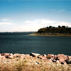
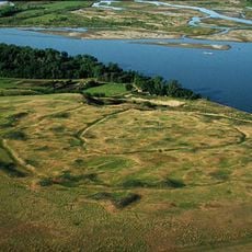
Knife River Indian Villages National Historic Site stretches across 1,758 acres along the Knife River and preserves the remains of three ancient villages with visible earth lodge depressions. The site shows how these settlements were organized along the river and contains scattered artifacts that tell the story of daily life in these communities.

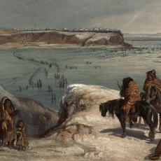
These villages began forming around 1300 and grew into important centers of trade and life on the northern plains. The communities remained active settlement places until disease and other pressures led to their abandonment in the 1800s.

The Mandan and Hidatsa peoples built their communities here for centuries, with earth lodges serving as the center of family and village life. Visitors walking through the area can sense how closely these settlements connected people to the river and the land around them.

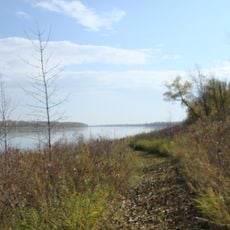
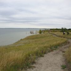
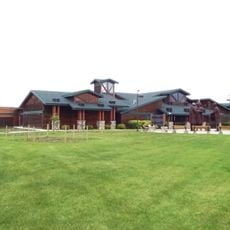
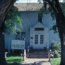
The site is accessed through trails that connect the different village areas at various difficulty levels. The museum on-site displays artifacts and provides context that helps visitors understand what they are seeing in the landscape.

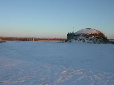
Visitors can enter a reconstructed earth lodge built in 1995 that demonstrates the traditional construction methods of Northern Plains peoples. This hands-on experience gives a real sense of the interior space and how families lived in these structures.

Location: Mercer County

Website: http://nps.gov/knri

GPS coordinates: 47.35417,-101.38583

Latest update: December 6, 2025 17:40

Photos
Natural and historical sites in North Dakota

North Dakota is a Great Plains state with a history shaped by trading posts, military forts, and Native American settlements. The region stretches from the Missouri River to the Canadian border, preserving sites that tell stories from the 19th century alongside Cold War relics and natural areas....

Around this place
Hell Creek Formation
United States of America

Hell Creek Formation

51.3 km
United States of America

Lake Sakakawea

16.1 km
North Dakota State Capitol
United States of America

North Dakota State Capitol

74.9 km
Fort Mandan
United States of America

Fort Mandan

9.9 km
North Dakota Governor's Residence
United States of America

North Dakota Governor's Residence

75.1 km
Salem Sue
United States of America

Salem Sue

55.9 km
Bismarck North Dakota Temple
United States of America

Bismarck North Dakota Temple

71.9 km
Audubon National Wildlife Refuge
United States of America

Audubon National Wildlife Refuge

30.8 km
Fort Clark Trading Post State Historic Site
United States of America

Fort Clark Trading Post State Historic Site

14.1 km
Lake Sakakawea State Park
United States of America

Lake Sakakawea State Park

19.5 km
Cross Ranch State Park
United States of America

Cross Ranch State Park

33.1 km
Fort Stevenson State Park
United States of America

Fort Stevenson State Park

26.5 km
Double Ditch
United States of America

Double Ditch

59.2 km
United States of America

Liberty Memorial Building

75.2 km
North Dakota Lewis and Clark Interpretive Center
United States of America

North Dakota Lewis and Clark Interpretive Center

26.6 km
Liberty Memorial Bridge
United States of America

Liberty Memorial Bridge

73 km
Fred Krause House
United States of America

Fred Krause House

19.5 km
Holy Trinity Ukrainian Greek Orthodox Church
United States of America

Holy Trinity Ukrainian Greek Orthodox Church

50 km
Lost Lake National Wildlife Refuge
United States of America

Lost Lake National Wildlife Refuge

38.1 km
German Evangelical St. Johns Church
United States of America

German Evangelical St. Johns Church

70.9 km
Former McLean County Courthouse
United States of America

Former McLean County Courthouse

27.9 km
Chief Looking's Village site
United States of America

Chief Looking's Village site

72 km
Sheridan County Courthouse
United States of America

Sheridan County Courthouse

72.7 km
United States of America

Ingersoll School

31.6 km
Missouri River High Bridge
United States of America

Missouri River High Bridge

73.2 km
McLean County Courthouse
United States of America

McLean County Courthouse

28 km
Sims Lutheran Church
United States of America

Sims Lutheran Church

65.3 km
Louis Rehm Barn
United States of America

Louis Rehm Barn

70 km
Show the full map
Reviews

Visited this place? Tap the stars to rate it and share your experience / photos with the community! Try now! You can cancel it anytime.

« Knife River Indian Villages National Historic Site - Archaeological site in Stanton, United States » is provided by Around Us (aroundus.com). Images and texts are derived from Wikimedia project under a Creative Commons license. You are allowed to copy, distribute, and modify copies of this page, under the conditions set by the license, as long as this note is clearly visible.

Discover hidden gems everywhere you go!

From secret cafés to breathtaking viewpoints, skip the crowded tourist spots and find places that match your style. Our app makes it easy with voice search, smart filtering, route optimization, and insider tips from travelers worldwide. Download now for the complete mobile experience.

Around Us App Screenshot

A unique approach to discovering new places

Le Figaro

All the places worth exploring

France Info

A tailor-made excursion in just a few clicks

20 Minutes