Enable Location

We need your location to show you interesting places around you

Discover nearby places

Find interesting locations and hidden gems around you

Precise directions

Get accurate directions and distances to places

Your location is never shared with other users. It's only used when you tap the location button.

Bellingham Square Historic District

Log in to your account

Start exploring — it's free

Trusted by 61,844 travelers worldwide

Continue with Google
Continue with Apple
or

We will send you a code to connect

By continuing, you accept our Terms and Conditions and our Privacy Policy

Check your inbox

We've sent a pincode in your inbox. Please enter the code below.

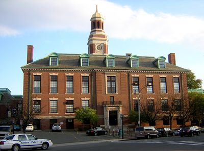
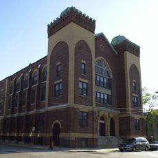
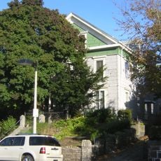
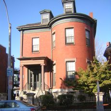
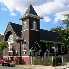
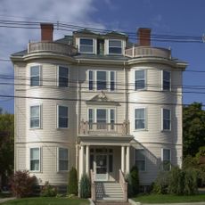
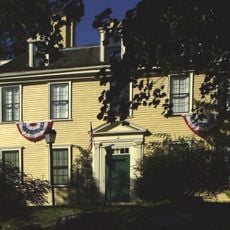
Bellingham Square Historic District, Commercial and civic district in Chelsea, Massachusetts.

Description

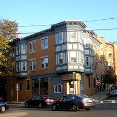
Bellingham Square Historic District sits at a six-way intersection where Broadway, Washington Avenue, Bellingham Street, Hawthorn Street, and 5th Street converge. The area contains a mix of civic buildings, retail shops, and educational facilities positioned around this central traffic hub.

History

The district emerged from reconstruction efforts following the Great Chelsea Fire of 1908, which devastated much of the city. This disaster led to the implementation of new construction standards and progressive urban planning methods for that era.

Culture

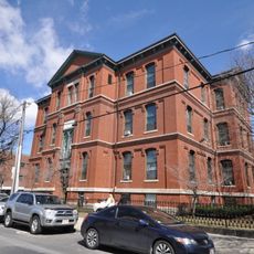
The Chelsea Public Library and Bunker Hill Community College campus define this area with their buildings and serve as gathering places for residents and students. These institutions shape the social life of the neighborhood through educational programs and community activities.

Practical

The district is easily navigable on foot and well-connected to public transportation options. Visitors will find shops, municipal services, and educational facilities all within convenient walking distance of one another.

Did you know?

The district was completely rebuilt using modern urban planning principles, making it an early example of a planned neighborhood. This methodical reconstruction set it apart from other American cities that rebuilt haphazardly after disasters.

Location
GPS coordinates
42.39278,-71.03333
Latest update
December 14, 2025 14:43

AroundUs brings together thousands of curated places, local tips, and hidden gems, enriched daily by 60,000 contributors worldwide. Discover all places nearby (Massachusetts).

Around this place
Bunker Hill Monument
United States of America

Bunker Hill Monument

2.9 km
Boston Navy Yard
United States of America

Boston Navy Yard

2.4 km
Tobin Bridge
United States of America

Tobin Bridge

1.5 km
USS Cassin Young
United States of America

USS Cassin Young

2.9 km
Chelsea Street Bridge
United States of America

Chelsea Street Bridge

1.1 km
Eagle Hill Historic District
United States of America

Eagle Hill Historic District

1.3 km
Revere Beach Parkway
United States of America

Revere Beach Parkway

1.4 km
Our Lady of Mount Carmel Church
United States of America

Our Lady of Mount Carmel Church

2.5 km
Congregation Agudath Shalom
United States of America

Congregation Agudath Shalom

343 m
Andrew P. McArdle Memorial Bridge
United States of America

Andrew P. McArdle Memorial Bridge

912 m
Rumney Marsh Burying Ground
United States of America

Rumney Marsh Burying Ground

2.8 km
Massachusetts Korean War Memorial
United States of America

Massachusetts Korean War Memorial

2.6 km
Donald McKay House
United States of America

Donald McKay House

1.4 km
Temple Ohabei Shalom Cemetery
United States of America

Temple Ohabei Shalom Cemetery

1.9 km
Mary Ellen Welch Greenway
United States of America

Mary Ellen Welch Greenway

1.9 km
Trinity Neighborhood House
United States of America

Trinity Neighborhood House

1.5 km
Monument Square Historic District
United States of America

Monument Square Historic District

2.9 km
C. Henry Kimball House
United States of America

C. Henry Kimball House

1 km
Naval Hospital Boston Historic District
United States of America

Naval Hospital Boston Historic District

1.1 km
Church of Christ
United States of America

Church of Christ

2.8 km
Baker Congregational Church
United States of America

Baker Congregational Church

1.7 km
Bennington Street Burying Ground
United States of America

Bennington Street Burying Ground

1.7 km
Immaculate Conception Rectory
United States of America

Immaculate Conception Rectory

2.4 km
Bellingham-Cary House
United States of America

Bellingham-Cary House

755 m
James O. Conway Memorial
United States of America

James O. Conway Memorial

2.8 km
Downtown Chelsea Residential Historic District
United States of America

Downtown Chelsea Residential Historic District

528 m
Theodore Lyman School
United States of America

Theodore Lyman School

2.3 km
East Boston Branch Library
United States of America

East Boston Branch Library

1.9 km
Show the full map
« Bellingham Square Historic District - Commercial and civic district in Chelsea, Massachusetts » is provided by Around Us (aroundus.com). Images and texts are derived from Wikimedia project under a Creative Commons license. You are allowed to copy, distribute, and modify copies of this page, under the conditions set by the license, as long as this note is clearly visible.

Discover hidden gems everywhere you go!

From secret cafés to breathtaking viewpoints, skip the crowded tourist spots and find places that match your style. Our app makes it easy with voice search, smart filtering, route optimization, and insider tips from travelers worldwide. Download now for the complete mobile experience.

Around Us App Screenshot

A unique approach to discovering new places

Le Figaro

All the places worth exploring

France Info

A tailor-made excursion in just a few clicks

20 Minutes

Around Us
Travel Guide & Maps
Download

Send to your phone

QR Code
1

Open the camera app on your mobile.

2

Point at the QR code with your camera. A notification will appear.

3

Tap the notification to open the link.