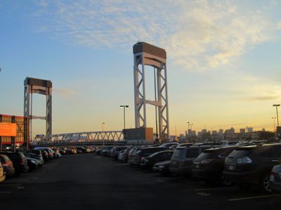
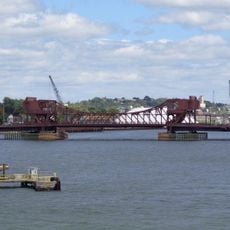
Chelsea Street Bridge, Vertical-lift road bridge in Chelsea, Massachusetts.
Chelsea Street Bridge is a vertical-lift road bridge that spans Chelsea Creek between East Boston and Chelsea, carrying two lanes of traffic in each direction and sidewalks on both sides. Its central span can be raised vertically to allow tall vessels to pass underneath.
The current structure opened in 2012, replacing a single-leaf bascule bridge from 1937 that had served the crossing for over 70 years. The new bridge was built to handle increased road traffic and updated requirements for vessels using Chelsea Creek.
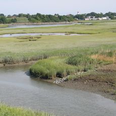
The bridge links East Boston and Chelsea, and people cross it on foot, by bus, or by car as part of their daily routine. From the sidewalks, walkers get a clear view over Chelsea Creek and the working port around it.
When a vessel needs to pass, the bridge span is raised and all traffic, including pedestrians, must wait briefly on either side. Lifts tend to happen during daytime hours, so crossing during off-peak times can help avoid unexpected stops.
The MBTA Silver Line SL3 bus route runs directly across this bridge on the same roadway as regular vehicle traffic, with no separate bus-only lane or dedicated infrastructure. This means the bridge carries both a regional transit route and standard road traffic on a single shared surface.
The community of curious travelers
AroundUs brings together thousands of curated places, local tips, and hidden gems, enriched daily by 60,000 contributors worldwide.