Chest opened
+${chestReward.xp} XP
Explorer
NOUVEAU ×${chestReward.collectible.quantity}
tapez pour fermer
Chest locked

Open chests in the app

Around Us is built for your phone — chests unlock when you walk, explore and capture nearby places.

Enable Location

We need your location to show you interesting places around you

Discover nearby places

Find interesting locations and hidden gems around you

Precise directions

Get accurate directions and distances to places

Your location is never shared with other users. It's only used when you tap the location button.

Log in to your account

Start exploring — it's free

Trusted by 72,883 travelers worldwide

Continue with Google
Continue with Apple
or

We will send you a code to connect

By continuing, you accept our Terms and Conditions and our Privacy Policy

Check your inbox

We've sent a pincode in your inbox. Please enter the code below.

Conestoga Trail
Discussion Reviews Photo
1.5k Popularity

Conestoga Trail, Hiking trail in Lancaster County, Pennsylvania, US.

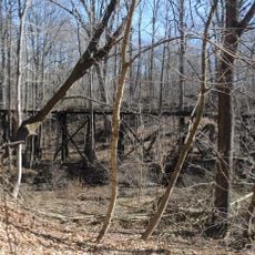
The Conestoga Trail is a hiking route that runs through Lancaster County, connecting forests, farmland, and areas along the Susquehanna River with varied terrain. The route is marked with orange blazes and mixes woodland paths with sections on roads.

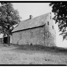
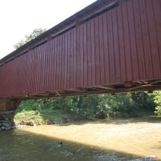
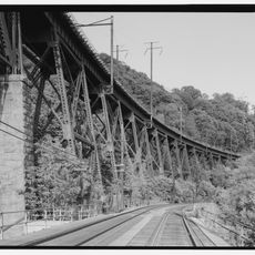
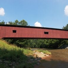
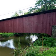
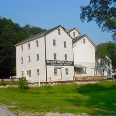
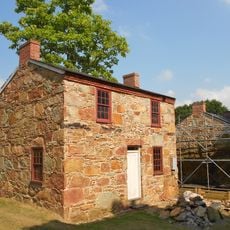
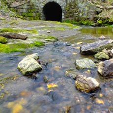
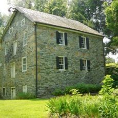
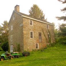
The route follows sections of old transportation paths that connected colonial settlements, and it passes near three historic stone bridges built in the 1800s. These bridges reflect the engineering and construction methods of that period.

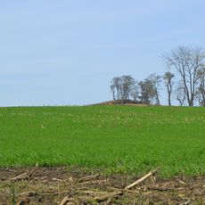
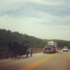
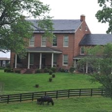
The trail passes through farmland where you can observe how Amish and Mennonite communities live and work with traditional methods. This agricultural landscape shapes how people in the area build their homes, move around, and structure their daily routines.

The trail is marked with orange blazes, but planning is important since camping is prohibited on most private sections and more than half the route uses roads. Check which sections are publicly accessible before you go, as many parts cross private property.

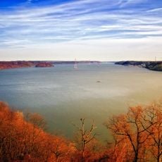
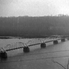
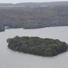
The trail connects with the Mason-Dixon Trail at Lock 12 and leads to the Kelly Run Gorge and The Pinnacle overlook. These locations offer unexpected river views and vistas of the surrounding landscape that many hikers miss on their first visit.

The community of curious travelers

AroundUs brings together thousands of curated places, local tips, and hidden gems, enriched daily by 60,000 contributors worldwide.

Start exploring
GPS coordinates
39.81420,-76.33110
Latest update
December 14, 2025 14:20
Around this place
Safe Harbor Dam
United States of America

Safe Harbor Dam

13 km
Hans Herr House
United States of America

Hans Herr House

19.5 km
Susquehannock State Park
United States of America

Susquehannock State Park

3.4 km
Conestoga Town
United States of America

Conestoga Town

17.3 km
Conowingo Bridge
United States of America

Conowingo Bridge

18.5 km
Norman Wood Bridge
United States of America

Norman Wood Bridge

774 m
Baumgardener's Covered Bridge
United States of America

Baumgardener's Covered Bridge

13.3 km
Robert Fulton Birthplace
United States of America

Robert Fulton Birthplace

14.6 km
Safe Harbor Bridge
United States of America

Safe Harbor Bridge

13.2 km
Colemanville Covered Bridge
United States of America

Colemanville Covered Bridge

9.5 km
Lime Valley Covered Bridge
United States of America

Lime Valley Covered Bridge

18.3 km
Indian Steps Cabin
United States of America

Indian Steps Cabin

6.7 km
Muddy Creek Forks Historic District
United States of America

Muddy Creek Forks Historic District

12.4 km
McCalls Ferry Farm
United States of America

McCalls Ferry Farm

2.5 km
Coulsontown Cottages Historic District
United States of America

Coulsontown Cottages Historic District

10.2 km
Duncan Island
United States of America

Duncan Island

5.9 km
Holtwood Environmental Preserve
United States of America

Holtwood Environmental Preserve

2.5 km
Delta Trestle Bridge, Maryland and Pennsylvania Railroad
United States of America

Delta Trestle Bridge, Maryland and Pennsylvania Railroad

9.5 km
Col. John Streett House
United States of America

Col. John Streett House

19.6 km
Wallace-Cross Mill
United States of America

Wallace-Cross Mill

18 km
Guinston United Presbyterian Church
United States of America

Guinston United Presbyterian Church

13.9 km
Whiteford-Cardiff Historic District
United States of America

Whiteford-Cardiff Historic District

11 km
Mill Green Historic District
United States of America

Mill Green Historic District

16.7 km
Slate Ridge School
United States of America

Slate Ridge School

11.3 km
Delta Historic District
United States of America

Delta Historic District

10 km
Payne's Folly
United States of America

Payne's Folly

17.6 km
Maze Quest Fun Park
United States of America

Maze Quest Fun Park

12 km
1719 Museum
United States of America

1719 Museum

19.4 km
Show the full map
Reviews
Share your experience

No review yet

Discussions
Start a discussion...

No discussion yet

« Conestoga Trail - Hiking trail in Lancaster County, Pennsylvania, US » is provided by Around Us (aroundus.com). Images and texts are derived from Wikimedia project under a Creative Commons license. You are allowed to copy, distribute, and modify copies of this page, under the conditions set by the license, as long as this note is clearly visible.

Discover hidden gems everywhere you go!

From secret cafés to breathtaking viewpoints, skip the crowded tourist spots and find places that match your style. Our app makes it easy with voice search, smart filtering, route optimization, and insider tips from travelers worldwide. Download now for the complete mobile experience.

Around Us App Screenshot

A unique approach to discovering new places

Le Figaro

All the places worth exploring

France Info

A tailor-made excursion in just a few clicks

20 Minutes

Around Us
Travel Guide & Maps
Download

Send to your phone

QR Code
1

Open the camera app on your mobile.

2

Point at the QR code with your camera. A notification will appear.

3

Tap the notification to open the link.