Chest opened
+${chestReward.xp} XP
Explorer
NOUVEAU ×${chestReward.collectible.quantity}
tapez pour fermer

See the monuments around you in AR Open chests in the app

Around Us is built for your phone — point your camera at the streets and discover the monuments and places around you in augmented reality. Around Us is built for your phone — chests unlock when you walk, explore and capture nearby places.

•

Enable Location

We need your location to show you interesting places around you

Discover nearby places

Find interesting locations and hidden gems around you

Precise directions

Get accurate directions and distances to places

Your location is never shared with other users. It's only used when you tap the location button.

Izobilnoe Reservoir

Log in to your account

Start exploring — it's free

Trusted by 93,277 travelers worldwide

Continue with Google
Continue with Apple
or

We will send you a code to connect

By continuing, you accept our Terms and Conditions and our Privacy Policy

Check your inbox

We've sent a pincode in your inbox. Please enter the code below.

Izobilnoe Reservoir, Reservoir in Alushta region, Crimea

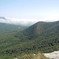
Izobilnoe Reservoir lies on the Ulu-Uzen River in Crimea, formed where the Sofu-Uzen and Uzen-Bash rivers meet. It is the deepest reservoir on the peninsula, with a maximum depth of 70 m, a water surface of 0.61 km² and a 4 km length. An earth dam 70 m high and 550 m long holds the water.

The reservoir was built during the Soviet era to support agriculture and regional development. It has remained a key resource for local people, though water levels have dropped sharply in recent years due to drought and reduced rainfall.

The reservoir is fed by the Sofu-Uzen and Uzen-Bash rivers, and the Ulu-Uzen flows out of it. Its Crimean Tatar name, Körbekül yapma gölü, links it to the village of Körbekül, now Izobilne. The reservoir supplies fresh water to Alushta and is used for irrigation.

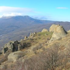
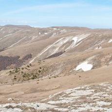
The reservoir lies southwest of Izobilne village in the Alushta region, on the Ulu-Uzen River, reached by road from Alushta. The 70 m earth dam, 550 m long, is the main structure to look for. By 2025 the basin had largely dried out after years of overuse, poor upkeep and extreme heat, so expect exposed bed rather than water.

The reservoir's earth dam stands 70 m high and 550 m long, built in 1979 by SMU-630 of the Kyivhydrospetsbud trust. Its design capacity exceeded 36 million m³, yet the planned volume was 13.25 million m³. Prolonged overuse, poor upkeep during the Russian occupation and extreme heat left it essentially dry in 2025.

The community of curious travelers

AroundUs brings together thousands of curated places, local tips, and hidden gems, enriched daily by 93,277 contributors worldwide.

Start exploring
GPS coordinates
44.69500,34.34620
Latest update
October 29, 2026 06:39
Reviews
Share your experience

No review yet

Discussions
Start a discussion...

No discussion yet

« Izobilnoe Reservoir - Reservoir in Alushta region, Crimea » is provided by Around Us (aroundus.com). Images and texts are derived from Wikimedia project under a Creative Commons license. You are allowed to copy, distribute, and modify copies of this page, under the conditions set by the license, as long as this note is clearly visible.

Discover hidden gems everywhere you go!

From secret cafés to breathtaking viewpoints, skip the crowded tourist spots and find places that match your style. Our app makes it easy with voice search, smart filtering, route optimization, and insider tips from travelers worldwide. Download now for the complete mobile experience.

Around Us App Screenshot
❝

A unique approach to discovering new places❞

— Le Figaro

❝

All the places worth exploring❞

— France Info

❝

A tailor-made excursion in just a few clicks❞

— 20 Minutes

Around Us
Travel Guide & Maps
Download

Send to your phone

QR Code
1

Open the camera app on your mobile.

2

Point at the QR code with your camera. A notification will appear.

3

Tap the notification to open the link.