See the monuments around you in AROpen chests in the app
Around Us is built for your phone — point your camera at the streets and discover the monuments and places around you in augmented reality.Around Us is built for your phone — chests unlock when you walk, explore and capture nearby places.
This island shows what happens when volcanic forces meet the sea, creating landscapes that people have learned to call home.
Jeju Island in South Korea tells the story of how volcanoes shaped a place and how people learned to live there. The island rises from the sea, born from volcanic eruptions that created mountains, cones, and underground tunnels. What you see when you walk around Jeju today shows both this geological past and the lives of people who have made the island home for centuries.
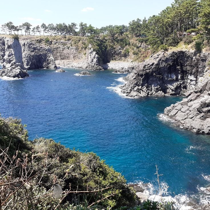
The natural landscape dominates your experience here. Hallasan, the highest mountain in South Korea, sits at the island's center with its crater visible from many directions. Along the coasts, you find waterfalls that drop into the ocean, basalt cliffs carved by waves, and smaller volcanic cones that rise from beaches. Lava tubes run underground beneath your feet, and forests of ancient trees offer shelter from the open volcanic terrain. The beaches have sand and turquoise water, while smaller islands nearby invite exploration by bike or boat.
But Jeju is more than geology. Traditional villages preserve the island's building style, with stone houses and low walls that tell you how people adapted to this volcanic land. The Haenyeo, female divers who have worked these waters for generations, represent a living culture tied to the sea. Walking paths cross the island, connecting villages, ports, fields, and coastlines. Tea plantations, botanical gardens, and coastal cafes show how Jeju has developed while keeping its character. Every corner of the island reflects the connection between its volcanic nature and the people who call it home.
This island shows what happens when volcanic forces meet the sea, creating landscapes that people have learned to call home.
Jeju Island in South Korea tells the story of how volcanoes shaped a place and how people learned to live there. The island rises from the sea, born from volcanic eruptions that created mountains, cones, and underground tunnels. What you see when you walk around Jeju today shows both this geological past and the lives of people who have made the island home for centuries.
The natural landscape dominates your experience here. Hallasan, the highest mountain in South Korea, sits at the island's center with its crater visible from many directions. Along the coasts, you find waterfalls that drop into the ocean, basalt cliffs carved by waves, and smaller volcanic cones that rise from beaches. Lava tubes run underground beneath your feet, and forests of ancient trees offer shelter from the open volcanic terrain. The beaches have sand and turquoise water, while smaller islands nearby invite exploration by bike or boat.
But Jeju is more than geology. Traditional villages preserve the island's building style, with stone houses and low walls that tell you how people adapted to this volcanic land. The Haenyeo, female divers who have worked these waters for generations, represent a living culture tied to the sea. Walking paths cross the island, connecting villages, ports, fields, and coastlines. Tea plantations, botanical gardens, and coastal cafes show how Jeju has developed while keeping its character. Every corner of the island reflects the connection between its volcanic nature and the people who call it home.
Hallasan National Park sits at the center of Jeju Island and holds the highest mountain in South Korea. This dormant volcano gives the whole island its shape. At the top, a crater opens up, and the slopes around it change with the seasons, from flowering trees in spring to snow-covered rocks in winter. Walking trails cross the mountain through forests and open terrain, making it accessible to those willing to climb.
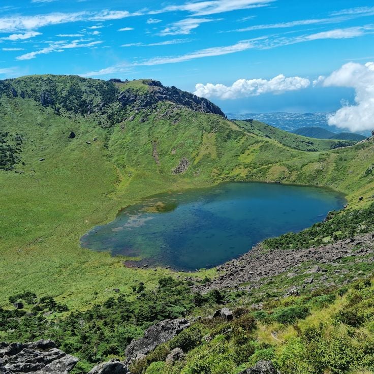
Baengnokdam Crater sits at the top of Hallasan, the highest mountain in South Korea, at the center of Jeju Island. Hikers who make the long climb reach a crater lake ringed by bare rock. From up here, the rest of the island and the surrounding sea open up in every direction, showing how volcanic this land truly is.
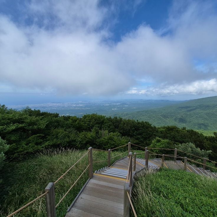
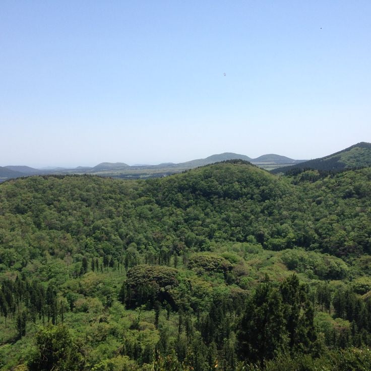
The Eoseungsaengak Trail leads up a small volcanic cone on Jeju Island. From the top, you get a wide view over the island's volcanic interior, with fields, forests, and the peak of Hallasan visible in the distance. The hike is shorter than the routes up Hallasan, making it a good option for those who want to see the landscape from above without a long climb.
The 1100 Highland Wetland sits high on the slopes of Hallasan, Jeju's central volcano. While much of the island is shaped by bare lava rock and coastline, this high-altitude zone feels different. Still water, reeds, and plants that thrive in cooler, wetter conditions give the area a quiet character unlike the rest of Jeju.
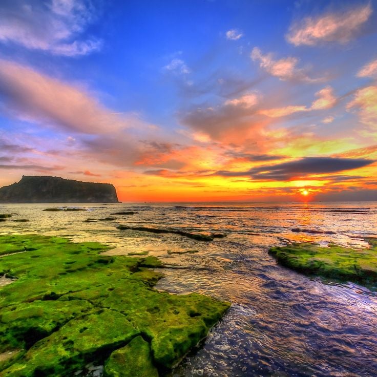
Seongsan Ilchulbong, known as Sunrise Peak, is a volcanic tuff cone that rises straight out of the sea on the eastern tip of Jeju Island. It formed from an underwater eruption and is part of the UNESCO World Heritage site on Jeju. The crater at the top is wide and bowl-shaped, surrounded by sharp rock edges. Many visitors climb up before dawn to watch the sun rise over the ocean, which is exactly how this peak got its name.
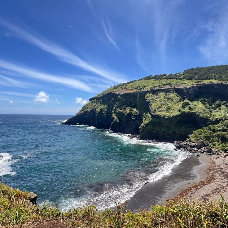
Seopjikoji Cape sits at the eastern tip of Jeju Island, where grassy slopes and basalt cliffs meet the sea. The view across the water toward Seongsan Ilchulbong, a volcanic crater rising from the ocean, draws many visitors. In spring, yellow canola flowers cover the fields along the walking path, giving the cape a warm, open feel. The wind blows steadily here, and the path along the edge of the cliffs offers a clear sense of how volcanic rock shapes this coastline.
Geomunoreum is a volcanic cone on Jeju Island that helps explain how the island's underground lava tunnels were formed. Walking up this cone gives you a sense of how molten rock once moved through the earth, carving out a large network of tunnels and caves below. From the top, the surrounding landscape shows just how much the island's shape owes to volcanic activity over time.
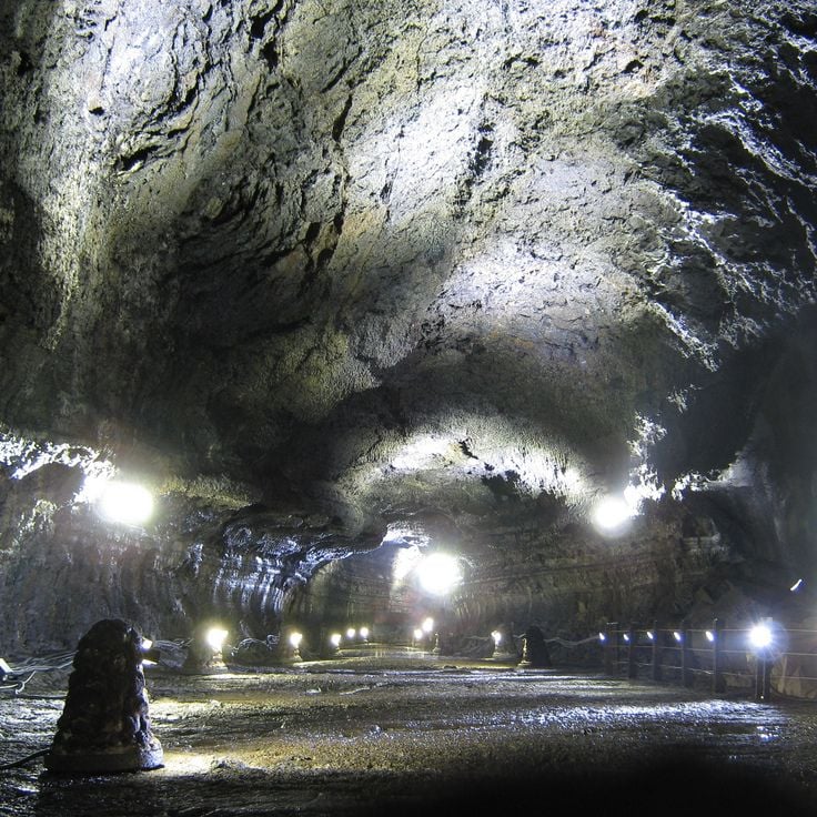
Manjanggul Lava Tube is one of the longest lava tubes in the world and part of the Geomunoreum volcanic system on Jeju Island. Walking through it, you follow the path that molten lava once carved underground, leaving behind a long, dark corridor with rocky walls and formations shaped by cooling rock. The tube gives a direct sense of how volcanic forces built the island from below.
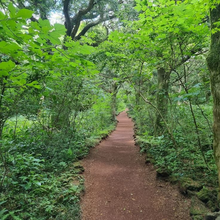
Bijarim Forest stands apart from the open volcanic terrain that defines much of Jeju Island. This forest is home to Torreya trees, many of them very old, growing so closely together that the light filters through the canopy in soft patches. Walking here feels different from the rest of the island, cooler and more sheltered, with the sound of wind through dense branches rather than open sky above.
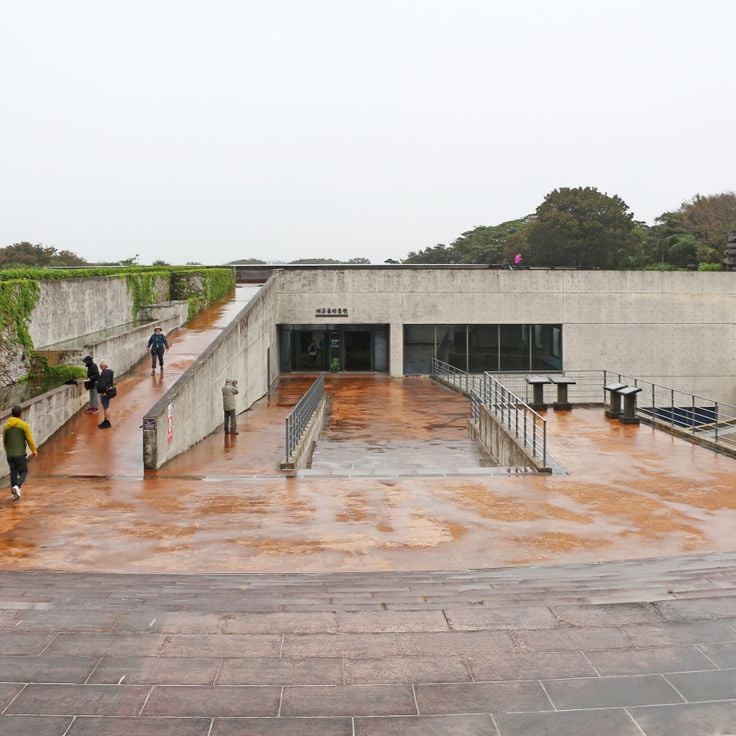
Jeju Stone Park explores the role that volcanic rock has played in shaping Jeju Island. Walking through this park, you can see how stone shaped the way people built, lived, and told stories here. Local legends and traditional structures made of lava rock sit side by side, giving a clear sense of how deeply stone is woven into the island's everyday life and identity.
Udo Island sits just off the eastern coast of Jeju, facing Seongsan across a short stretch of water. The island has black lava cliffs, sandy beaches, and small villages where daily life moves slowly. Coastal roads wind around the island and are easy to follow by bike or scooter, making Udo a natural stop for anyone exploring Jeju by the sea.
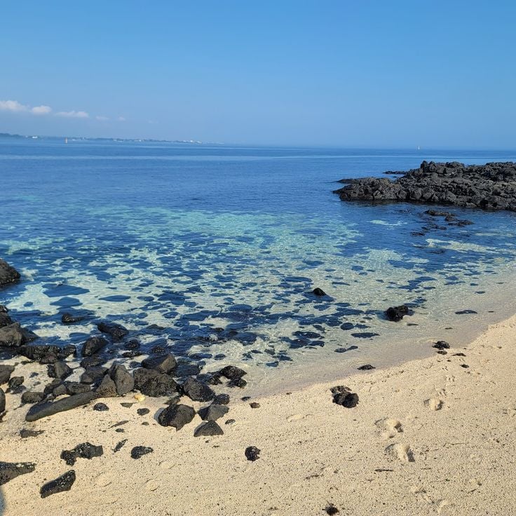
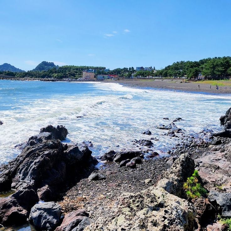
Seobin Baeksa Beach sits on Udo Island, a small volcanic island off the northeast coast of Jeju. The beach is known for its white coral gravel, which gives it a texture different from most beaches on the main island. The water here is clear and blue, and on good days you can see Hallasan rising in the distance. Udo is easy to reach by ferry, and most visitors explore the island by bike or electric cart.
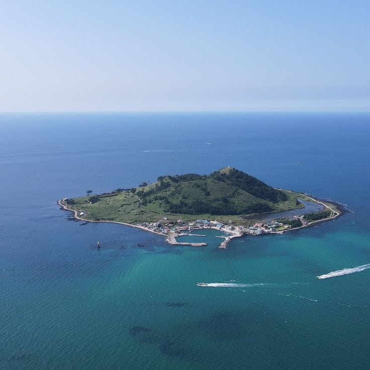
Biyangdo Island sits off the coast of Jeju and is a small volcanic island you can reach by boat. Those who come here find basalt rocks, coastal paths, and open water on all sides. The island is a good place to experience the volcanic character of Jeju in a setting that feels simple and close to the sea.
Jeongbang Waterfall in Seogwipo drops straight down a basalt cliff and falls directly into the sea below. This is one of the few places in the world where a waterfall meets the ocean without any beach or riverbed in between. The black rock face, the falling water, and the open sea make this a striking stop along Jeju's southern coast.
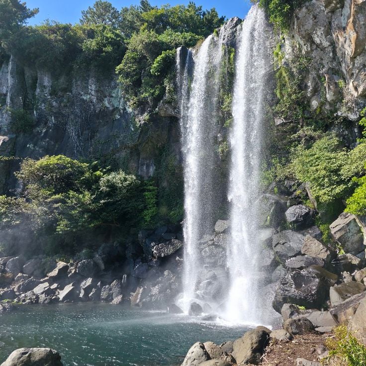
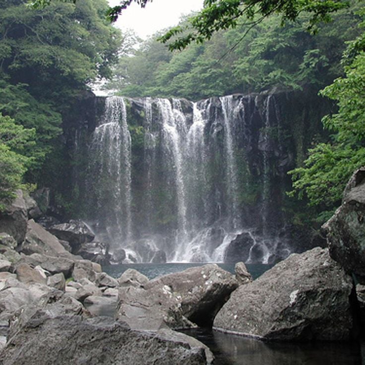
Cheonjiyeon Waterfall sits just outside the city of Seogwipo and is easy to reach on foot. Water drops over a basalt wall into a dark pool below. Subtropical plants grow thick along the surrounding cliffs and path, framing the fall with greenery. This waterfall shows clearly how the volcanic rock of Jeju shapes the water that flows across the island.
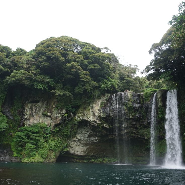
The Cheonjeyeon Waterfalls are a series of three falls and natural pools set in the Jungmun area of Seogwipo. Water moves over basalt rock shaped by the same volcanic forces that formed Jeju itself. Each waterfall feeds into the next before reaching the sea. The path through the gorge is lined with trees and ferns, giving the walk a feeling of stepping deep into the island's interior.
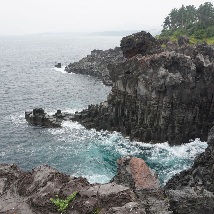
Jusangjeolli Cliff, on the southern coast of Jeju Island near Seogwipo, is a wall of basalt columns that formed when lava from a volcanic eruption met the sea and cooled rapidly. The result is a dense row of hexagonal and rectangular stone pillars rising straight from the water. Waves break against the rock constantly, giving the spot a raw, open quality. This cliff is a clear example of how volcanic forces shaped Jeju's coastline over thousands of years.
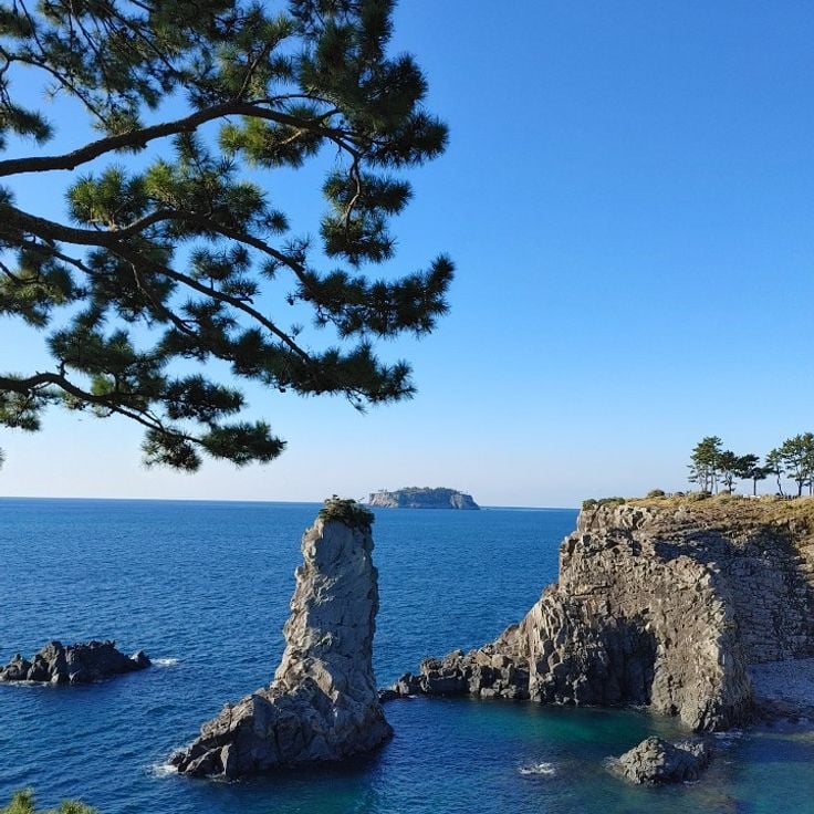
Oedolgae is a large basalt rock that rises straight out of the sea just off the coast of Seogwipo. It stands alone in the water, surrounded by cliffs and coastal plants. This sea stack is a direct result of the volcanic forces that shaped Jeju Island, and it shows how wind and waves have worked the lava over a very long time.
The Soesokkak Estuary sits in Seogwipo, where a river pushes through a narrow passage of volcanic rock before meeting the sea. The walls of dark basalt rise on both sides, covered with trees and moss. Small boats move slowly through the water, and the whole place feels tucked away from the open coast. It is a good example of how Jeju's volcanic past shaped even its smallest waterways.
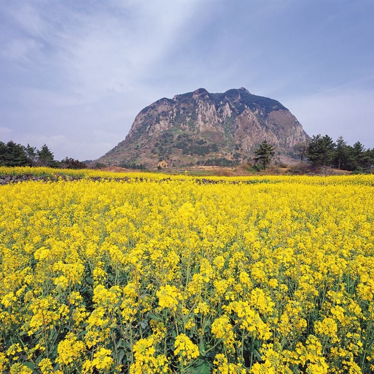
Sanbangsan Mountain rises on the southwestern tip of Jeju Island as a broad volcanic dome. Unlike the crater cones found elsewhere on the island, it has a rounded, solid top with no summit crater. A small cave shrine sits partway up its flank, and from there you can look out over the coast and the sea beyond. The dark basalt rock shows the same volcanic origins that shaped the rest of Jeju.
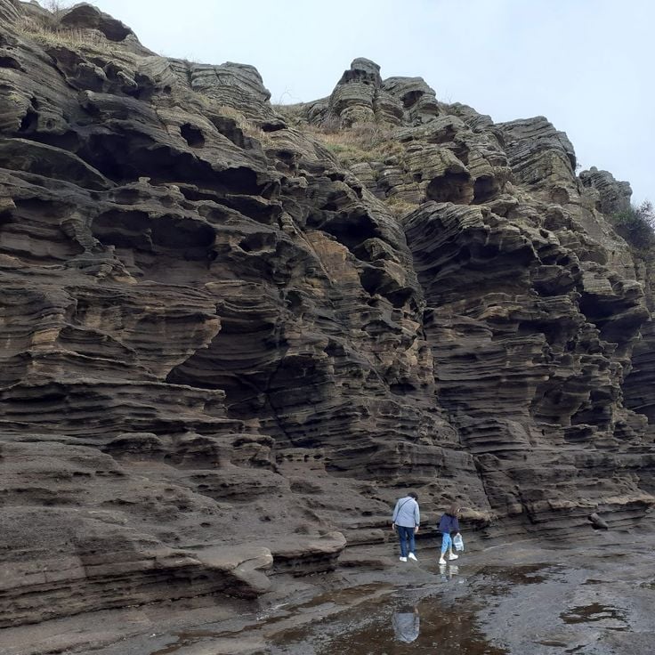
The Yongmeori Coast sits at the base of Sanbangsan mountain, where layers of rock rise from the sea like canyon walls. Waves have carved these formations over a very long time, shaping ridges, hollows, and columns of stone that stand close to the waterline. Walking the narrow path between the cliffs and the ocean gives a clear sense of how the sea and the volcanic past of Jeju have worked together to shape this stretch of coastline.
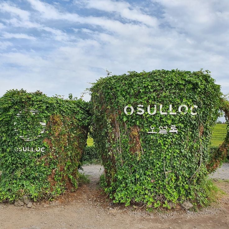
Osulloc Tea Museum & Tea Fields sits in Seogwipo and offers a clear visual change from the volcanic terrain that covers much of Jeju Island. Rows of green tea plants spread across the hillsides, creating an open and orderly landscape. The museum tells the story of tea cultivation on the island and gives visitors a place to learn about this side of Jeju's identity, far from lava cliffs and craters.
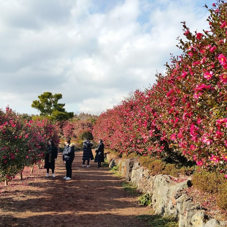
Camellia Hill is a botanical garden in Seogwipo, on the southern side of Jeju Island, best known for its camellia collection. The plants bloom at different times of year, so the garden looks and feels different depending on when you visit. Paths wind through dense plantings, and the island's volcanic rock appears between the flower beds throughout the grounds.
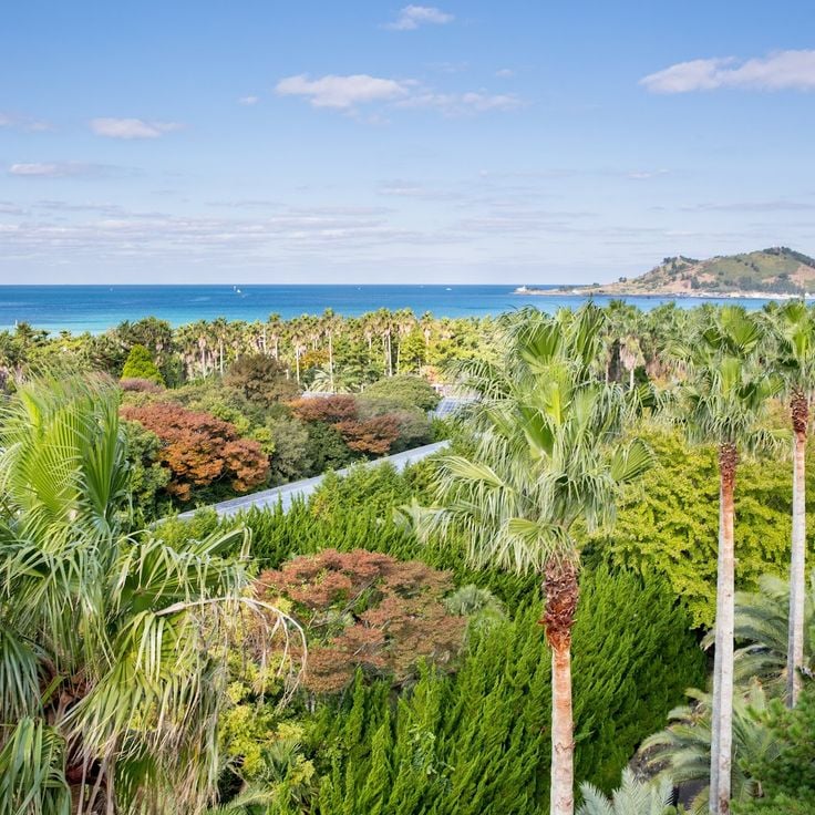
Hallim Park sits on the western coast of Jeju Island and brings together subtropical plants, themed garden sections, and the island's volcanic landscape. Walking through it, you move from dense greenery to open lava tube caves that run beneath the garden paths, then past traditional thatched stone houses that show how people once lived on this volcanic island.
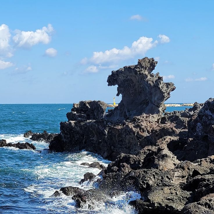
Yongduam Rock, also called Dragon Head Rock, is a basalt formation on the coast near Jeju City. The sea has shaped it over centuries into a form that looks like a dragon rising from the water. It sits right at the shoreline, easy to reach on foot, and has long been one of the most familiar sights on the island for locals and visitors alike.
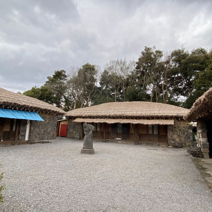
Seongeup Folk Village sits in the interior of Jeju Island and gives a clear picture of how people lived here for centuries. The stone houses are built from volcanic rock, and low walls run between them, shaping the layout of the village. Thatched roofs complete the look of a place that has kept its traditional building style. Walking through Seongeup feels like stepping into daily life as it was on this island long ago.
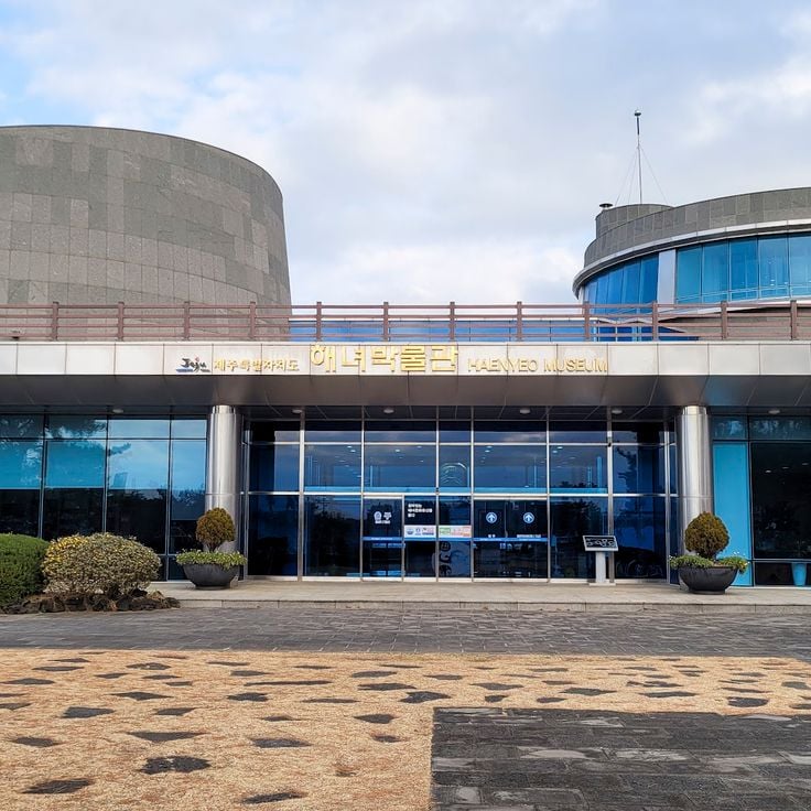
The Jeju Haenyeo Museum tells the story of the women who have dived these waters for generations, collecting shellfish and sea creatures to support their families. It gives a human face to Jeju's long relationship with the sea, showing how these divers lived, worked, and passed their skills from mother to daughter. Visiting this museum helps you understand a side of island life that geology alone cannot explain.
The Jeju Olle Trail is a network of walking paths that cross the island from coast to village to field. The routes take you along shorelines, past small ports, through farming land, and over volcanic terrain. Some sections run beside the sea, others climb the slopes of volcanic cones. Walking these paths gives you a ground-level sense of how the island looks and feels in daily life.
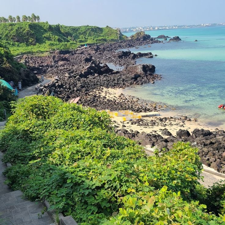
The Aewol Handam Coastal Walk follows the shoreline along a stretch of volcanic rock on the northwest side of Jeju. Black basalt meets the water here, and the path runs close to the sea. The area has become known for its oceanfront cafes that line the coast, drawing locals and visitors who come to walk, sit, and watch the waves.
Hallasan National Park sits at the center of Jeju Island and holds the highest mountain in South Korea. This dormant volcano gives the whole island its shape. At the top, a crater opens up, and the slopes around it change with the seasons, from flowering trees in spring to snow-covered rocks in winter. Walking trails cross the mountain through forests and open terrain, making it accessible to those willing to climb.
Baengnokdam Crater sits at the top of Hallasan, the highest mountain in South Korea, at the center of Jeju Island. Hikers who make the long climb reach a crater lake ringed by bare rock. From up here, the rest of the island and the surrounding sea open up in every direction, showing how volcanic this land truly is.
The Eoseungsaengak Trail leads up a small volcanic cone on Jeju Island. From the top, you get a wide view over the island's volcanic interior, with fields, forests, and the peak of Hallasan visible in the distance. The hike is shorter than the routes up Hallasan, making it a good option for those who want to see the landscape from above without a long climb.
The 1100 Highland Wetland sits high on the slopes of Hallasan, Jeju's central volcano. While much of the island is shaped by bare lava rock and coastline, this high-altitude zone feels different. Still water, reeds, and plants that thrive in cooler, wetter conditions give the area a quiet character unlike the rest of Jeju.
Seongsan Ilchulbong, known as Sunrise Peak, is a volcanic tuff cone that rises straight out of the sea on the eastern tip of Jeju Island. It formed from an underwater eruption and is part of the UNESCO World Heritage site on Jeju. The crater at the top is wide and bowl-shaped, surrounded by sharp rock edges. Many visitors climb up before dawn to watch the sun rise over the ocean, which is exactly how this peak got its name.
Seopjikoji Cape sits at the eastern tip of Jeju Island, where grassy slopes and basalt cliffs meet the sea. The view across the water toward Seongsan Ilchulbong, a volcanic crater rising from the ocean, draws many visitors. In spring, yellow canola flowers cover the fields along the walking path, giving the cape a warm, open feel. The wind blows steadily here, and the path along the edge of the cliffs offers a clear sense of how volcanic rock shapes this coastline.
Geomunoreum is a volcanic cone on Jeju Island that helps explain how the island's underground lava tunnels were formed. Walking up this cone gives you a sense of how molten rock once moved through the earth, carving out a large network of tunnels and caves below. From the top, the surrounding landscape shows just how much the island's shape owes to volcanic activity over time.
Manjanggul Lava Tube is one of the longest lava tubes in the world and part of the Geomunoreum volcanic system on Jeju Island. Walking through it, you follow the path that molten lava once carved underground, leaving behind a long, dark corridor with rocky walls and formations shaped by cooling rock. The tube gives a direct sense of how volcanic forces built the island from below.
Bijarim Forest stands apart from the open volcanic terrain that defines much of Jeju Island. This forest is home to Torreya trees, many of them very old, growing so closely together that the light filters through the canopy in soft patches. Walking here feels different from the rest of the island, cooler and more sheltered, with the sound of wind through dense branches rather than open sky above.
Jeju Stone Park explores the role that volcanic rock has played in shaping Jeju Island. Walking through this park, you can see how stone shaped the way people built, lived, and told stories here. Local legends and traditional structures made of lava rock sit side by side, giving a clear sense of how deeply stone is woven into the island's everyday life and identity.
Udo Island sits just off the eastern coast of Jeju, facing Seongsan across a short stretch of water. The island has black lava cliffs, sandy beaches, and small villages where daily life moves slowly. Coastal roads wind around the island and are easy to follow by bike or scooter, making Udo a natural stop for anyone exploring Jeju by the sea.
Seobin Baeksa Beach sits on Udo Island, a small volcanic island off the northeast coast of Jeju. The beach is known for its white coral gravel, which gives it a texture different from most beaches on the main island. The water here is clear and blue, and on good days you can see Hallasan rising in the distance. Udo is easy to reach by ferry, and most visitors explore the island by bike or electric cart.
Biyangdo Island sits off the coast of Jeju and is a small volcanic island you can reach by boat. Those who come here find basalt rocks, coastal paths, and open water on all sides. The island is a good place to experience the volcanic character of Jeju in a setting that feels simple and close to the sea.
Jeongbang Waterfall in Seogwipo drops straight down a basalt cliff and falls directly into the sea below. This is one of the few places in the world where a waterfall meets the ocean without any beach or riverbed in between. The black rock face, the falling water, and the open sea make this a striking stop along Jeju's southern coast.
Cheonjiyeon Waterfall sits just outside the city of Seogwipo and is easy to reach on foot. Water drops over a basalt wall into a dark pool below. Subtropical plants grow thick along the surrounding cliffs and path, framing the fall with greenery. This waterfall shows clearly how the volcanic rock of Jeju shapes the water that flows across the island.
The Cheonjeyeon Waterfalls are a series of three falls and natural pools set in the Jungmun area of Seogwipo. Water moves over basalt rock shaped by the same volcanic forces that formed Jeju itself. Each waterfall feeds into the next before reaching the sea. The path through the gorge is lined with trees and ferns, giving the walk a feeling of stepping deep into the island's interior.
Jusangjeolli Cliff, on the southern coast of Jeju Island near Seogwipo, is a wall of basalt columns that formed when lava from a volcanic eruption met the sea and cooled rapidly. The result is a dense row of hexagonal and rectangular stone pillars rising straight from the water. Waves break against the rock constantly, giving the spot a raw, open quality. This cliff is a clear example of how volcanic forces shaped Jeju's coastline over thousands of years.
Oedolgae is a large basalt rock that rises straight out of the sea just off the coast of Seogwipo. It stands alone in the water, surrounded by cliffs and coastal plants. This sea stack is a direct result of the volcanic forces that shaped Jeju Island, and it shows how wind and waves have worked the lava over a very long time.
The Soesokkak Estuary sits in Seogwipo, where a river pushes through a narrow passage of volcanic rock before meeting the sea. The walls of dark basalt rise on both sides, covered with trees and moss. Small boats move slowly through the water, and the whole place feels tucked away from the open coast. It is a good example of how Jeju's volcanic past shaped even its smallest waterways.
Sanbangsan Mountain rises on the southwestern tip of Jeju Island as a broad volcanic dome. Unlike the crater cones found elsewhere on the island, it has a rounded, solid top with no summit crater. A small cave shrine sits partway up its flank, and from there you can look out over the coast and the sea beyond. The dark basalt rock shows the same volcanic origins that shaped the rest of Jeju.
The Yongmeori Coast sits at the base of Sanbangsan mountain, where layers of rock rise from the sea like canyon walls. Waves have carved these formations over a very long time, shaping ridges, hollows, and columns of stone that stand close to the waterline. Walking the narrow path between the cliffs and the ocean gives a clear sense of how the sea and the volcanic past of Jeju have worked together to shape this stretch of coastline.
Osulloc Tea Museum & Tea Fields sits in Seogwipo and offers a clear visual change from the volcanic terrain that covers much of Jeju Island. Rows of green tea plants spread across the hillsides, creating an open and orderly landscape. The museum tells the story of tea cultivation on the island and gives visitors a place to learn about this side of Jeju's identity, far from lava cliffs and craters.
Camellia Hill is a botanical garden in Seogwipo, on the southern side of Jeju Island, best known for its camellia collection. The plants bloom at different times of year, so the garden looks and feels different depending on when you visit. Paths wind through dense plantings, and the island's volcanic rock appears between the flower beds throughout the grounds.
Hallim Park sits on the western coast of Jeju Island and brings together subtropical plants, themed garden sections, and the island's volcanic landscape. Walking through it, you move from dense greenery to open lava tube caves that run beneath the garden paths, then past traditional thatched stone houses that show how people once lived on this volcanic island.
Yongduam Rock, also called Dragon Head Rock, is a basalt formation on the coast near Jeju City. The sea has shaped it over centuries into a form that looks like a dragon rising from the water. It sits right at the shoreline, easy to reach on foot, and has long been one of the most familiar sights on the island for locals and visitors alike.
Seongeup Folk Village sits in the interior of Jeju Island and gives a clear picture of how people lived here for centuries. The stone houses are built from volcanic rock, and low walls run between them, shaping the layout of the village. Thatched roofs complete the look of a place that has kept its traditional building style. Walking through Seongeup feels like stepping into daily life as it was on this island long ago.
The Jeju Haenyeo Museum tells the story of the women who have dived these waters for generations, collecting shellfish and sea creatures to support their families. It gives a human face to Jeju's long relationship with the sea, showing how these divers lived, worked, and passed their skills from mother to daughter. Visiting this museum helps you understand a side of island life that geology alone cannot explain.
The Jeju Olle Trail is a network of walking paths that cross the island from coast to village to field. The routes take you along shorelines, past small ports, through farming land, and over volcanic terrain. Some sections run beside the sea, others climb the slopes of volcanic cones. Walking these paths gives you a ground-level sense of how the island looks and feels in daily life.
The Aewol Handam Coastal Walk follows the shoreline along a stretch of volcanic rock on the northwest side of Jeju. Black basalt meets the water here, and the path runs close to the sea. The area has become known for its oceanfront cafes that line the coast, drawing locals and visitors who come to walk, sit, and watch the waves.
Hallasan National Park sits at the center of Jeju Island and holds the highest mountain in South Korea. This dormant volcano gives the whole island its shape. At the top, a crater opens up, and the slopes around it change with the seasons, from flowering trees in spring to snow-covered rocks in winter. Walking trails cross the mountain through forests and open terrain, making it accessible to those willing to climb.
Baengnokdam Crater sits at the top of Hallasan, the highest mountain in South Korea, at the center of Jeju Island. Hikers who make the long climb reach a crater lake ringed by bare rock. From up here, the rest of the island and the surrounding sea open up in every direction, showing how volcanic this land truly is.
The Eoseungsaengak Trail leads up a small volcanic cone on Jeju Island. From the top, you get a wide view over the island's volcanic interior, with fields, forests, and the peak of Hallasan visible in the distance. The hike is shorter than the routes up Hallasan, making it a good option for those who want to see the landscape from above without a long climb.
The 1100 Highland Wetland sits high on the slopes of Hallasan, Jeju's central volcano. While much of the island is shaped by bare lava rock and coastline, this high-altitude zone feels different. Still water, reeds, and plants that thrive in cooler, wetter conditions give the area a quiet character unlike the rest of Jeju.
Seongsan Ilchulbong, known as Sunrise Peak, is a volcanic tuff cone that rises straight out of the sea on the eastern tip of Jeju Island. It formed from an underwater eruption and is part of the UNESCO World Heritage site on Jeju. The crater at the top is wide and bowl-shaped, surrounded by sharp rock edges. Many visitors climb up before dawn to watch the sun rise over the ocean, which is exactly how this peak got its name.
Seopjikoji Cape sits at the eastern tip of Jeju Island, where grassy slopes and basalt cliffs meet the sea. The view across the water toward Seongsan Ilchulbong, a volcanic crater rising from the ocean, draws many visitors. In spring, yellow canola flowers cover the fields along the walking path, giving the cape a warm, open feel. The wind blows steadily here, and the path along the edge of the cliffs offers a clear sense of how volcanic rock shapes this coastline.
Geomunoreum is a volcanic cone on Jeju Island that helps explain how the island's underground lava tunnels were formed. Walking up this cone gives you a sense of how molten rock once moved through the earth, carving out a large network of tunnels and caves below. From the top, the surrounding landscape shows just how much the island's shape owes to volcanic activity over time.
Manjanggul Lava Tube is one of the longest lava tubes in the world and part of the Geomunoreum volcanic system on Jeju Island. Walking through it, you follow the path that molten lava once carved underground, leaving behind a long, dark corridor with rocky walls and formations shaped by cooling rock. The tube gives a direct sense of how volcanic forces built the island from below.
Bijarim Forest stands apart from the open volcanic terrain that defines much of Jeju Island. This forest is home to Torreya trees, many of them very old, growing so closely together that the light filters through the canopy in soft patches. Walking here feels different from the rest of the island, cooler and more sheltered, with the sound of wind through dense branches rather than open sky above.
Jeju Stone Park explores the role that volcanic rock has played in shaping Jeju Island. Walking through this park, you can see how stone shaped the way people built, lived, and told stories here. Local legends and traditional structures made of lava rock sit side by side, giving a clear sense of how deeply stone is woven into the island's everyday life and identity.
Udo Island sits just off the eastern coast of Jeju, facing Seongsan across a short stretch of water. The island has black lava cliffs, sandy beaches, and small villages where daily life moves slowly. Coastal roads wind around the island and are easy to follow by bike or scooter, making Udo a natural stop for anyone exploring Jeju by the sea.
Seobin Baeksa Beach sits on Udo Island, a small volcanic island off the northeast coast of Jeju. The beach is known for its white coral gravel, which gives it a texture different from most beaches on the main island. The water here is clear and blue, and on good days you can see Hallasan rising in the distance. Udo is easy to reach by ferry, and most visitors explore the island by bike or electric cart.
Biyangdo Island sits off the coast of Jeju and is a small volcanic island you can reach by boat. Those who come here find basalt rocks, coastal paths, and open water on all sides. The island is a good place to experience the volcanic character of Jeju in a setting that feels simple and close to the sea.
Jeongbang Waterfall in Seogwipo drops straight down a basalt cliff and falls directly into the sea below. This is one of the few places in the world where a waterfall meets the ocean without any beach or riverbed in between. The black rock face, the falling water, and the open sea make this a striking stop along Jeju's southern coast.
Cheonjiyeon Waterfall sits just outside the city of Seogwipo and is easy to reach on foot. Water drops over a basalt wall into a dark pool below. Subtropical plants grow thick along the surrounding cliffs and path, framing the fall with greenery. This waterfall shows clearly how the volcanic rock of Jeju shapes the water that flows across the island.
The Cheonjeyeon Waterfalls are a series of three falls and natural pools set in the Jungmun area of Seogwipo. Water moves over basalt rock shaped by the same volcanic forces that formed Jeju itself. Each waterfall feeds into the next before reaching the sea. The path through the gorge is lined with trees and ferns, giving the walk a feeling of stepping deep into the island's interior.
Jusangjeolli Cliff, on the southern coast of Jeju Island near Seogwipo, is a wall of basalt columns that formed when lava from a volcanic eruption met the sea and cooled rapidly. The result is a dense row of hexagonal and rectangular stone pillars rising straight from the water. Waves break against the rock constantly, giving the spot a raw, open quality. This cliff is a clear example of how volcanic forces shaped Jeju's coastline over thousands of years.
Oedolgae is a large basalt rock that rises straight out of the sea just off the coast of Seogwipo. It stands alone in the water, surrounded by cliffs and coastal plants. This sea stack is a direct result of the volcanic forces that shaped Jeju Island, and it shows how wind and waves have worked the lava over a very long time.
The Soesokkak Estuary sits in Seogwipo, where a river pushes through a narrow passage of volcanic rock before meeting the sea. The walls of dark basalt rise on both sides, covered with trees and moss. Small boats move slowly through the water, and the whole place feels tucked away from the open coast. It is a good example of how Jeju's volcanic past shaped even its smallest waterways.
Sanbangsan Mountain rises on the southwestern tip of Jeju Island as a broad volcanic dome. Unlike the crater cones found elsewhere on the island, it has a rounded, solid top with no summit crater. A small cave shrine sits partway up its flank, and from there you can look out over the coast and the sea beyond. The dark basalt rock shows the same volcanic origins that shaped the rest of Jeju.
The Yongmeori Coast sits at the base of Sanbangsan mountain, where layers of rock rise from the sea like canyon walls. Waves have carved these formations over a very long time, shaping ridges, hollows, and columns of stone that stand close to the waterline. Walking the narrow path between the cliffs and the ocean gives a clear sense of how the sea and the volcanic past of Jeju have worked together to shape this stretch of coastline.
Osulloc Tea Museum & Tea Fields sits in Seogwipo and offers a clear visual change from the volcanic terrain that covers much of Jeju Island. Rows of green tea plants spread across the hillsides, creating an open and orderly landscape. The museum tells the story of tea cultivation on the island and gives visitors a place to learn about this side of Jeju's identity, far from lava cliffs and craters.
Camellia Hill is a botanical garden in Seogwipo, on the southern side of Jeju Island, best known for its camellia collection. The plants bloom at different times of year, so the garden looks and feels different depending on when you visit. Paths wind through dense plantings, and the island's volcanic rock appears between the flower beds throughout the grounds.
Hallim Park sits on the western coast of Jeju Island and brings together subtropical plants, themed garden sections, and the island's volcanic landscape. Walking through it, you move from dense greenery to open lava tube caves that run beneath the garden paths, then past traditional thatched stone houses that show how people once lived on this volcanic island.
Yongduam Rock, also called Dragon Head Rock, is a basalt formation on the coast near Jeju City. The sea has shaped it over centuries into a form that looks like a dragon rising from the water. It sits right at the shoreline, easy to reach on foot, and has long been one of the most familiar sights on the island for locals and visitors alike.
Seongeup Folk Village sits in the interior of Jeju Island and gives a clear picture of how people lived here for centuries. The stone houses are built from volcanic rock, and low walls run between them, shaping the layout of the village. Thatched roofs complete the look of a place that has kept its traditional building style. Walking through Seongeup feels like stepping into daily life as it was on this island long ago.
The Jeju Haenyeo Museum tells the story of the women who have dived these waters for generations, collecting shellfish and sea creatures to support their families. It gives a human face to Jeju's long relationship with the sea, showing how these divers lived, worked, and passed their skills from mother to daughter. Visiting this museum helps you understand a side of island life that geology alone cannot explain.
The Jeju Olle Trail is a network of walking paths that cross the island from coast to village to field. The routes take you along shorelines, past small ports, through farming land, and over volcanic terrain. Some sections run beside the sea, others climb the slopes of volcanic cones. Walking these paths gives you a ground-level sense of how the island looks and feels in daily life.
The Aewol Handam Coastal Walk follows the shoreline along a stretch of volcanic rock on the northwest side of Jeju. Black basalt meets the water here, and the path runs close to the sea. The area has become known for its oceanfront cafes that line the coast, drawing locals and visitors who come to walk, sit, and watch the waves.
After exploring Jeju's volcanoes and villages, take time to walk the Olle Trail. These paths connect the island's quietest corners and let you move at your own pace, discovering small details that maps don't show. Bring water and wear good shoes, as the paths cross rocky terrain and can be slippery after rain.