See the monuments around you in AROpen chests in the app
Around Us is built for your phone — point your camera at the streets and discover the monuments and places around you in augmented reality.Around Us is built for your phone — chests unlock when you walk, explore and capture nearby places.
Eastern Anatolia spreads its treasures among ancient ruins, stone fortresses and mountain landscapes that tell millennia of history.
Eastern Anatolia keeps traces of several millennia of history. Traveling through this region, you meet Greek and Roman ruins, medieval stone fortresses, churches and monasteries built by Armenians and Georgians, as well as Ottoman palaces perched on the heights. The landscapes change constantly: from dry high plateaus to green valleys, from frozen mountain lakes to singular geological formations. Ani, former capital of the Bagratid kingdom, shows how important this region was along the Silk Road. Further south, Lake Van spreads its blue waters surrounded by dormant volcanoes.
This collection brings together 30 sites that tell different sides of Eastern Anatolia. You will find great names in archaeology such as Arslantepe, recognized by UNESCO for its role in the birth of the first complex societies, but also lesser known castles such as that of Hoşap which overlooks the plateaus. Armenian churches remain on isolated islands or cling to mountainsides. Geological curiosities such as the meteorite crater of Gürbulak and Mount Nemrut, with its inner lakes, fascinate with their natural formation. The palace of İshak Paşa, built on a rocky promontory, impresses with its size.
This selection mixes monumental heritage and wild natural areas. The historic towns offer alleys where forgotten architecture remains, while natural parks such as the one at Munzur shelter rivers and wooded slopes. Even less visited sites, such as the funerary steles of Ahlat by the water or the hot springs of Ovacık, are worth the detour. Eastern Anatolia only reveals itself to patient visitors, ready to look beyond the main roads.
Eastern Anatolia spreads its treasures among ancient ruins, stone fortresses and mountain landscapes that tell millennia of history.
Eastern Anatolia keeps traces of several millennia of history. Traveling through this region, you meet Greek and Roman ruins, medieval stone fortresses, churches and monasteries built by Armenians and Georgians, as well as Ottoman palaces perched on the heights. The landscapes change constantly: from dry high plateaus to green valleys, from frozen mountain lakes to singular geological formations. Ani, former capital of the Bagratid kingdom, shows how important this region was along the Silk Road. Further south, Lake Van spreads its blue waters surrounded by dormant volcanoes.
This collection brings together 30 sites that tell different sides of Eastern Anatolia. You will find great names in archaeology such as Arslantepe, recognized by UNESCO for its role in the birth of the first complex societies, but also lesser known castles such as that of Hoşap which overlooks the plateaus. Armenian churches remain on isolated islands or cling to mountainsides. Geological curiosities such as the meteorite crater of Gürbulak and Mount Nemrut, with its inner lakes, fascinate with their natural formation. The palace of İshak Paşa, built on a rocky promontory, impresses with its size.
This selection mixes monumental heritage and wild natural areas. The historic towns offer alleys where forgotten architecture remains, while natural parks such as the one at Munzur shelter rivers and wooded slopes. Even less visited sites, such as the funerary steles of Ahlat by the water or the hot springs of Ovacık, are worth the detour. Eastern Anatolia only reveals itself to patient visitors, ready to look beyond the main roads.
Ani was once one of the largest cities along the Silk Road and served as the capital of the Armenian Bagratid kingdom. Walking through the ruins today, you can see medieval church walls, mosques, and fortress gates still standing on a high plateau near the Armenian border. The site became a UNESCO World Heritage Site in 2016. Ani gives a clear sense of how active and connected this part of eastern Anatolia once was.
The historic center of Kars carries clear marks of the period when the city was under Russian control in the 19th century. The streets run straight and wide, laid out in a planned grid. Along them stand multi-story buildings made from dark basalt stone, many of which are still in use today. This architecture gives Kars a look unlike most other cities in eastern Anatolia. Walking through the center, you notice how Russian urban planning and everyday Turkish life sit side by side.
Lake Çıldır sits on a high plateau in northeastern Turkey and is best known in winter, when it freezes over completely. Local villagers then cross the ice by horse-drawn sleigh, a practice that gives the place a character hard to find elsewhere. In summer, the water reflects an open sky, and the shores are lined with grazing land. The lake is one of the highest in Turkey and sits in a landscape shaped by volcanic rock.
The Öşvank monastery church is a medieval Georgian church standing on a wooded hill near Erzurum. Its stone walls and apse are largely intact. The building feels solid and somewhat isolated, surrounded by mountains and forest. It can be reached by small country roads, away from the main routes of eastern Anatolia.
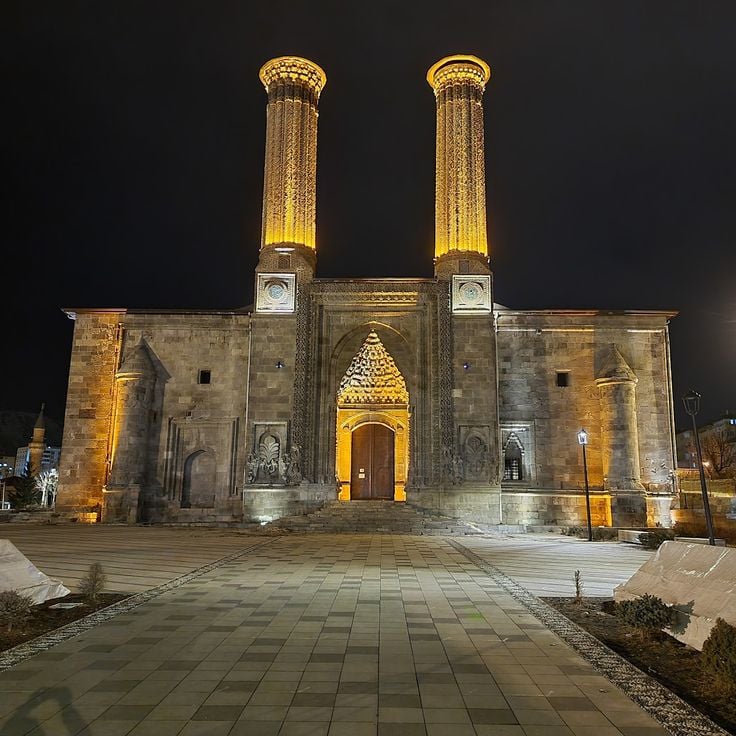
The Çifte Minareli Medrese stands in the heart of Erzurum and is one of the most recognized Seljuk buildings in Anatolia. Its two slender minarets, carved from red stone, rise above the city's rooftops and can be seen from far away. The front portal is covered with geometric and floral stone carvings that show the skill of 13th-century craftsmen. Inside, a two-story arcade runs around the courtyard, giving the space a clear and balanced shape that feels open and deliberate.
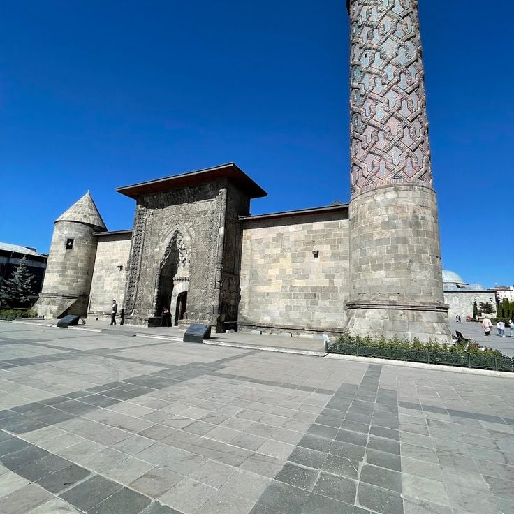
The Yakutiye Medresesi in Erzurum was built in the 14th century during the Ilkhanid period and stands as one of the most recognized examples of Seljuk architecture in eastern Anatolia. It now works as a museum displaying objects from the region. The finely carved stone portal is the first thing you notice when you arrive. Inside, the rooms hold local archaeological finds and decorative pieces from different eras.
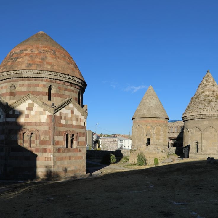
The Üç Kümbetler, meaning the Three Tombs, stand on the edge of Erzurum and are among the oldest funerary monuments in the region. Built during the medieval period, they show the stone-carving traditions of eastern Anatolia, with geometric patterns and cylindrical caps that have survived for centuries. Each tomb has its own shape and decoration, giving the group a quiet, layered presence. Visitors who wander away from the main streets of Erzurum often discover this site and find it one of the most direct connections to the medieval past of the city.
The Palandöken massif rises directly south of Erzurum, forming a backdrop that is visible from almost anywhere in the city. In winter, heavy snowfall covers the slopes, which are popular with skiers from across Turkey. In summer, the mountain opens up to hikers who walk trails overlooking the high plains of eastern Anatolia. The air is cold and fresh even in warmer months, and the views from the upper slopes reach far into the surrounding landscape.
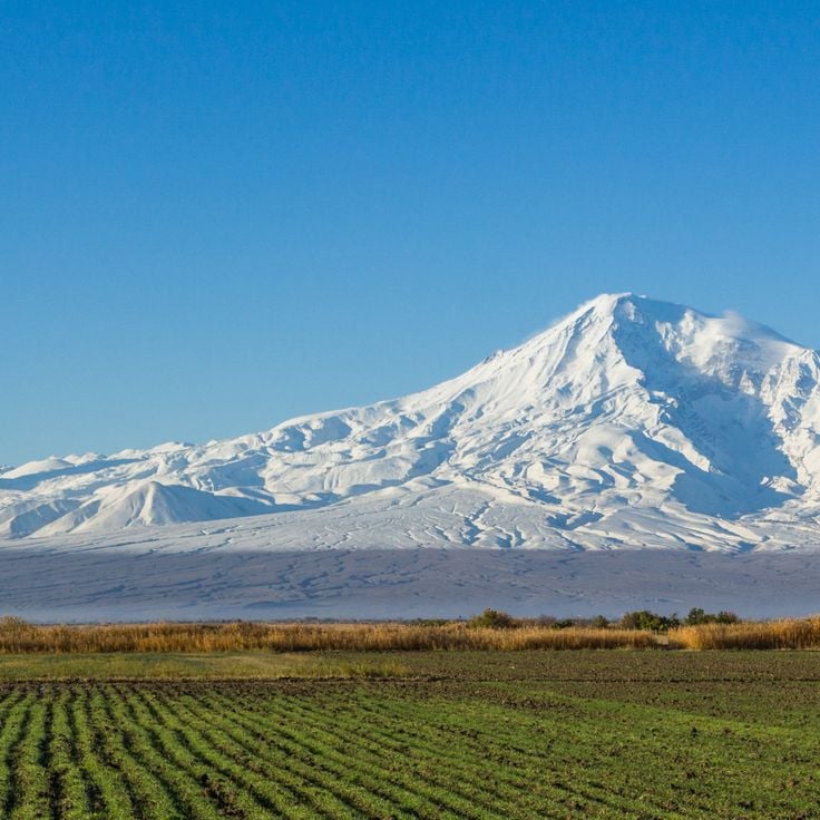
Mount Ararat stands above the Ağrı plain as the highest peak in Turkey. This dormant volcano has two summits, one large and one smaller, both permanently covered in snow and ice. Its outline is visible from far away, rising sharply above the surrounding flatlands. For centuries, many cultures have linked this mountain to the biblical story of Noah's Ark, giving it a deep place in Armenian memory and in the traditions of the wider region.
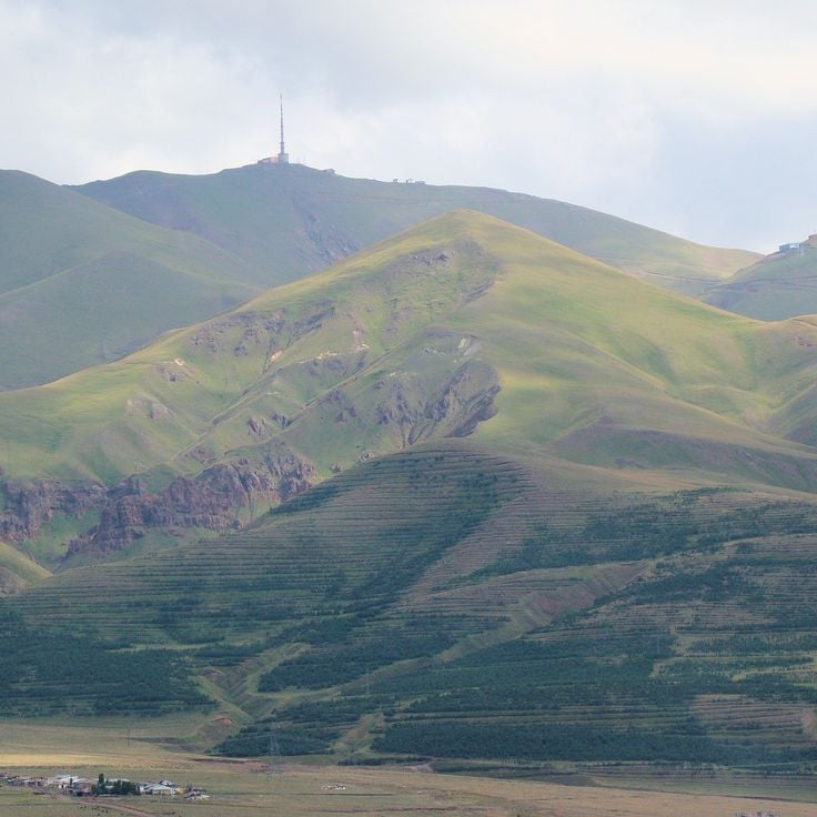
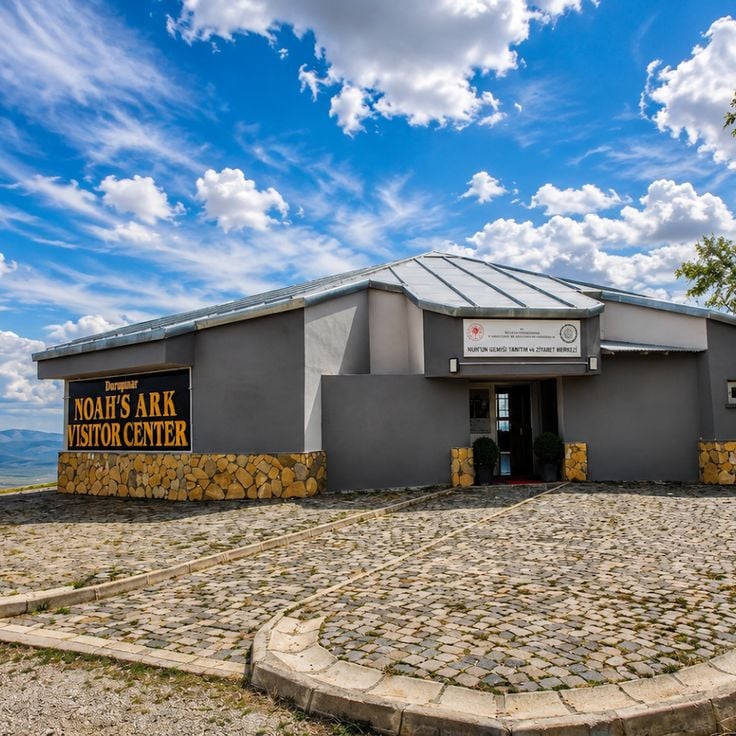
The Durupinar formation sits near Doğubayazıt and has an elongated, slightly raised shape that looks remarkably like a boat hull. This natural rock formation was created by geological shifts over time. It drew widespread attention when some people claimed it could be the remains of Noah's Ark. Scientists have not confirmed this theory, but visitors still come to walk around it and take in the open landscape of the surrounding hills. The site is easy to reach and sits in a bare, windswept setting that adds to its curious feel.
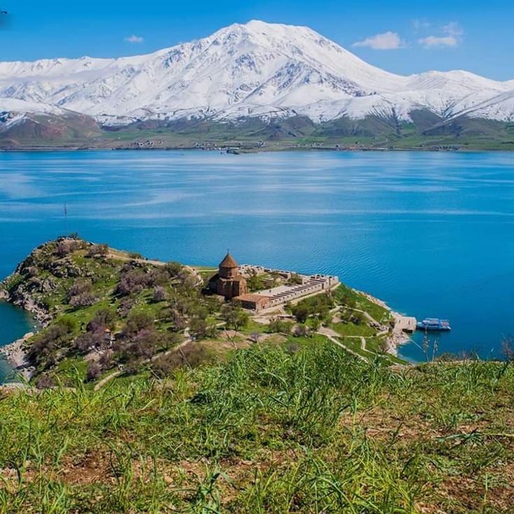
Lake Van is one of the largest alkaline lakes in the world and sits in the middle of a volcanic landscape in eastern Anatolia. Its water is so salty and mineral-rich that almost nothing lives in it except a small local fish species. The shores are dotted with Armenian churches, Urartian rock inscriptions, and old cemeteries. The surrounding mountains, some of which are ancient volcanoes, frame the lake on all sides, giving it a raw and open quality that is easy to feel when walking along its banks.
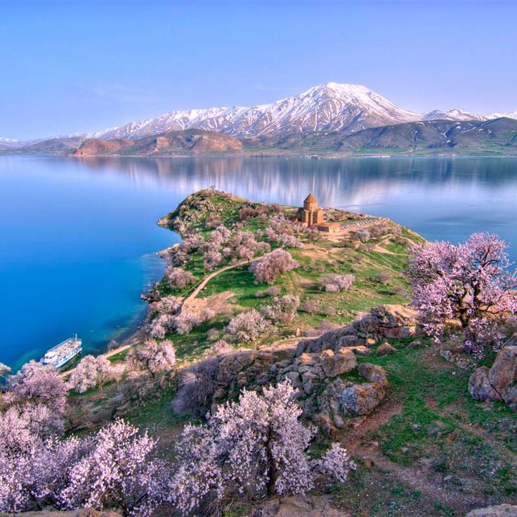
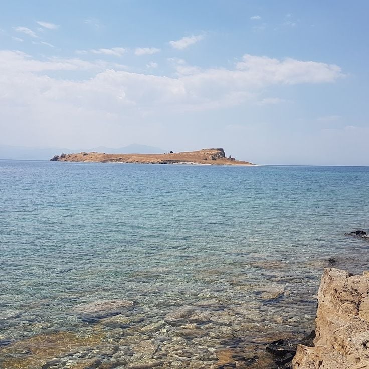
Akdamar Island sits in the middle of Lake Van and is home to an Armenian church built over a thousand years ago. The church is covered in carved stone reliefs showing biblical scenes, and the detail of the stonework is easy to appreciate up close. Getting there requires a short boat ride, and once on the island, the views across the lake and toward the surrounding mountains are wide open. The island itself is rocky and bare, which makes the old church feel even more out of place in the best way.
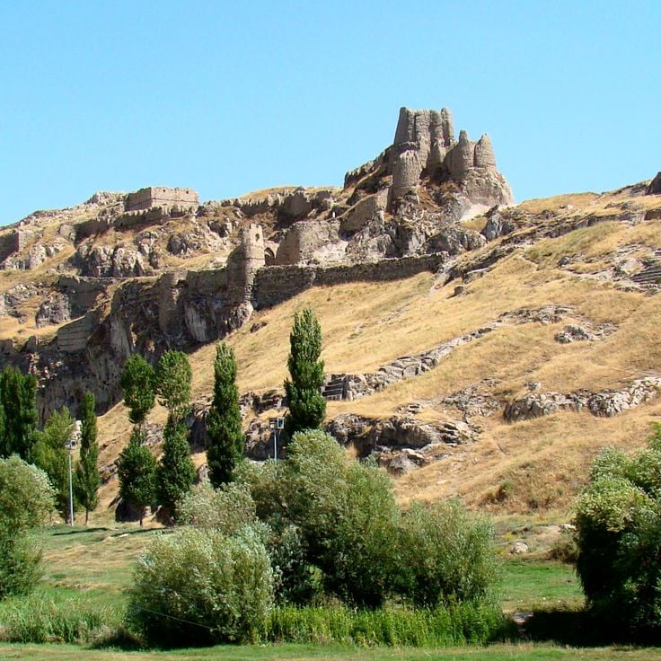
The Van Fortress sits on a long rocky ridge right at the edge of Lake Van. It was built by the Urartians, whose capital city of Tushpa once stood here, making it one of the oldest fortifications in all of Anatolia. Cuneiform inscriptions carved into the rock face are still visible today, and the view from the top stretches across the lake and the surrounding mountains. The area around the fortress is dotted with ancient ruins that hint at a large city that once thrived on this shore.
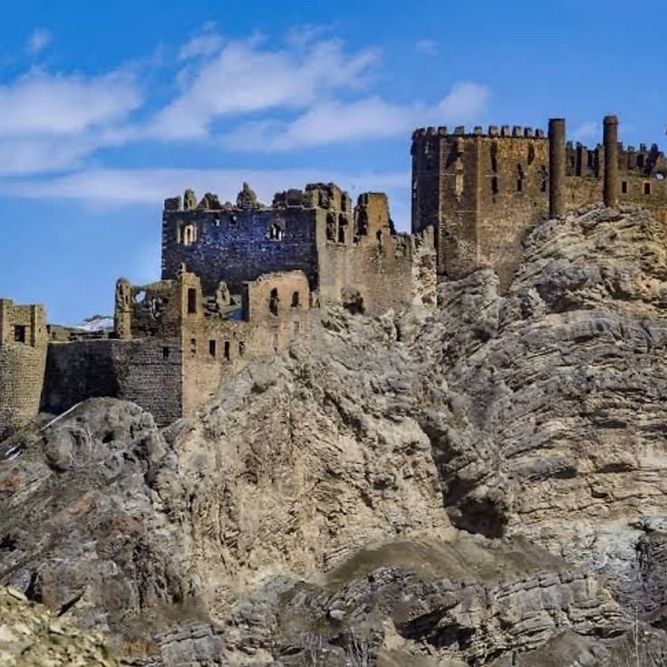
Hoşap Castle stands on a rocky hill above a small village near Van. A Kurdish ruler had it built in the 17th century to control the road passing through the valley below. The dark stone walls and towers are still largely standing. From the top, you look out over a wide, dry plateau that stretches far into the distance. The carved stone gate is one of the most striking features of the site.
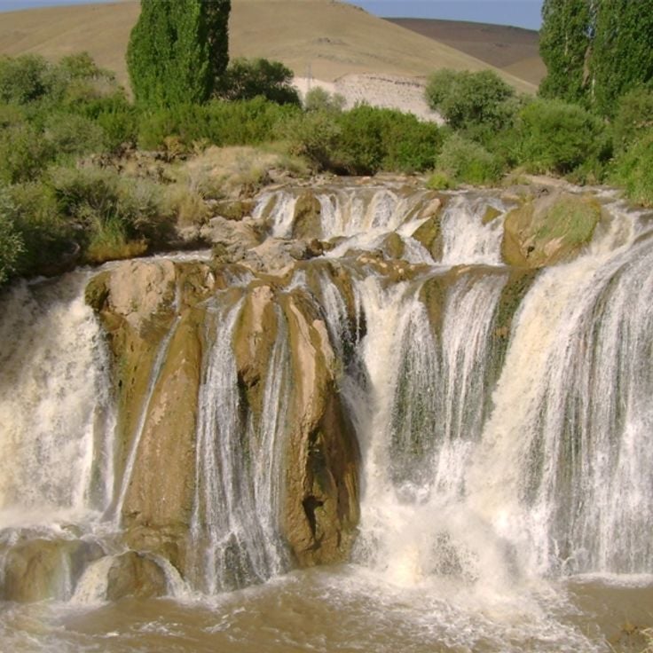
The Muradiye waterfall sits close to the city of Van and drops over a rocky ledge in a wide curtain of water. It is at its strongest in spring, when snowmelt sends a heavy flow over the edge. The surrounding area is open and easy to walk through, with low vegetation along the banks. Many locals come here for a short walk, and the site is simple to reach by road.
Çarpanak Island sits in the middle of Lake Van and can only be reached by boat. On the island, you can see the ruins of an Armenian monastery, with old stone walls still standing among the vegetation. The lake around it is surrounded by dormant volcanoes, and the water has a particular blue color due to its high mineral content. This is a place where history and natural setting meet in a way that feels remote and unhurried.
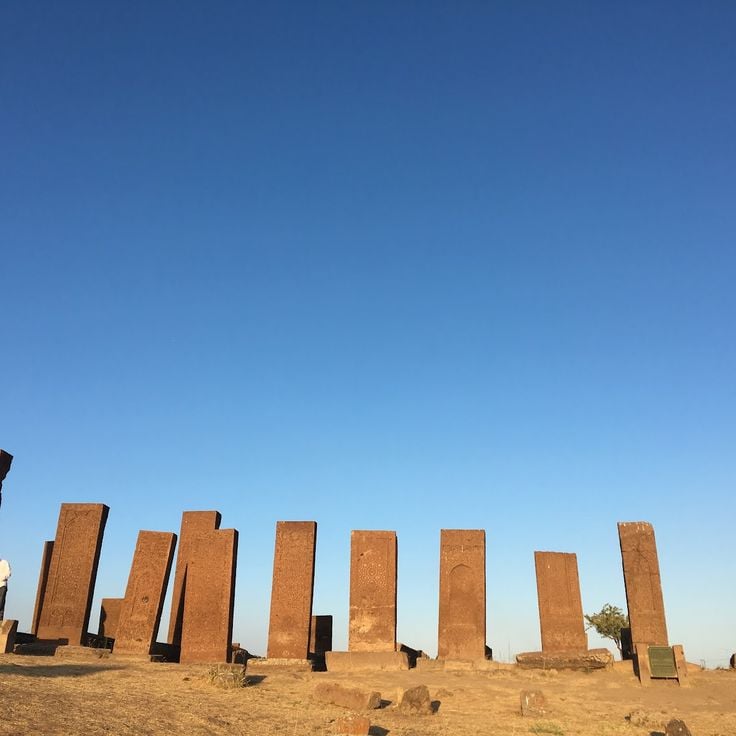
Ahlat sits on the shore of Lake Van and holds one of the largest medieval Islamic cemeteries in the region. Hundreds of Seljuk tombstones rise from the ground, carved with geometric patterns and Arabic inscriptions. The stones date from the 11th to the 13th century, a period when Ahlat was a major center of Seljuk power in eastern Anatolia. Walking among them, with the blue water of the lake nearby, gives a strong sense of the weight of that history.
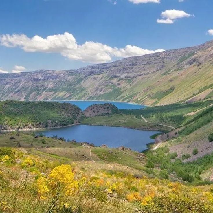
Mount Nemrut near Tatvan is an extinct volcano with a wide caldera at its summit. Inside the caldera, several lakes have formed over time, including one with warm water fed by hot springs and another with cold water. The rocky shores are covered with dark lava and patches of grass. From the rim, you can see Lake Van stretching out below. This volcano is one of the most striking natural features of eastern Anatolia, and the caldera feels remote and raw when you stand inside it.
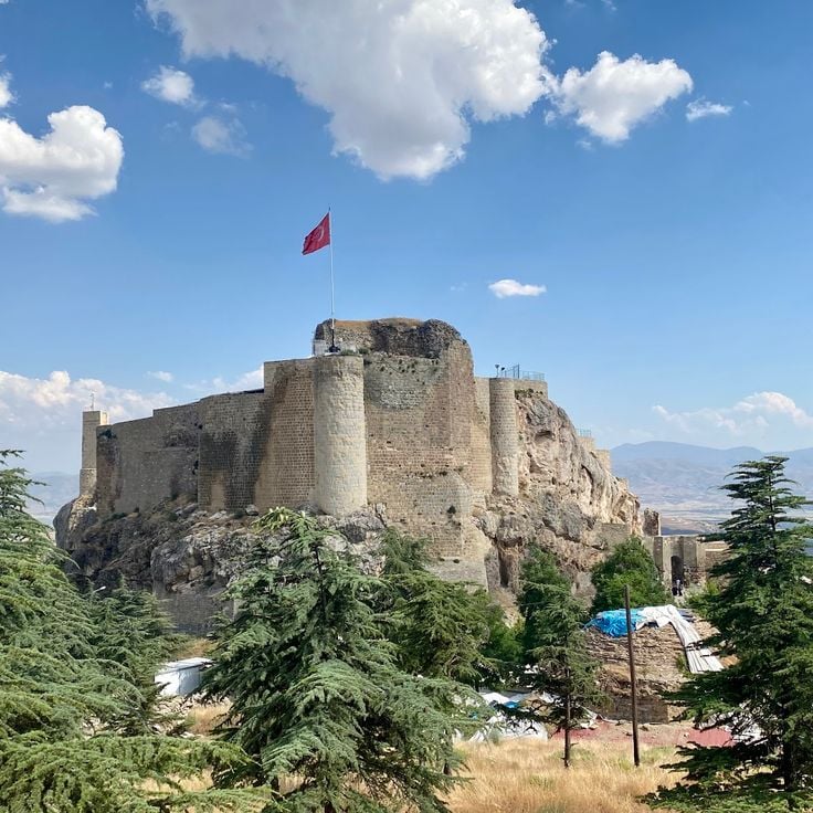
Harput is an old fortified town perched on a rocky hill above the plain of Elazığ. The medieval castle walls are visible from a distance and look out over the valley below. Within the town, you can find an Armenian church, a Seljuk-era mosque and old gravestones that mark the presence of many different peoples over the centuries. Harput was once a key stop along the trade routes of eastern Anatolia, and walking through it today gives a clear sense of how many layers of history have settled here.
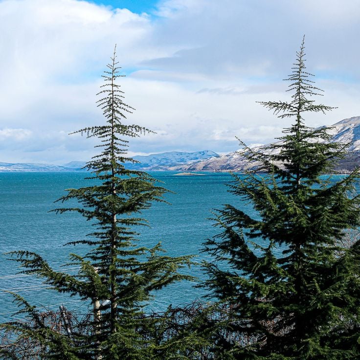
Lake Hazar sits in the Elazığ province and is a tectonic lake surrounded by mountains. The water shifts in color depending on the light and the time of day. The shores are quiet and rarely visited by travelers passing through eastern Anatolia, making it a good stop for those who want a moment away from the main roads.
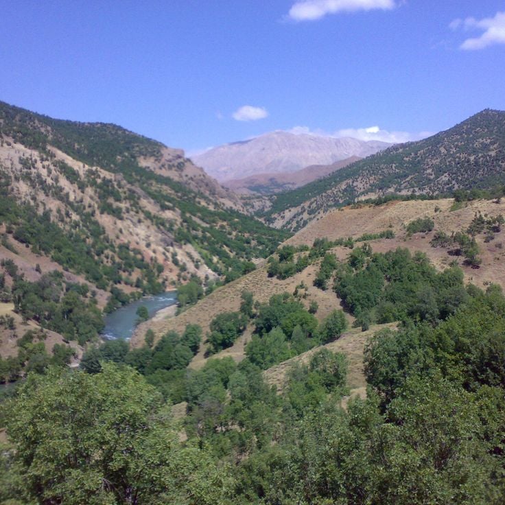
Munzur Valley and its national park sit in the province of Tunceli, in eastern Anatolia. The Munzur River runs fast and cold through deep gorges, with forested slopes rising on either side. The terrain shifts from rocky ridges to open meadows as you move through the park. Bears, wolves, and eagles still live here. Few visitors make it this far, so the trails feel genuinely remote. This is one of the places in eastern Anatolia where nature has been left largely to itself.
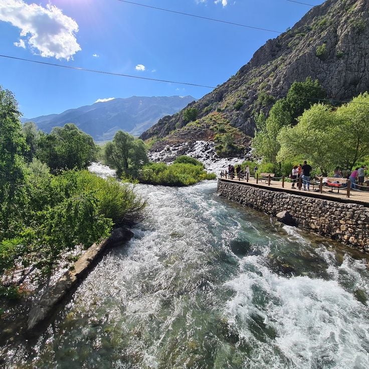
Ovacık and the Munzur springs sit in Tunceli province, in one of eastern Turkey's least visited valleys. The area is shaped by the Munzur range, whose slopes are covered with forest and crossed by cold mountain streams. The springs feed the Munzur River, which runs through a national park of the same name. Trails are rough and crowds are rare. Visitors come mostly to walk, to watch the river, and to stop in small villages where life moves slowly. The place rewards those who are willing to travel off the main roads.
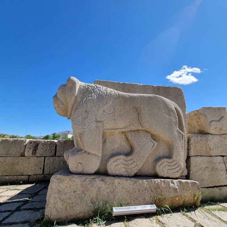
Tell Arslantepe, on the outskirts of Malatya, is one of the most important archaeological sites in Turkey. Beneath the low earthen mound lie layers of human occupation going back thousands of years. Researchers found here some of the earliest evidence of palace architecture, administrative systems, and early state organization. The site has been on the UNESCO World Heritage List since 2021.
The old town of Kemaliye sits in a deep canyon carved by the Euphrates River, in the Erzincan region. Stone houses cling to the rock face, linked by steep and narrow lanes that wind between the slopes. Life here moves slowly, shaped by the mountains that surround the town on every side. Walking through Kemaliye feels like stepping into a place where the river, the cliffs, and the old buildings all belong to the same story.
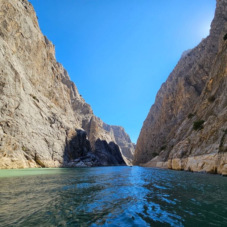
The Karanlık Canyon was carved by the Euphrates River through solid rock and is one of the most striking natural features of eastern Anatolia. The cliffs rise steeply on both sides of the river. A road cut directly into the stone runs through the gorge, offering open views of the river far below at every turn. The light changes dramatically depending on the time of day, and the canyon walls cast long shadows that keep the valley dark for hours, which is exactly where its name comes from.
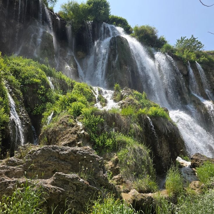
The Girlevik Falls, near Erzincan, are a series of cascades dropping over rocky ledges into a green gorge. The surrounding slopes are covered with trees, making this spot feel very different from the dry plateaus that dominate eastern Turkey. The sound of falling water and the cool shade give the place a refreshing quality that stands in sharp contrast to the open, arid land nearby.
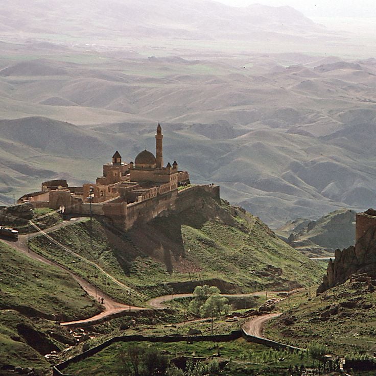
The Ishak Pasha Palace was built in the 17th and 18th centuries on a rocky ledge above the town of Doğubayazıt. Its architecture mixes Ottoman, Armenian, Georgian and Persian styles in a way that reflects the many cultures that passed through this part of eastern Anatolia. Inside, you find a harem, a mosque, reception halls and a tomb. From the terrace, on a clear day, you can see Mount Ararat rising in the distance. The palace gives a real sense of how powerful local rulers once lived along the old Silk Road.
Ani was once one of the largest cities along the Silk Road and served as the capital of the Armenian Bagratid kingdom. Walking through the ruins today, you can see medieval church walls, mosques, and fortress gates still standing on a high plateau near the Armenian border. The site became a UNESCO World Heritage Site in 2016. Ani gives a clear sense of how active and connected this part of eastern Anatolia once was.
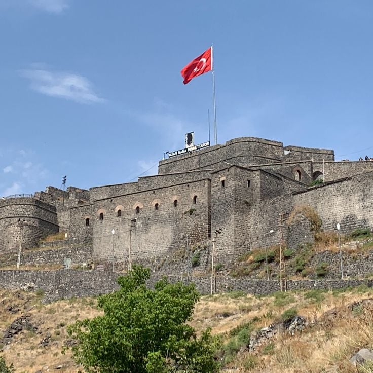
The historic center of Kars carries clear marks of the period when the city was under Russian control in the 19th century. The streets run straight and wide, laid out in a planned grid. Along them stand multi-story buildings made from dark basalt stone, many of which are still in use today. This architecture gives Kars a look unlike most other cities in eastern Anatolia. Walking through the center, you notice how Russian urban planning and everyday Turkish life sit side by side.
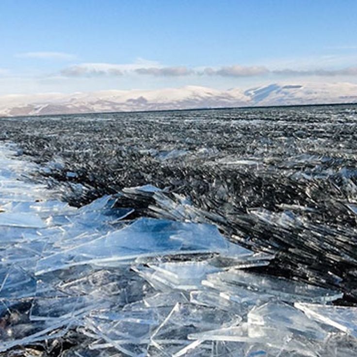
Lake Çıldır sits on a high plateau in northeastern Turkey and is best known in winter, when it freezes over completely. Local villagers then cross the ice by horse-drawn sleigh, a practice that gives the place a character hard to find elsewhere. In summer, the water reflects an open sky, and the shores are lined with grazing land. The lake is one of the highest in Turkey and sits in a landscape shaped by volcanic rock.
The Öşvank monastery church is a medieval Georgian church standing on a wooded hill near Erzurum. Its stone walls and apse are largely intact. The building feels solid and somewhat isolated, surrounded by mountains and forest. It can be reached by small country roads, away from the main routes of eastern Anatolia.
The Çifte Minareli Medrese stands in the heart of Erzurum and is one of the most recognized Seljuk buildings in Anatolia. Its two slender minarets, carved from red stone, rise above the city's rooftops and can be seen from far away. The front portal is covered with geometric and floral stone carvings that show the skill of 13th-century craftsmen. Inside, a two-story arcade runs around the courtyard, giving the space a clear and balanced shape that feels open and deliberate.
The Yakutiye Medresesi in Erzurum was built in the 14th century during the Ilkhanid period and stands as one of the most recognized examples of Seljuk architecture in eastern Anatolia. It now works as a museum displaying objects from the region. The finely carved stone portal is the first thing you notice when you arrive. Inside, the rooms hold local archaeological finds and decorative pieces from different eras.
The Üç Kümbetler, meaning the Three Tombs, stand on the edge of Erzurum and are among the oldest funerary monuments in the region. Built during the medieval period, they show the stone-carving traditions of eastern Anatolia, with geometric patterns and cylindrical caps that have survived for centuries. Each tomb has its own shape and decoration, giving the group a quiet, layered presence. Visitors who wander away from the main streets of Erzurum often discover this site and find it one of the most direct connections to the medieval past of the city.
The Palandöken massif rises directly south of Erzurum, forming a backdrop that is visible from almost anywhere in the city. In winter, heavy snowfall covers the slopes, which are popular with skiers from across Turkey. In summer, the mountain opens up to hikers who walk trails overlooking the high plains of eastern Anatolia. The air is cold and fresh even in warmer months, and the views from the upper slopes reach far into the surrounding landscape.
Mount Ararat stands above the Ağrı plain as the highest peak in Turkey. This dormant volcano has two summits, one large and one smaller, both permanently covered in snow and ice. Its outline is visible from far away, rising sharply above the surrounding flatlands. For centuries, many cultures have linked this mountain to the biblical story of Noah's Ark, giving it a deep place in Armenian memory and in the traditions of the wider region.
The Durupinar formation sits near Doğubayazıt and has an elongated, slightly raised shape that looks remarkably like a boat hull. This natural rock formation was created by geological shifts over time. It drew widespread attention when some people claimed it could be the remains of Noah's Ark. Scientists have not confirmed this theory, but visitors still come to walk around it and take in the open landscape of the surrounding hills. The site is easy to reach and sits in a bare, windswept setting that adds to its curious feel.
Lake Van is one of the largest alkaline lakes in the world and sits in the middle of a volcanic landscape in eastern Anatolia. Its water is so salty and mineral-rich that almost nothing lives in it except a small local fish species. The shores are dotted with Armenian churches, Urartian rock inscriptions, and old cemeteries. The surrounding mountains, some of which are ancient volcanoes, frame the lake on all sides, giving it a raw and open quality that is easy to feel when walking along its banks.
Akdamar Island sits in the middle of Lake Van and is home to an Armenian church built over a thousand years ago. The church is covered in carved stone reliefs showing biblical scenes, and the detail of the stonework is easy to appreciate up close. Getting there requires a short boat ride, and once on the island, the views across the lake and toward the surrounding mountains are wide open. The island itself is rocky and bare, which makes the old church feel even more out of place in the best way.
The Van Fortress sits on a long rocky ridge right at the edge of Lake Van. It was built by the Urartians, whose capital city of Tushpa once stood here, making it one of the oldest fortifications in all of Anatolia. Cuneiform inscriptions carved into the rock face are still visible today, and the view from the top stretches across the lake and the surrounding mountains. The area around the fortress is dotted with ancient ruins that hint at a large city that once thrived on this shore.
Hoşap Castle stands on a rocky hill above a small village near Van. A Kurdish ruler had it built in the 17th century to control the road passing through the valley below. The dark stone walls and towers are still largely standing. From the top, you look out over a wide, dry plateau that stretches far into the distance. The carved stone gate is one of the most striking features of the site.
The Muradiye waterfall sits close to the city of Van and drops over a rocky ledge in a wide curtain of water. It is at its strongest in spring, when snowmelt sends a heavy flow over the edge. The surrounding area is open and easy to walk through, with low vegetation along the banks. Many locals come here for a short walk, and the site is simple to reach by road.
Çarpanak Island sits in the middle of Lake Van and can only be reached by boat. On the island, you can see the ruins of an Armenian monastery, with old stone walls still standing among the vegetation. The lake around it is surrounded by dormant volcanoes, and the water has a particular blue color due to its high mineral content. This is a place where history and natural setting meet in a way that feels remote and unhurried.
Ahlat sits on the shore of Lake Van and holds one of the largest medieval Islamic cemeteries in the region. Hundreds of Seljuk tombstones rise from the ground, carved with geometric patterns and Arabic inscriptions. The stones date from the 11th to the 13th century, a period when Ahlat was a major center of Seljuk power in eastern Anatolia. Walking among them, with the blue water of the lake nearby, gives a strong sense of the weight of that history.
Mount Nemrut near Tatvan is an extinct volcano with a wide caldera at its summit. Inside the caldera, several lakes have formed over time, including one with warm water fed by hot springs and another with cold water. The rocky shores are covered with dark lava and patches of grass. From the rim, you can see Lake Van stretching out below. This volcano is one of the most striking natural features of eastern Anatolia, and the caldera feels remote and raw when you stand inside it.
Harput is an old fortified town perched on a rocky hill above the plain of Elazığ. The medieval castle walls are visible from a distance and look out over the valley below. Within the town, you can find an Armenian church, a Seljuk-era mosque and old gravestones that mark the presence of many different peoples over the centuries. Harput was once a key stop along the trade routes of eastern Anatolia, and walking through it today gives a clear sense of how many layers of history have settled here.
Lake Hazar sits in the Elazığ province and is a tectonic lake surrounded by mountains. The water shifts in color depending on the light and the time of day. The shores are quiet and rarely visited by travelers passing through eastern Anatolia, making it a good stop for those who want a moment away from the main roads.
Munzur Valley and its national park sit in the province of Tunceli, in eastern Anatolia. The Munzur River runs fast and cold through deep gorges, with forested slopes rising on either side. The terrain shifts from rocky ridges to open meadows as you move through the park. Bears, wolves, and eagles still live here. Few visitors make it this far, so the trails feel genuinely remote. This is one of the places in eastern Anatolia where nature has been left largely to itself.
Ovacık and the Munzur springs sit in Tunceli province, in one of eastern Turkey's least visited valleys. The area is shaped by the Munzur range, whose slopes are covered with forest and crossed by cold mountain streams. The springs feed the Munzur River, which runs through a national park of the same name. Trails are rough and crowds are rare. Visitors come mostly to walk, to watch the river, and to stop in small villages where life moves slowly. The place rewards those who are willing to travel off the main roads.
Tell Arslantepe, on the outskirts of Malatya, is one of the most important archaeological sites in Turkey. Beneath the low earthen mound lie layers of human occupation going back thousands of years. Researchers found here some of the earliest evidence of palace architecture, administrative systems, and early state organization. The site has been on the UNESCO World Heritage List since 2021.
The old town of Kemaliye sits in a deep canyon carved by the Euphrates River, in the Erzincan region. Stone houses cling to the rock face, linked by steep and narrow lanes that wind between the slopes. Life here moves slowly, shaped by the mountains that surround the town on every side. Walking through Kemaliye feels like stepping into a place where the river, the cliffs, and the old buildings all belong to the same story.
The Karanlık Canyon was carved by the Euphrates River through solid rock and is one of the most striking natural features of eastern Anatolia. The cliffs rise steeply on both sides of the river. A road cut directly into the stone runs through the gorge, offering open views of the river far below at every turn. The light changes dramatically depending on the time of day, and the canyon walls cast long shadows that keep the valley dark for hours, which is exactly where its name comes from.
The Girlevik Falls, near Erzincan, are a series of cascades dropping over rocky ledges into a green gorge. The surrounding slopes are covered with trees, making this spot feel very different from the dry plateaus that dominate eastern Turkey. The sound of falling water and the cool shade give the place a refreshing quality that stands in sharp contrast to the open, arid land nearby.
The Ishak Pasha Palace was built in the 17th and 18th centuries on a rocky ledge above the town of Doğubayazıt. Its architecture mixes Ottoman, Armenian, Georgian and Persian styles in a way that reflects the many cultures that passed through this part of eastern Anatolia. Inside, you find a harem, a mosque, reception halls and a tomb. From the terrace, on a clear day, you can see Mount Ararat rising in the distance. The palace gives a real sense of how powerful local rulers once lived along the old Silk Road.
Ani was once one of the largest cities along the Silk Road and served as the capital of the Armenian Bagratid kingdom. Walking through the ruins today, you can see medieval church walls, mosques, and fortress gates still standing on a high plateau near the Armenian border. The site became a UNESCO World Heritage Site in 2016. Ani gives a clear sense of how active and connected this part of eastern Anatolia once was.
The historic center of Kars carries clear marks of the period when the city was under Russian control in the 19th century. The streets run straight and wide, laid out in a planned grid. Along them stand multi-story buildings made from dark basalt stone, many of which are still in use today. This architecture gives Kars a look unlike most other cities in eastern Anatolia. Walking through the center, you notice how Russian urban planning and everyday Turkish life sit side by side.
Lake Çıldır sits on a high plateau in northeastern Turkey and is best known in winter, when it freezes over completely. Local villagers then cross the ice by horse-drawn sleigh, a practice that gives the place a character hard to find elsewhere. In summer, the water reflects an open sky, and the shores are lined with grazing land. The lake is one of the highest in Turkey and sits in a landscape shaped by volcanic rock.
The Öşvank monastery church is a medieval Georgian church standing on a wooded hill near Erzurum. Its stone walls and apse are largely intact. The building feels solid and somewhat isolated, surrounded by mountains and forest. It can be reached by small country roads, away from the main routes of eastern Anatolia.
The Çifte Minareli Medrese stands in the heart of Erzurum and is one of the most recognized Seljuk buildings in Anatolia. Its two slender minarets, carved from red stone, rise above the city's rooftops and can be seen from far away. The front portal is covered with geometric and floral stone carvings that show the skill of 13th-century craftsmen. Inside, a two-story arcade runs around the courtyard, giving the space a clear and balanced shape that feels open and deliberate.
The Yakutiye Medresesi in Erzurum was built in the 14th century during the Ilkhanid period and stands as one of the most recognized examples of Seljuk architecture in eastern Anatolia. It now works as a museum displaying objects from the region. The finely carved stone portal is the first thing you notice when you arrive. Inside, the rooms hold local archaeological finds and decorative pieces from different eras.
The Üç Kümbetler, meaning the Three Tombs, stand on the edge of Erzurum and are among the oldest funerary monuments in the region. Built during the medieval period, they show the stone-carving traditions of eastern Anatolia, with geometric patterns and cylindrical caps that have survived for centuries. Each tomb has its own shape and decoration, giving the group a quiet, layered presence. Visitors who wander away from the main streets of Erzurum often discover this site and find it one of the most direct connections to the medieval past of the city.
The Palandöken massif rises directly south of Erzurum, forming a backdrop that is visible from almost anywhere in the city. In winter, heavy snowfall covers the slopes, which are popular with skiers from across Turkey. In summer, the mountain opens up to hikers who walk trails overlooking the high plains of eastern Anatolia. The air is cold and fresh even in warmer months, and the views from the upper slopes reach far into the surrounding landscape.
Mount Ararat stands above the Ağrı plain as the highest peak in Turkey. This dormant volcano has two summits, one large and one smaller, both permanently covered in snow and ice. Its outline is visible from far away, rising sharply above the surrounding flatlands. For centuries, many cultures have linked this mountain to the biblical story of Noah's Ark, giving it a deep place in Armenian memory and in the traditions of the wider region.
The Durupinar formation sits near Doğubayazıt and has an elongated, slightly raised shape that looks remarkably like a boat hull. This natural rock formation was created by geological shifts over time. It drew widespread attention when some people claimed it could be the remains of Noah's Ark. Scientists have not confirmed this theory, but visitors still come to walk around it and take in the open landscape of the surrounding hills. The site is easy to reach and sits in a bare, windswept setting that adds to its curious feel.
Lake Van is one of the largest alkaline lakes in the world and sits in the middle of a volcanic landscape in eastern Anatolia. Its water is so salty and mineral-rich that almost nothing lives in it except a small local fish species. The shores are dotted with Armenian churches, Urartian rock inscriptions, and old cemeteries. The surrounding mountains, some of which are ancient volcanoes, frame the lake on all sides, giving it a raw and open quality that is easy to feel when walking along its banks.
Akdamar Island sits in the middle of Lake Van and is home to an Armenian church built over a thousand years ago. The church is covered in carved stone reliefs showing biblical scenes, and the detail of the stonework is easy to appreciate up close. Getting there requires a short boat ride, and once on the island, the views across the lake and toward the surrounding mountains are wide open. The island itself is rocky and bare, which makes the old church feel even more out of place in the best way.
The Van Fortress sits on a long rocky ridge right at the edge of Lake Van. It was built by the Urartians, whose capital city of Tushpa once stood here, making it one of the oldest fortifications in all of Anatolia. Cuneiform inscriptions carved into the rock face are still visible today, and the view from the top stretches across the lake and the surrounding mountains. The area around the fortress is dotted with ancient ruins that hint at a large city that once thrived on this shore.
Hoşap Castle stands on a rocky hill above a small village near Van. A Kurdish ruler had it built in the 17th century to control the road passing through the valley below. The dark stone walls and towers are still largely standing. From the top, you look out over a wide, dry plateau that stretches far into the distance. The carved stone gate is one of the most striking features of the site.
The Muradiye waterfall sits close to the city of Van and drops over a rocky ledge in a wide curtain of water. It is at its strongest in spring, when snowmelt sends a heavy flow over the edge. The surrounding area is open and easy to walk through, with low vegetation along the banks. Many locals come here for a short walk, and the site is simple to reach by road.
Çarpanak Island sits in the middle of Lake Van and can only be reached by boat. On the island, you can see the ruins of an Armenian monastery, with old stone walls still standing among the vegetation. The lake around it is surrounded by dormant volcanoes, and the water has a particular blue color due to its high mineral content. This is a place where history and natural setting meet in a way that feels remote and unhurried.
Ahlat sits on the shore of Lake Van and holds one of the largest medieval Islamic cemeteries in the region. Hundreds of Seljuk tombstones rise from the ground, carved with geometric patterns and Arabic inscriptions. The stones date from the 11th to the 13th century, a period when Ahlat was a major center of Seljuk power in eastern Anatolia. Walking among them, with the blue water of the lake nearby, gives a strong sense of the weight of that history.
Mount Nemrut near Tatvan is an extinct volcano with a wide caldera at its summit. Inside the caldera, several lakes have formed over time, including one with warm water fed by hot springs and another with cold water. The rocky shores are covered with dark lava and patches of grass. From the rim, you can see Lake Van stretching out below. This volcano is one of the most striking natural features of eastern Anatolia, and the caldera feels remote and raw when you stand inside it.
Harput is an old fortified town perched on a rocky hill above the plain of Elazığ. The medieval castle walls are visible from a distance and look out over the valley below. Within the town, you can find an Armenian church, a Seljuk-era mosque and old gravestones that mark the presence of many different peoples over the centuries. Harput was once a key stop along the trade routes of eastern Anatolia, and walking through it today gives a clear sense of how many layers of history have settled here.
Lake Hazar sits in the Elazığ province and is a tectonic lake surrounded by mountains. The water shifts in color depending on the light and the time of day. The shores are quiet and rarely visited by travelers passing through eastern Anatolia, making it a good stop for those who want a moment away from the main roads.
Munzur Valley and its national park sit in the province of Tunceli, in eastern Anatolia. The Munzur River runs fast and cold through deep gorges, with forested slopes rising on either side. The terrain shifts from rocky ridges to open meadows as you move through the park. Bears, wolves, and eagles still live here. Few visitors make it this far, so the trails feel genuinely remote. This is one of the places in eastern Anatolia where nature has been left largely to itself.
Ovacık and the Munzur springs sit in Tunceli province, in one of eastern Turkey's least visited valleys. The area is shaped by the Munzur range, whose slopes are covered with forest and crossed by cold mountain streams. The springs feed the Munzur River, which runs through a national park of the same name. Trails are rough and crowds are rare. Visitors come mostly to walk, to watch the river, and to stop in small villages where life moves slowly. The place rewards those who are willing to travel off the main roads.
Tell Arslantepe, on the outskirts of Malatya, is one of the most important archaeological sites in Turkey. Beneath the low earthen mound lie layers of human occupation going back thousands of years. Researchers found here some of the earliest evidence of palace architecture, administrative systems, and early state organization. The site has been on the UNESCO World Heritage List since 2021.
The old town of Kemaliye sits in a deep canyon carved by the Euphrates River, in the Erzincan region. Stone houses cling to the rock face, linked by steep and narrow lanes that wind between the slopes. Life here moves slowly, shaped by the mountains that surround the town on every side. Walking through Kemaliye feels like stepping into a place where the river, the cliffs, and the old buildings all belong to the same story.
The Karanlık Canyon was carved by the Euphrates River through solid rock and is one of the most striking natural features of eastern Anatolia. The cliffs rise steeply on both sides of the river. A road cut directly into the stone runs through the gorge, offering open views of the river far below at every turn. The light changes dramatically depending on the time of day, and the canyon walls cast long shadows that keep the valley dark for hours, which is exactly where its name comes from.
The Girlevik Falls, near Erzincan, are a series of cascades dropping over rocky ledges into a green gorge. The surrounding slopes are covered with trees, making this spot feel very different from the dry plateaus that dominate eastern Turkey. The sound of falling water and the cool shade give the place a refreshing quality that stands in sharp contrast to the open, arid land nearby.
The Ishak Pasha Palace was built in the 17th and 18th centuries on a rocky ledge above the town of Doğubayazıt. Its architecture mixes Ottoman, Armenian, Georgian and Persian styles in a way that reflects the many cultures that passed through this part of eastern Anatolia. Inside, you find a harem, a mosque, reception halls and a tomb. From the terrace, on a clear day, you can see Mount Ararat rising in the distance. The palace gives a real sense of how powerful local rulers once lived along the old Silk Road.
Visiter l'Anatolie orientale demande de la patience et une certaine flexibilité. Les routes secondaires sont parfois sinueuses, et certains sites se découvrent lentement, loin des circuits touristiques habituels. Préparez votre voyage en consultant les conditions d'accès locales, notamment près des frontières. Les habitants des petits villages se montrent souvent accueillants et partagent volontiers leurs connaissances sur les ruines voisines.