Chest opened
+${chestReward.xp} XP
Explorer
NOUVEAU ×${chestReward.collectible.quantity}
tapez pour fermer
Chest locked

Open chests in the app

Around Us is built for your phone — chests unlock when you walk, explore and capture nearby places.

Enable Location

We need your location to show you interesting places around you

Discover nearby places

Find interesting locations and hidden gems around you

Precise directions

Get accurate directions and distances to places

Your location is never shared with other users. It's only used when you tap the location button.

Log in to your account

Start exploring — it's free

Trusted by 72,885 travelers worldwide

Continue with Google
Continue with Apple
or

We will send you a code to connect

By continuing, you accept our Terms and Conditions and our Privacy Policy

Check your inbox

We've sent a pincode in your inbox. Please enter the code below.

Atasu Dam
Discussion Reviews Photo
1.6k Popularity

Atasu Dam, Embankment dam in Maçka, Turkey

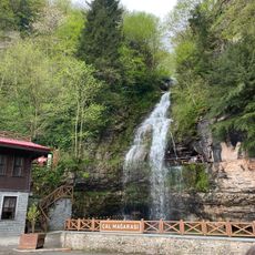
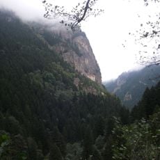
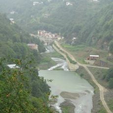
The Atasu Dam is a concrete-faced rock-fill structure located on the Gaylan River near Trabzon, built to manage water resources in this mountainous region. The facility holds water in a large reservoir that serves multiple functions for the surrounding area.

The project began in 1998 as part of Turkey's plan to expand hydroelectric power generation and improve water management along the Black Sea coast. Work was completed in 2010, adding to the country's infrastructure for managing natural resources.

The dam has become part of the landscape that shapes daily life in this region, affecting how water is managed and used by communities downstream. Its presence influences local agricultural patterns and the way people think about resource management in the Black Sea area.

The site is located about 16 kilometers south of Trabzon and is accessible by road, though the surrounding terrain is hilly and requires some effort to reach certain viewpoints. Visitors should plan for varying weather conditions common to the region and wear appropriate footwear for uneven ground.

The structure uses specialized layering techniques that help it withstand the rocky terrain and geological pressures of the location. This engineering method was developed specifically to match the challenging conditions found on the Gaylan River.

The community of curious travelers

AroundUs brings together thousands of curated places, local tips, and hidden gems, enriched daily by 60,000 contributors worldwide.

Start exploring
Location
Elevation above the sea
245 m
GPS coordinates
40.85752,39.69940
Latest update
December 14, 2025 14:27
Reviews
Share your experience

No review yet

Discussions
Start a discussion...

No discussion yet

« Atasu Dam - Embankment dam in Maçka, Turkey » is provided by Around Us (aroundus.com). Images and texts are derived from Wikimedia project under a Creative Commons license. You are allowed to copy, distribute, and modify copies of this page, under the conditions set by the license, as long as this note is clearly visible.

Discover hidden gems everywhere you go!

From secret cafés to breathtaking viewpoints, skip the crowded tourist spots and find places that match your style. Our app makes it easy with voice search, smart filtering, route optimization, and insider tips from travelers worldwide. Download now for the complete mobile experience.

Around Us App Screenshot

A unique approach to discovering new places

Le Figaro

All the places worth exploring

France Info

A tailor-made excursion in just a few clicks

20 Minutes

Around Us
Travel Guide & Maps
Download

Send to your phone

QR Code
1

Open the camera app on your mobile.

2

Point at the QR code with your camera. A notification will appear.

3

Tap the notification to open the link.