Enable Location

We need your location to show you interesting places around you

Discover nearby places

Find interesting locations and hidden gems around you

Precise directions

Get accurate directions and distances to places

Your location is never shared with other users. It's only used when you tap the location button.

Log in to your account

Start exploring — it's free

Trusted by 63,948 travelers worldwide

Continue with Google
Continue with Apple
or

We will send you a code to connect

By continuing, you accept our Terms and Conditions and our Privacy Policy

Check your inbox

We've sent a pincode in your inbox. Please enter the code below.

Discussion Reviews Photo
3.2k Popularity

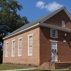
Belle Air Plantation, human settlement in Virginia, United States of America

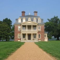
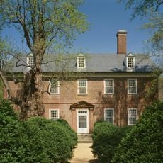
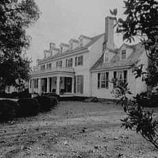
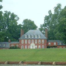
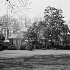
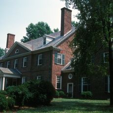
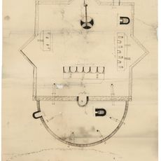
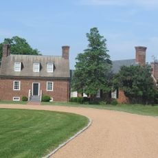
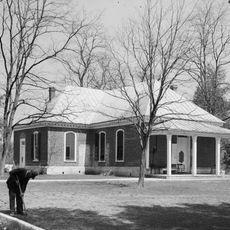
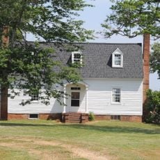
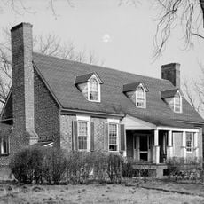
Belle Air Plantation is a historic house in Charles City County, Virginia, listed on the National Register of Historic Places. The main structure has five sections with exposed interior framing and was likely built between 1725 and 1750, with a three-room western addition added around 1800.

The house was likely built between 1725 and 1750 and is one of the few surviving Virginia homes with exposed interior framing from that period. Around 1800, a three-room western section was added, showing how the property evolved over centuries of occupation.

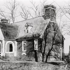
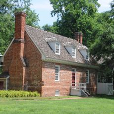
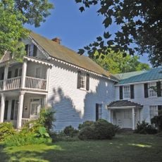
The name Belle Air reflects the region's early settlement history and connection to colonial life in Virginia. The exposed wooden construction methods visible inside show how builders of that era worked with available materials and traditional techniques.

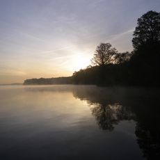
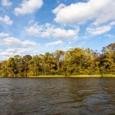
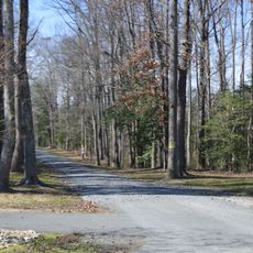
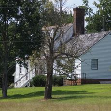
Belle Air can be viewed from nearby roads, but visitors should respect the privacy of the owners and not disturb the property. The site sits along Route 5 Scenic Byway, which is easily accessible by car for those exploring Virginia's historic sites.

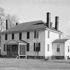
The house is one of the few surviving Virginia homes with exposed interior framing that blends post-medieval building techniques with early American construction methods. This rare combination makes it valuable for understanding how local building practices evolved during the colonial period.

The community of curious travelers

AroundUs brings together thousands of curated places, local tips, and hidden gems, enriched daily by 60,000 contributors worldwide.

Start exploring
Location
Inception
1700
GPS coordinates
37.34690,-77.06110
Latest update
February 9, 2026 08:23
Around this place
Shirley Plantation
United States of America

Shirley Plantation

16.2 km
Berkeley Plantation
United States of America

Berkeley Plantation

11 km
Sherwood Forest Plantation
United States of America

Sherwood Forest Plantation

4.4 km
Westover Plantation
United States of America

Westover Plantation

10 km
Flowerdew Hundred Plantation
United States of America

Flowerdew Hundred Plantation

6.8 km
Lower Brandon Plantation
United States of America

Lower Brandon Plantation

11.6 km
Benjamin Harrison Memorial Bridge
United States of America

Benjamin Harrison Memorial Bridge

14.7 km
Malvern Hill
United States of America

Malvern Hill

16.9 km
Weyanoke, Virginia
United States of America

Weyanoke, Virginia

6.2 km
Evelynton
United States of America

Evelynton

8.5 km
James River National Wildlife Refuge
United States of America

James River National Wildlife Refuge

10.7 km
Presquile National Wildlife Refuge
United States of America

Presquile National Wildlife Refuge

17.8 km
Fort Powhatan
United States of America

Fort Powhatan

8.7 km
United States of America

Dogham, Doggams

15.4 km
Emmaus Baptist Church
United States of America

Emmaus Baptist Church

17.1 km
Dancing Point
United States of America

Dancing Point

17.8 km
Upper Weyanoke
United States of America

Upper Weyanoke

5.5 km
Hardens
United States of America

Hardens

15.8 km
Charles City County Courthouse
United States of America

Charles City County Courthouse

1.2 km
Olivet Presbyterian Church
United States of America

Olivet Presbyterian Church

14.8 km
Margots
United States of America

Margots

15.8 km
Spring Hill (Providence Forge, Virginia)
United States of America

Spring Hill (Providence Forge, Virginia)

17.1 km
United States of America

Lott Cary Birth Site

4.5 km
Poplar Springs
United States of America

Poplar Springs

8.7 km
Nance-Major House and Store
United States of America

Nance-Major House and Store

1.1 km
Glebe of Westover Parish
United States of America

Glebe of Westover Parish

1.8 km
Royal New Kent Golf Club
United States of America

Royal New Kent Golf Club

14.6 km
Jordan Point Light
United States of America

Jordan Point Light

14.9 km
Show the full map
Reviews
Share your experience

No review yet

Discussions
Start a discussion...

No discussion yet

« Belle Air Plantation - human settlement in Virginia, United States of America » is provided by Around Us (aroundus.com). Images and texts are derived from Wikimedia project under a Creative Commons license. You are allowed to copy, distribute, and modify copies of this page, under the conditions set by the license, as long as this note is clearly visible.

Discover hidden gems everywhere you go!

From secret cafés to breathtaking viewpoints, skip the crowded tourist spots and find places that match your style. Our app makes it easy with voice search, smart filtering, route optimization, and insider tips from travelers worldwide. Download now for the complete mobile experience.

Around Us App Screenshot

A unique approach to discovering new places

Le Figaro

All the places worth exploring

France Info

A tailor-made excursion in just a few clicks

20 Minutes

Around Us
Travel Guide & Maps
Download

Send to your phone

QR Code
1

Open the camera app on your mobile.

2

Point at the QR code with your camera. A notification will appear.

3

Tap the notification to open the link.