Enable Location

We need your location to show you interesting places around you

Discover nearby places

Find interesting locations and hidden gems around you

Precise directions

Get accurate directions and distances to places

Your location is never shared with other users. It's only used when you tap the location button.

Chamartín

Log in to your account

Start exploring — it's free

Trusted by 61,401 travelers worldwide

Continue with Google
Continue with Apple
or

We will send you a code to connect

By continuing, you accept our Terms and Conditions and our Privacy Policy

Check your inbox

We've sent a pincode in your inbox. Please enter the code below.

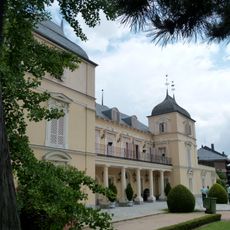
Chamartín, Administrative district in northern Madrid, Spain

Description

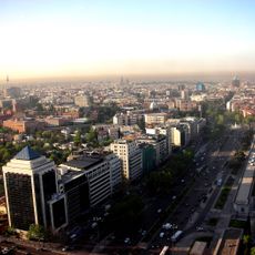
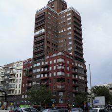
Chamartín is a district in northern Madrid that spans multiple neighborhoods with a mix of residential areas and business zones. The area includes major transportation hubs and urban infrastructure that integrate it with the city's wider network.

History

The area was originally an independent municipality called Chamartín de la Rosa before merging with Madrid in 1948. This annexation transformed it from a separate town into an integral part of the expanding capital.

Culture

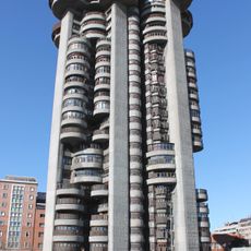
The National Auditorium of Music serves as a meeting place where people gather to experience classical performances and contemporary shows. It shapes how residents and visitors use this part of the city, drawing those who appreciate live music into its concert halls.

Practical

The district is well connected through multiple metro lines, bus routes, and the Chamartín railway station, making it easy to reach different areas. Most places are walkable once you are in a particular neighborhood, and there is adequate pedestrian infrastructure throughout.

Did you know?

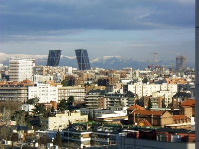
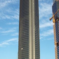
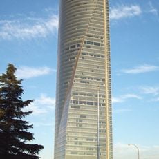
A cluster of four of Spain's tallest skyscrapers stands within this area, forming the Cuatro Torres Business District. These modern towers are visible from many parts of the city and define Madrid's skyline.

Location
Inception
November 14, 1947
Shares border with
Tetuán, Chamberí, Salamanca, Ciudad Lineal, Fuencarral-El Pardo
GPS coordinates
40.45333,-3.67750
Latest update
December 20, 2025 01:07

AroundUs brings together thousands of curated places, local tips, and hidden gems, enriched daily by 60,000 contributors worldwide. Discover all places nearby (Madrid).

« Chamartín - Administrative district in northern Madrid, Spain » is provided by Around Us (aroundus.com). Images and texts are derived from Wikimedia project under a Creative Commons license. You are allowed to copy, distribute, and modify copies of this page, under the conditions set by the license, as long as this note is clearly visible.

Discover hidden gems everywhere you go!

From secret cafés to breathtaking viewpoints, skip the crowded tourist spots and find places that match your style. Our app makes it easy with voice search, smart filtering, route optimization, and insider tips from travelers worldwide. Download now for the complete mobile experience.

Around Us App Screenshot

A unique approach to discovering new places

Le Figaro

All the places worth exploring

France Info

A tailor-made excursion in just a few clicks

20 Minutes

Around Us
Travel Guide & Maps
Download

Send to your phone

QR Code
1

Open the camera app on your mobile.

2

Point at the QR code with your camera. A notification will appear.

3

Tap the notification to open the link.