Perry County

Log in to your account

AroundUs is a community-driven map of interesting places, built by curious explorers like you. It grows with every review, story, and photo you share.
Connect to save your favorite spots, contribute locations, and create personalized routes.
Continue with Google
Continue with Apple
Continue with X
Continue with Facebook
Continue with email
By continuing, you accept our Terms and Conditions and our Privacy Policy
Create an account
Add to collection
Map
Suggest a change
Share

Perry County, Administrative county in southern Indiana, US

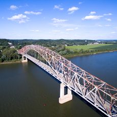
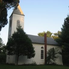
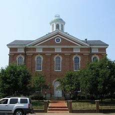
Perry County is an administrative county in southern Indiana characterized by dense forests and rolling terrain. The county stretches along the Ohio River border and contains several small communities, with Tell City being the largest population center.

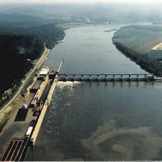
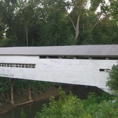
The county was established in 1814 and named after Commodore Oliver Hazard Perry, a naval commander from the War of 1812. Early growth was tied to steamboat travel on the Ohio River, which brought commerce and settlement to the region.

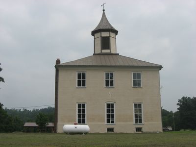
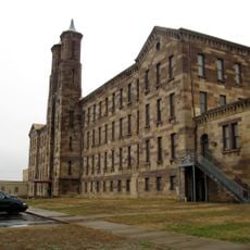
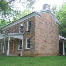
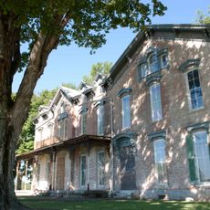
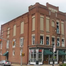
Tell City, the largest settlement in the county, displays 19th-century buildings along its main street where people gather at local shops and cafes. The town keeps its ties to riverboat history and traditional crafts, which remain active in workshops throughout the community.

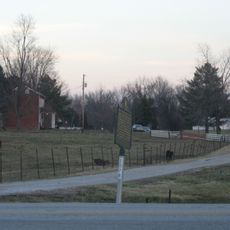
This region is best explored by allowing time for longer drives, as communities are spread across sparsely populated roads. Visitors should plan their route in advance and use local maps or GPS to navigate to smaller settlements.

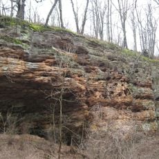
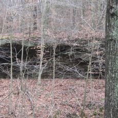
More than 60,000 acres of the Hoosier National Forest span the county area, creating one of Indiana's most forested regions. This extensive woodland coverage means large portions of the county remain sparsely developed and retain a rural character.

Location: Indiana

Inception: September 7, 1814

Capital city: Tell City

Shares border with: Crawford County, Spencer County, Dubois County, Meade County, Breckinridge County, Hancock County

Website: http://perrycounty.in.gov

GPS coordinates: 38.08000,-86.64000

Latest update: December 7, 2025 19:25

Photos
Around this place
Holiday World & Splashin' Safari
United States of America

Holiday World & Splashin' Safari

24.6 km
The Voyage
United States of America

The Voyage

24.2 km
The Raven
United States of America

The Raven

24.5 km
The Legend
United States of America

The Legend

24.4 km
Wildebeest
United States of America

Wildebeest

24.5 km
Monastery Immaculate Conception
United States of America

Monastery Immaculate Conception

24.8 km
United States of America

The Howler

24.1 km
Cannelton Locks and Dam
United States of America

Cannelton Locks and Dam

20.9 km
Rockhouse Cliffs Rockshelters
United States of America

Rockhouse Cliffs Rockshelters

5.9 km
Cannelton Cotton Mill
United States of America

Cannelton Cotton Mill

20.9 km
Bob Cummings – Lincoln Trail Bridge
United States of America

Bob Cummings – Lincoln Trail Bridge

21.7 km
Christ of the Ohio
United States of America

Christ of the Ohio

16.9 km
Potts Creek Rockshelter
United States of America

Potts Creek Rockshelter

17.9 km
Jacob Rickenbaugh House
United States of America

Jacob Rickenbaugh House

12.3 km
Huffman Mill Covered Bridge
United States of America

Huffman Mill Covered Bridge

12.3 km
Santa Claus Museum and Village
United States of America

Santa Claus Museum and Village

23.9 km
St. Boniface Catholic Church
United States of America

St. Boniface Catholic Church

17.5 km
Joseph Holt House and Chapel
United States of America

Joseph Holt House and Chapel

19.6 km
Joe Pell Building
United States of America

Joe Pell Building

28 km
Old Perry County Courthouse
United States of America

Old Perry County Courthouse

20.2 km
Cannelton Historic District
United States of America

Cannelton Historic District

20.8 km
Tell City Oddfellows' Hall
United States of America

Tell City Oddfellows' Hall

18.4 km
United States of America

Lewisport Masonic Lodge

28 km
Deutsch Evangelische St. Paul's Kirche
United States of America

Deutsch Evangelische St. Paul's Kirche

23.8 km
Hancock County Courthouse
United States of America

Hancock County Courthouse

22.1 km
Robert C. Beauchamp House
United States of America

Robert C. Beauchamp House

22.6 km
Immaculate Conception Church
United States of America

Immaculate Conception Church

21.8 km
Mill Creek Bridge
United States of America

Mill Creek Bridge

20.2 km
Show the full map
Reviews

Visited this place? Tap the stars to rate it and share your experience / photos with the community! Try now! You can cancel it anytime.

Administrative divisions
« Perry County - Administrative county in southern Indiana, US » is provided by Around Us (aroundus.com). Images and texts are derived from Wikimedia project under a Creative Commons license. You are allowed to copy, distribute, and modify copies of this page, under the conditions set by the license, as long as this note is clearly visible.

Discover hidden gems everywhere you go!

From secret cafés to breathtaking viewpoints, skip the crowded tourist spots and find places that match your style. Our app makes it easy with voice search, smart filtering, route optimization, and insider tips from travelers worldwide. Download now for the complete mobile experience.

Around Us App Screenshot

A unique approach to discovering new places

Le Figaro

All the places worth exploring

France Info

A tailor-made excursion in just a few clicks

20 Minutes