Chest opened
+${chestReward.xp} XP
Explorer
NOUVEAU ×${chestReward.collectible.quantity}
tapez pour fermer
Chest locked

Open chests in the app

Around Us is built for your phone — chests unlock when you walk, explore and capture nearby places.

Enable Location

We need your location to show you interesting places around you

Discover nearby places

Find interesting locations and hidden gems around you

Precise directions

Get accurate directions and distances to places

Your location is never shared with other users. It's only used when you tap the location button.

South Riding

Log in to your account

Start exploring — it's free

Trusted by 72,885 travelers worldwide

Continue with Google
Continue with Apple
or

We will send you a code to connect

By continuing, you accept our Terms and Conditions and our Privacy Policy

Check your inbox

We've sent a pincode in your inbox. Please enter the code below.

Discussion Reviews 1 Photos
12.2k Popularity

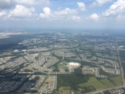
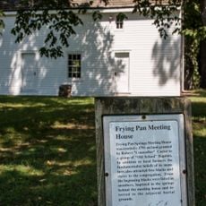
South Riding, Planned community in Loudoun County, Virginia, United States

South Riding is a planned community in Loudoun County with tree-lined streets, playgrounds, and pools throughout the area. The location includes schools, shopping centers, and a large recreation center for residents and visitors.

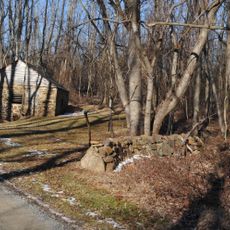
The community developed starting in the mid-1990s as a planned residential area in a fast-growing region. A management body was established to organize services and facilities for the growing population.

Events happen throughout the year in the parks, including outdoor summer movies and concerts on Friday evenings. These gatherings bring neighbors together and create spaces where families meet.

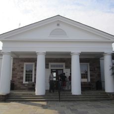
The area is well-supplied with shops, restaurants, and cafes for daily needs. A large recreation center with indoor pool and fitness areas offers additional options for activities.

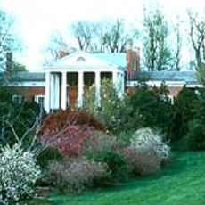
A golf course opened in the late 1990s and ranks among the well-known courses in the region. The design and grounds make it a notable destination for golfers in the area.

The community of curious travelers

AroundUs brings together thousands of curated places, local tips, and hidden gems, enriched daily by 60,000 contributors worldwide.

Start exploring
Location
Elevation above the sea
86 m
GPS coordinates
38.92080,-77.50390
Latest update
December 7, 2025 20:46
Around this place
Enola Gay
United States of America

Enola Gay

5.3 km
Steven F. Udvar-Hazy Center
United States of America

Steven F. Udvar-Hazy Center

5.3 km
CIA University
United States of America

CIA University

6.7 km
Henry House
United States of America

Henry House

11.9 km
Ellanor C. Lawrence Park
United States of America

Ellanor C. Lawrence Park

9.8 km
Stone Bridge
United States of America

Stone Bridge

10.7 km
Robinson House
United States of America

Robinson House

11.4 km
National Weather Service Baltimore/Washington
United States of America

National Weather Service Baltimore/Washington

6.4 km
Mount Zion Old School Baptist Church
United States of America

Mount Zion Old School Baptist Church

10.4 km
Arcola Elementary School
United States of America

Arcola Elementary School

4.1 km
Donald D. Engen Observation Tower
United States of America

Donald D. Engen Observation Tower

5.4 km
United States of America

Culpeper Basin

13 km
Arcola Slave Quarters
United States of America

Arcola Slave Quarters

3.7 km
Fleetwood Farm
United States of America

Fleetwood Farm

9.1 km
Merrybrook
United States of America

Merrybrook

9.1 km
Herndon Historic District
United States of America

Herndon Historic District

11.6 km
Ashburn Presbyterian Church
United States of America

Ashburn Presbyterian Church

13.2 km
Frying Pan Meetinghouse
United States of America

Frying Pan Meetinghouse

8.1 km
Floris Historic District
United States of America

Floris Historic District

8.6 km
Little River Turnpike Bridge
United States of America

Little River Turnpike Bridge

13.2 km
Locust Bottom
United States of America

Locust Bottom

12.2 km
Fair Oaks
United States of America

Fair Oaks

12.1 km
Francis–Gulick Mill
United States of America

Francis–Gulick Mill

12.8 km
Henry Hill Visitor Center
United States of America

Henry Hill Visitor Center

12.1 km
Oak Hill
United States of America

Oak Hill

13.2 km
Ray Muth Sr. Memorial Park
United States of America

Ray Muth Sr. Memorial Park

13.2 km
Henry Hill
United States of America

Henry Hill

11.9 km
Centreville Regional Library
United States of America

Centreville Regional Library

10.7 km
Show the full map
Reviews
Share your experience

No review yet

Discussions
Start a discussion...

No discussion yet

« South Riding - Planned community in Loudoun County, Virginia, United States » is provided by Around Us (aroundus.com). Images and texts are derived from Wikimedia project under a Creative Commons license. You are allowed to copy, distribute, and modify copies of this page, under the conditions set by the license, as long as this note is clearly visible.

Discover hidden gems everywhere you go!

From secret cafés to breathtaking viewpoints, skip the crowded tourist spots and find places that match your style. Our app makes it easy with voice search, smart filtering, route optimization, and insider tips from travelers worldwide. Download now for the complete mobile experience.

Around Us App Screenshot

A unique approach to discovering new places

Le Figaro

All the places worth exploring

France Info

A tailor-made excursion in just a few clicks

20 Minutes

Around Us
Travel Guide & Maps
Download

Send to your phone

QR Code
1

Open the camera app on your mobile.

2

Point at the QR code with your camera. A notification will appear.

3

Tap the notification to open the link.