Chest opened
+${chestReward.xp} XP
Explorer
NOUVEAU ×${chestReward.collectible.quantity}
tapez pour fermer
Chest locked

Open chests in the app

Around Us is built for your phone — chests unlock when you walk, explore and capture nearby places.

Enable Location

We need your location to show you interesting places around you

Discover nearby places

Find interesting locations and hidden gems around you

Precise directions

Get accurate directions and distances to places

Your location is never shared with other users. It's only used when you tap the location button.

Log in to your account

Start exploring — it's free

Trusted by 72,881 travelers worldwide

Continue with Google
Continue with Apple
or

We will send you a code to connect

By continuing, you accept our Terms and Conditions and our Privacy Policy

Check your inbox

We've sent a pincode in your inbox. Please enter the code below.

Kekekabic Trail
Discussion Reviews Photo
3k Popularity

Kekekabic Trail, Weg in den Vereinigten Staaten

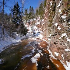
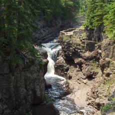
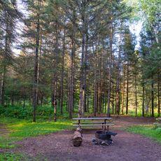
The Kekekabic Trail is a roughly 41-mile path that winds through forests and lakes in Minnesota's Boundary Waters Canoe Area Wilderness. It runs from near the Gunflint Trail to Fenberg Road and passes through dense woods, rocky sections, stream crossings, and open areas, marked with cairns and ribbons to guide hikers.

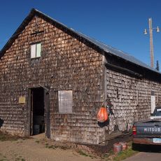
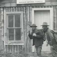
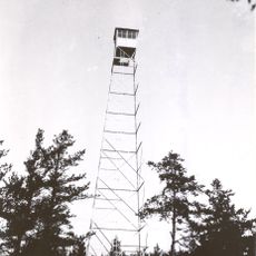
The trail was built in the 1930s by the US Forest Service to provide access to a fire tower at Kekekabic Lake. Major storms, particularly a severe windstorm in 2016, felled countless trees and made sections impassable, but volunteers have worked steadily to clear obstacles and restore accessibility.

The trail passes through areas shaped by indigenous use long ago, visible in the landscape and its layering of human activity over time. Today, hikers follow the same passages, creating a continuity between past and present ways of moving through this wilderness.

Bring good maps or GPS, plenty of water, snacks, and basic first aid supplies, as the route is remote and help is far away. Wear sturdy boots and dress in layers to handle terrain changes and quick weather shifts, and plan your daily distances carefully since sections are rugged and navigation can be challenging.

The trail was nearly impassable for years after storms, lying dormant until volunteer groups rallied to restore it, making it a rare example of grassroots wilderness recovery. Hikers can now walk routes that were reclaimed through community effort rather than official funding or development.

The community of curious travelers

AroundUs brings together thousands of curated places, local tips, and hidden gems, enriched daily by 60,000 contributors worldwide.

Start exploring
Location
Location
Location
GPS coordinates
48.05080,-91.16860
Latest update
February 9, 2026 08:23
Around this place
Boundary Waters Canoe Area Wilderness
United States of America

Boundary Waters Canoe Area Wilderness

26.2 km
Eagle Mountain
United States of America

Eagle Mountain

48.4 km
Superior Hiking Trail
United States of America

Superior Hiking Trail

58.6 km
Quetico Provincial Park
Canada

Quetico Provincial Park

47.1 km
Tettegouche State Park
United States of America

Tettegouche State Park

79.6 km
Height of Land Portage
Canada

Height of Land Portage

45.1 km
Temperance River State Park
United States of America

Temperance River State Park

59.6 km
Bear Head Lake State Park
United States of America

Bear Head Lake State Park

73 km
Cascade River State Park
United States of America

Cascade River State Park

61.4 km
Hegman Lake Pictograph
United States of America

Hegman Lake Pictograph

54.7 km
George H. Crosby Manitou State Park
United States of America

George H. Crosby Manitou State Park

63.8 km
Finland State Forest
United States of America

Finland State Forest

61.8 km
Grand Marais Light
United States of America

Grand Marais Light

70.7 km
Burntside Lodge
United States of America

Burntside Lodge

60 km
Listening Point
United States of America

Listening Point

65.3 km
Amboy and George Spencer Shipwreck Sites
United States of America

Amboy and George Spencer Shipwreck Sites

65 km
United States of America

North Shore Commercial Fishing Museum

58.5 km
Hartley Building
United States of America

Hartley Building

78.3 km
State Theater
United States of America

State Theater

54.3 km
Schroeder Lumber Company Bunkhouse
United States of America

Schroeder Lumber Company Bunkhouse

60.1 km
Church of St. Francis Xavier
United States of America

Church of St. Francis Xavier

71.8 km
Cook County Courthouse
United States of America

Cook County Courthouse

70.6 km
Jim Scott Fishhouse
United States of America

Jim Scott Fishhouse

70.4 km
Isabella Ranger Station
United States of America

Isabella Ranger Station

49.9 km
Dorothy Molter Museum
United States of America

Dorothy Molter Museum

52.2 km
Cascade Lookout Tower
United States of America

Cascade Lookout Tower

56.2 km
Kekekabic Lookout Tower
United States of America

Kekekabic Lookout Tower

2.4 km
Finland Lookout Tower
United States of America

Finland Lookout Tower

66.3 km
Show the full map
Reviews
Share your experience

No review yet

Discussions
Start a discussion...

No discussion yet

« Kekekabic Trail - Weg in den Vereinigten Staaten » is provided by Around Us (aroundus.com). Images and texts are derived from Wikimedia project under a Creative Commons license. You are allowed to copy, distribute, and modify copies of this page, under the conditions set by the license, as long as this note is clearly visible.

Discover hidden gems everywhere you go!

From secret cafés to breathtaking viewpoints, skip the crowded tourist spots and find places that match your style. Our app makes it easy with voice search, smart filtering, route optimization, and insider tips from travelers worldwide. Download now for the complete mobile experience.

Around Us App Screenshot

A unique approach to discovering new places

Le Figaro

All the places worth exploring

France Info

A tailor-made excursion in just a few clicks

20 Minutes

Around Us
Travel Guide & Maps
Download

Send to your phone

QR Code
1

Open the camera app on your mobile.

2

Point at the QR code with your camera. A notification will appear.

3

Tap the notification to open the link.