Chest opened
+${chestReward.xp} XP
Explorer
NOUVEAU ×${chestReward.collectible.quantity}
tapez pour fermer
Chest locked

Open chests in the app

Around Us is built for your phone — chests unlock when you walk, explore and capture nearby places.

Enable Location

We need your location to show you interesting places around you

Discover nearby places

Find interesting locations and hidden gems around you

Precise directions

Get accurate directions and distances to places

Your location is never shared with other users. It's only used when you tap the location button.

Log in to your account

Start exploring — it's free

Trusted by 72,991 travelers worldwide

Continue with Google
Continue with Apple
or

We will send you a code to connect

By continuing, you accept our Terms and Conditions and our Privacy Policy

Check your inbox

We've sent a pincode in your inbox. Please enter the code below.

Rifle River State Recreation Area
Discussion Reviews Photo
3.3k Popularity

Rifle River State Recreation Area, Protected recreation area in Ogemaw County, Michigan, US.

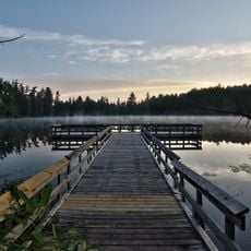
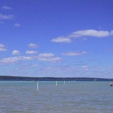
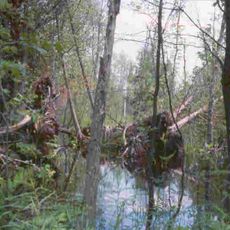
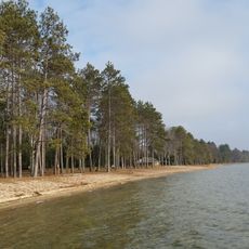
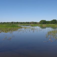
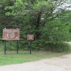
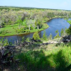
Rifle River State Recreation Area is a protected area in Michigan combining forests, lakes, and river sections across its grounds. The site features campsites, boat ramps, swimming spots, and walking trails that pass through different types of landscape.

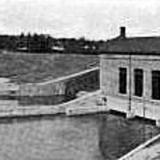
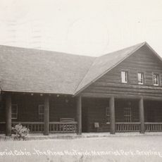
The land entered state control in 1945 after serving as a private retreat for a business executive. This conversion into a public recreation area allowed the general public to benefit from these forests and waterways.

The area serves as a place where local communities and visitors connect with nature, using the trails and waterways for recreation and relaxation. It represents how protected lands become gathering spots for people seeking outdoor activities and a break from daily life.

Visitors need a Recreation Passport to use the grounds and access facilities like campsites and boat ramps. The trails are open year-round, but the best time to visit depends on the type of activity you plan to do.

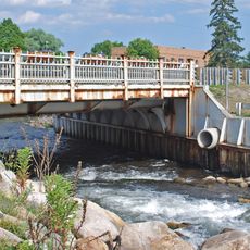
A suspension bridge crosses the Rifle River, giving visitors a distinctive walk over the flowing water. From an observation tower near Ridge Road, people can look out at ten different lakes and get a sense of the vast wilderness around them.

The community of curious travelers

AroundUs brings together thousands of curated places, local tips, and hidden gems, enriched daily by 60,000 contributors worldwide.

Start exploring
Location
GPS coordinates
44.39110,-84.02530
Latest update
December 12, 2025 09:01
Around this place
Hartwick Pines State Park
United States of America

Hartwick Pines State Park

64.6 km
Lumberman's Monument
United States of America

Lumberman's Monument

32.2 km
Sturgeon Point Light
United States of America

Sturgeon Point Light

69.5 km
Tawas Point State Park
United States of America

Tawas Point State Park

48.5 km
Harrisville State Park
United States of America

Harrisville State Park

64.7 km
South Higgins Lake State Park
United States of America

South Higgins Lake State Park

51.3 km
Au Sable State Forest
United States of America

Au Sable State Forest

34.4 km
Tawas Point Light
United States of America

Tawas Point Light

48.3 km
North Higgins Lake State Park
United States of America

North Higgins Lake State Park

59.8 km
Charity Island Light
United States of America

Charity Island Light

61 km
Gravelly Shoal Light
United States of America

Gravelly Shoal Light

56.9 km
Alabaster Historic District
United States of America

Alabaster Historic District

43 km
Dead Stream Flooding State Wildlife Management Area
United States of America

Dead Stream Flooding State Wildlife Management Area

65.2 km
Five Channels Dam
United States of America

Five Channels Dam

28.6 km
Cooke Dam
United States of America

Cooke Dam

37.2 km
Roscommon Zoo
United States of America

Roscommon Zoo

38.9 km
United States of America

Houghton Lake Flats Flooding State Wildlife Management Area

62.3 km
Eggleston School
United States of America

Eggleston School

42.1 km
Edward E. Hartwick Memorial Building
United States of America

Edward E. Hartwick Memorial Building

63.2 km
Douglas House
United States of America

Douglas House

58.4 km
Oscoda County Courthouse
United States of America

Oscoda County Courthouse

29.9 km
Ogemaw Hills Pathway
United States of America

Ogemaw Hills Pathway

16.6 km
M-72–Au Sable River Bridge
United States of America

M-72–Au Sable River Bridge

62.2 km
Second Arenac County Courthouse
United States of America

Second Arenac County Courthouse

40.6 km
White Pine National
United States of America

White Pine National

57.1 km
Wurtsmith Air Museum
United States of America

Wurtsmith Air Museum

53.6 km
CoopersVille USA
United States of America

CoopersVille USA

46.4 km
Au Sable National Scenic River
United States of America

Au Sable National Scenic River

28.8 km
Show the full map
Reviews
Share your experience

No review yet

Discussions
Start a discussion...

No discussion yet

« Rifle River State Recreation Area - Protected recreation area in Ogemaw County, Michigan, US » is provided by Around Us (aroundus.com). Images and texts are derived from Wikimedia project under a Creative Commons license. You are allowed to copy, distribute, and modify copies of this page, under the conditions set by the license, as long as this note is clearly visible.

Discover hidden gems everywhere you go!

From secret cafés to breathtaking viewpoints, skip the crowded tourist spots and find places that match your style. Our app makes it easy with voice search, smart filtering, route optimization, and insider tips from travelers worldwide. Download now for the complete mobile experience.

Around Us App Screenshot

A unique approach to discovering new places

Le Figaro

All the places worth exploring

France Info

A tailor-made excursion in just a few clicks

20 Minutes

Around Us
Travel Guide & Maps
Download

Send to your phone

QR Code
1

Open the camera app on your mobile.

2

Point at the QR code with your camera. A notification will appear.

3

Tap the notification to open the link.