Enable Location

We need your location to show you interesting places around you

Discover nearby places

Find interesting locations and hidden gems around you

Precise directions

Get accurate directions and distances to places

Your location is never shared with other users. It's only used when you tap the location button.

Rowlandton Mound Site

Log in to your account

Start exploring — it's free

Trusted by 63,010 travelers worldwide

Continue with Google
Continue with Apple
or

We will send you a code to connect

By continuing, you accept our Terms and Conditions and our Privacy Policy

Check your inbox

We've sent a pincode in your inbox. Please enter the code below.

Rowlandton Mound Site
Discussion Reviews 1 Photos
2.3k Popularity

Rowlandton Mound Site, Archaeological site in McCracken County, Kentucky, United States.

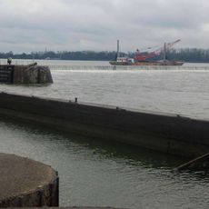
Rowlandton Mound Site is an archaeological location in McCracken County featuring a central platform mound and remains of a settlement from ancient times. The site spans about 3 hectares near the Ohio River with physical evidence of past occupation and structures.

The settlement developed between 1100 and 1350 CE on the edge of an ancient lake as a Mississippian cultural center. It was founded by local Late Woodland peoples who built it independently rather than as an outpost of nearby established sites.

The site reveals how indigenous people organized their communities and traded with distant regions during the Mississippian period. Visitors can see evidence of craft production and daily routines that shaped life in this riverside settlement.

Visitors need to obtain permission from local authorities and coordinate access before visiting this archaeological site. Since it is an active research location, exploration is restricted and typically requires prior arrangement or guidance.

Research found that this location was founded by local communities rather than as an extension of established settlements nearby. This discovery challenges assumptions about how Mississippian settlements spread and developed in the Ohio River region.

The community of curious travelers

AroundUs brings together thousands of curated places, local tips, and hidden gems, enriched daily by 60,000 contributors worldwide.

Start exploring
Location
GPS coordinates
37.09500,-88.63650
Latest update
December 13, 2025 12:23
Around this place
Kincaid Mounds State Historic Site
United States of America

Kincaid Mounds State Historic Site

13 km
Fort Massac
United States of America

Fort Massac

7.1 km
Irvin S. Cobb Bridge
United States of America

Irvin S. Cobb Bridge

2.3 km
Metropolis Bridge
United States of America

Metropolis Bridge

10.9 km
United States of America

Honeywell Uranium Hexafluoride Processing Facility

13.7 km
Whitehaven
United States of America

Whitehaven

5.1 km
Kentucky Dam Village State Resort Park
United States of America

Kentucky Dam Village State Resort Park

31.9 km
Dixon Springs State Park
United States of America

Dixon Springs State Park

32.1 km
Lock and Dam Number 52
United States of America

Lock and Dam Number 52

3.5 km
Smithland Lock and Dam
United States of America

Smithland Lock and Dam

20.1 km
Mermet Lake State Fish and Wildlife Area
United States of America

Mermet Lake State Fish and Wildlife Area

26.6 km
Fort Anderson
United States of America

Fort Anderson

3.1 km
Lloyd Tilghman House
United States of America

Lloyd Tilghman House

3.4 km
Lloyd Tilghman Memorial
United States of America

Lloyd Tilghman Memorial

2.1 km
David Yeiser House
United States of America

David Yeiser House

3.1 km
Confederate Monument in Paducah
United States of America

Confederate Monument in Paducah

1.5 km
Elijah P. Curtis House
United States of America

Elijah P. Curtis House

10.7 km
Golconda Historic District
United States of America

Golconda Historic District

33 km
United States of America

Lusk's Ferry, Illinois

33.2 km
Oak Hill
United States of America

Oak Hill

26.6 km
Masonic Temple
United States of America

Masonic Temple

3.7 km
Kenmil Place
United States of America

Kenmil Place

4.2 km
Richard Olive House
United States of America

Richard Olive House

21.2 km
Pete Lyles House
United States of America

Pete Lyles House

22.4 km
Masonic Hall-Federal Commissary Building
United States of America

Masonic Hall-Federal Commissary Building

21 km
Massac Theatre
United States of America

Massac Theatre

10.6 km
Fort Massac State Park
United States of America

Fort Massac State Park

7.1 km
Superman statue
United States of America

Superman statue

10.7 km
Show the full map
Reviews
Share your experience

No review yet

Discussions
Start a discussion...

No discussion yet

« Rowlandton Mound Site - Archaeological site in McCracken County, Kentucky, United States » is provided by Around Us (aroundus.com). Images and texts are derived from Wikimedia project under a Creative Commons license. You are allowed to copy, distribute, and modify copies of this page, under the conditions set by the license, as long as this note is clearly visible.

Discover hidden gems everywhere you go!

From secret cafés to breathtaking viewpoints, skip the crowded tourist spots and find places that match your style. Our app makes it easy with voice search, smart filtering, route optimization, and insider tips from travelers worldwide. Download now for the complete mobile experience.

Around Us App Screenshot

A unique approach to discovering new places

Le Figaro

All the places worth exploring

France Info

A tailor-made excursion in just a few clicks

20 Minutes

Around Us
Travel Guide & Maps
Download

Send to your phone

QR Code
1

Open the camera app on your mobile.

2

Point at the QR code with your camera. A notification will appear.

3

Tap the notification to open the link.