Sinks of Gandy

Log in to your account

AroundUs is a community-driven map of interesting places, built by curious explorers like you. It grows with every review, story, and photo you share.
Connect to save your favorite spots, contribute locations, and create personalized routes.
By continuing, you accept our Terms and Conditions and our Privacy Policy
Add to collection
Map
Suggest a change
Share

Sinks of Gandy, Natural cave tunnel in Osceola, United States

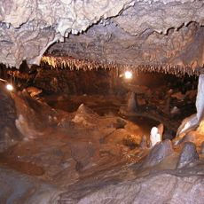
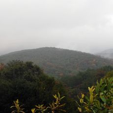
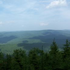
Sinks of Gandy is a limestone cave in West Virginia where Gandy Creek flows through underground passages. The tunnel system runs beneath Yokum Knob with chambers that vary in size as the water cuts through the rock.

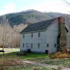
The cave was part of the landscape during the American Civil War when military action occurred near its entrance. Scientists later explored and measured the passages to better understand the underground system.

The National Speleological Society conducted the first professional survey of the underground passages on September 1, 1940, measuring 3056 feet of tunnels.

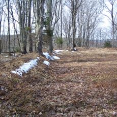
Bring protective clothing, water shoes, and reliable flashlights when visiting, as the passages are wet and dark. Plan for slow walking over slippery surfaces and watch your step carefully throughout the cave.

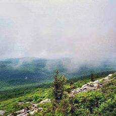
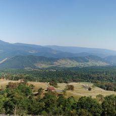
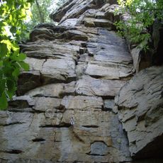
The main entrance is a large opening in the limestone cliff set within a sunken meadow. This depression in the landscape shows how water gradually shaped the terrain over thousands of years.

Location: West Virginia

Elevation above the sea: 1,059 m

GPS coordinates: 38.71470,-79.64250

Latest update: December 8, 2025 19:58

Photos
Around this place
Spruce Knob
United States of America

Spruce Knob

9.7 km
Germany Valley
United States of America

Germany Valley

22.6 km
Durbin and Greenbrier Valley Railroad
United States of America

Durbin and Greenbrier Valley Railroad

25.1 km
Seneca Caverns
United States of America

Seneca Caverns

22.7 km
White Top
United States of America

White Top

22.7 km
Bickle Knob
United States of America

Bickle Knob

25.6 km
Gaudineer Scenic Area
United States of America

Gaudineer Scenic Area

19.9 km
Spruce Knob-Seneca Rocks National Recreation Area
United States of America

Spruce Knob-Seneca Rocks National Recreation Area

27.3 km
Gaudineer Knob
United States of America

Gaudineer Knob

20.7 km
Laurel Fork North Wilderness
United States of America

Laurel Fork North Wilderness

5.5 km
Sites Homestead
United States of America

Sites Homestead

26.9 km
Middle Mountain Cabins
United States of America

Middle Mountain Cabins

8.5 km
Tygart Valley Homesteads Historic District
United States of America

Tygart Valley Homesteads Historic District

24 km
Randolph County Courthouse and Jail
United States of America

Randolph County Courthouse and Jail

29 km
Laurel Fork South Wilderness
United States of America

Laurel Fork South Wilderness

6.6 km
Shavers Fork Mountain Complex
United States of America

Shavers Fork Mountain Complex

20.7 km
Camp Bartow Historic District
United States of America

Camp Bartow Historic District

22.9 km
Franklin Gorge
United States of America

Franklin Gorge

28.5 km
Castle Mountain
United States of America

Castle Mountain

20.9 km
Gov. H. Guy Kump House
United States of America

Gov. H. Guy Kump House

28.5 km
Circleville School
United States of America

Circleville School

14.3 km
First Ward School
United States of America

First Ward School

29.1 km
Day-Vandevander Mill
United States of America

Day-Vandevander Mill

26.4 km
McCoy House
United States of America

McCoy House

28.3 km
Franklin Historic District
United States of America

Franklin Historic District

28.1 km
Beverly Historic District
United States of America

Beverly Historic District

24.6 km
Taylor-Condry House
United States of America

Taylor-Condry House

28.2 km
Butcher Hill Historic District
United States of America

Butcher Hill Historic District

24.3 km
Show the full map
Reviews

Visited this place? Tap the stars to rate it and share your experience / photos with the community! Try now! You can cancel it anytime.

« Sinks of Gandy - Natural cave tunnel in Osceola, United States » is provided by Around Us (aroundus.com). Images and texts are derived from Wikimedia project under a Creative Commons license. You are allowed to copy, distribute, and modify copies of this page, under the conditions set by the license, as long as this note is clearly visible.

Discover hidden gems everywhere you go!

From secret cafés to breathtaking viewpoints, skip the crowded tourist spots and find places that match your style. Our app makes it easy with voice search, smart filtering, route optimization, and insider tips from travelers worldwide. Download now for the complete mobile experience.

Around Us App Screenshot

A unique approach to discovering new places

Le Figaro

All the places worth exploring

France Info

A tailor-made excursion in just a few clicks

20 Minutes