Enable Location

We need your location to show you interesting places around you

Discover nearby places

Find interesting locations and hidden gems around you

Precise directions

Get accurate directions and distances to places

Your location is never shared with other users. It's only used when you tap the location button.

Aberdeen

Log in to your account

Start exploring — it's free

Trusted by 62,473 travelers worldwide

Continue with Google
Continue with Apple
or

We will send you a code to connect

By continuing, you accept our Terms and Conditions and our Privacy Policy

Check your inbox

We've sent a pincode in your inbox. Please enter the code below.

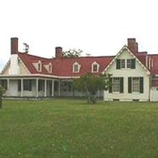
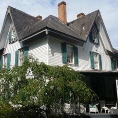
Aberdeen, human settlement in United States of America

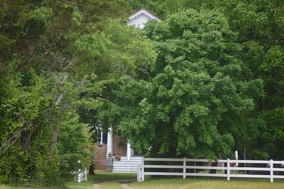
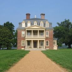
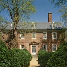
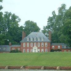
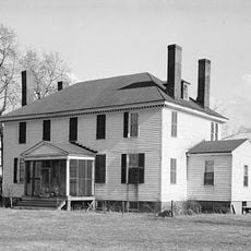
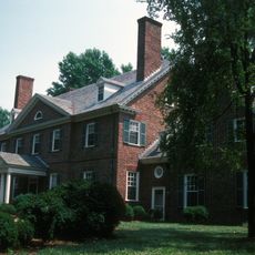
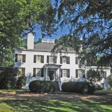
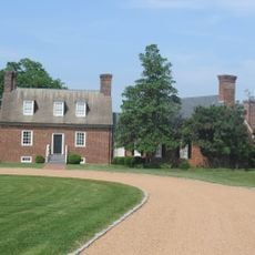
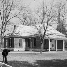
Aberdeen is a large brick house built around 1810 in Prince George County with a rectangular shape and side hall plan. The solid structure shows Georgian style features including a peaked pediment, Doric columns, neatly patterned Flemish bond brickwork, and wood trim from the Federal period on its interior.

Thomas Cocke built the house around 1810 and named it after a Scottish region while inheriting large estate lands from his father. Cocke conducted soil improvement experiments with Edmund Ruffin using marl, work that significantly influenced Virginia farming practices before the Civil War.

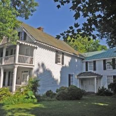
The name Aberdeen comes from a region in Scotland, reflecting the Cocke family's heritage and ties to their ancestry. The house and surrounding farmland show how wealthy landowners and those who worked the fields shaped rural Virginia life over many generations.

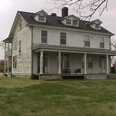
The house is not open to the public as a museum, but its exterior and surrounding farmland can be viewed from the road. Visitors should respect private property and enjoy observing the architecture and landscape from a distance.

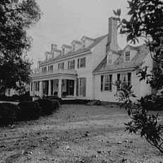
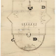
Artist Edward Darby created a pen and ink drawing of the house in the 1930s as part of a Depression-era project to document historic buildings. This artwork preserves the house's appearance from nearly a century ago and shows the detailed craftsmanship of that period.

The community of curious travelers

AroundUs brings together thousands of curated places, local tips, and hidden gems, enriched daily by 60,000 contributors worldwide.

Start exploring
GPS coordinates
37.22639,-77.14528
Latest update
February 9, 2026 07:46
Around this place
Shirley Plantation
United States of America

Shirley Plantation

16.9 km
Berkeley Plantation
United States of America

Berkeley Plantation

11.1 km
Sherwood Forest Plantation
United States of America

Sherwood Forest Plantation

15.6 km
Westover Plantation
United States of America

Westover Plantation

12.1 km
Flowerdew Hundred Plantation
United States of America

Flowerdew Hundred Plantation

8.6 km
Lower Brandon Plantation
United States of America

Lower Brandon Plantation

13.9 km
Benjamin Harrison Memorial Bridge
United States of America

Benjamin Harrison Memorial Bridge

12.4 km
Greenway Plantation
United States of America

Greenway Plantation

14.7 km
Appomattox Manor
United States of America

Appomattox Manor

15.4 km
Weyanoke, Virginia
United States of America

Weyanoke, Virginia

10.1 km
Merchant's Hope
United States of America

Merchant's Hope

6.7 km
Evelynton
United States of America

Evelynton

11.6 km
James River National Wildlife Refuge
United States of America

James River National Wildlife Refuge

4.8 km
City Point National Cemetery
United States of America

City Point National Cemetery

16.1 km
Beacon Theatre
United States of America

Beacon Theatre

15.3 km
Upper Shirley
United States of America

Upper Shirley

16.7 km
Woodburn
United States of America

Woodburn

14.7 km
Edgewood Plantation and Harrison's Mill
United States of America

Edgewood Plantation and Harrison's Mill

12.1 km
Fort Powhatan
United States of America

Fort Powhatan

7.7 km
Upper Weyanoke
United States of America

Upper Weyanoke

10.2 km
Prince George County Courthouse Historic District
United States of America

Prince George County Courthouse Historic District

12.6 km
Charles City County Courthouse
United States of America

Charles City County Courthouse

14.3 km
City Point Historic District
United States of America

City Point Historic District

15.2 km
Nance-Major House and Store
United States of America

Nance-Major House and Store

14.6 km
Cedar Ridge
United States of America

Cedar Ridge

13.2 km
Downtown Hopewell Historic District
United States of America

Downtown Hopewell Historic District

15.4 km
Hopewell Municipal Building
United States of America

Hopewell Municipal Building

15.3 km
Jordan Point Light
United States of America

Jordan Point Light

11.9 km
Show the full map
« Aberdeen - human settlement in United States of America » is provided by Around Us (aroundus.com). Images and texts are derived from Wikimedia project under a Creative Commons license. You are allowed to copy, distribute, and modify copies of this page, under the conditions set by the license, as long as this note is clearly visible.

Discover hidden gems everywhere you go!

From secret cafés to breathtaking viewpoints, skip the crowded tourist spots and find places that match your style. Our app makes it easy with voice search, smart filtering, route optimization, and insider tips from travelers worldwide. Download now for the complete mobile experience.

Around Us App Screenshot

A unique approach to discovering new places

Le Figaro

All the places worth exploring

France Info

A tailor-made excursion in just a few clicks

20 Minutes

Around Us
Travel Guide & Maps
Download

Send to your phone

QR Code
1

Open the camera app on your mobile.

2

Point at the QR code with your camera. A notification will appear.

3

Tap the notification to open the link.