Enable Location

We need your location to show you interesting places around you

Discover nearby places

Find interesting locations and hidden gems around you

Precise directions

Get accurate directions and distances to places

Your location is never shared with other users. It's only used when you tap the location button.

Edgewood Plantation and Harrison's Mill

Log in to your account

Start exploring — it's free

Trusted by 62,469 travelers worldwide

Continue with Google
Continue with Apple
or

We will send you a code to connect

By continuing, you accept our Terms and Conditions and our Privacy Policy

Check your inbox

We've sent a pincode in your inbox. Please enter the code below.

Edgewood Plantation and Harrison's Mill

Edgewood Plantation and Harrison's Mill, human settlement in Virginia, United States of America

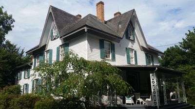
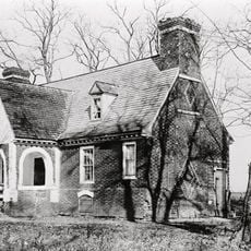
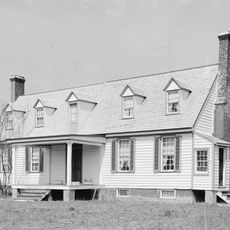
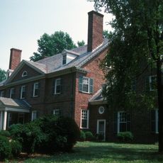
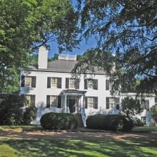
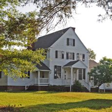
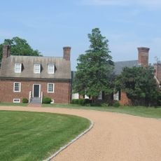
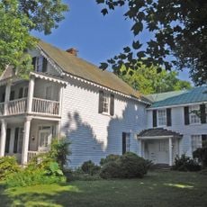
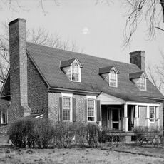
Edgewood Plantation and Harrison's Mill is a plantation house and historic mill in Virginia originally built on land that was once part of Berkeley Hundred. The main house was built in 1854 in Gothic Revival style with a three-story central staircase, while the mill dates to the 1700s and sits directly behind the residence.

Benjamin Harrison V originally built the mill in the 1700s, which remained in the Harrison family until the 1840s when financial troubles forced its sale. Richard S. Rowland later acquired the property and constructed the Gothic Revival house in 1854.

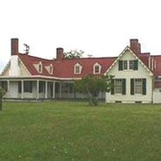
The name Edgewood refers to the property's location at the edge of wooded land. The house was home to the Rowland family from New Jersey, who used it both as a residence and as a center for their milling operations that served the local community.

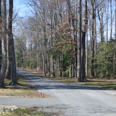
The estate is open daily from morning through late afternoon, with guided tours of the house available by appointment. The site sits along Route 5, a scenic and accessible road positioned between Richmond and Williamsburg.

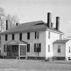
The mill served both sides during the Civil War, grinding corn for Union and Confederate troops. After the war, Mrs. Rowland reportedly built a wooden fence from leftover tent poles left by soldiers, showing how the conflict touched everyday life at the property.

The community of curious travelers

AroundUs brings together thousands of curated places, local tips, and hidden gems, enriched daily by 60,000 contributors worldwide.

Start exploring
Location
Inception
1854
GPS coordinates
37.33030,-77.18670
Latest update
February 9, 2026 08:20
Around this place
Shirley Plantation
United States of America

Shirley Plantation

5.8 km
Berkeley Plantation
United States of America

Berkeley Plantation

1.1 km
Westover Plantation
United States of America

Westover Plantation

1.2 km
Flowerdew Hundred Plantation
United States of America

Flowerdew Hundred Plantation

8.2 km
Benjamin Harrison Memorial Bridge
United States of America

Benjamin Harrison Memorial Bridge

3.5 km
Malvern Hill
United States of America

Malvern Hill

8.9 km
Greenway Plantation
United States of America

Greenway Plantation

8 km
Appomattox Manor
United States of America

Appomattox Manor

8.2 km
Weyanoke, Virginia
United States of America

Weyanoke, Virginia

11.6 km
Merchant's Hope
United States of America

Merchant's Hope

7.3 km
Evelynton
United States of America

Evelynton

2.9 km
James River National Wildlife Refuge
United States of America

James River National Wildlife Refuge

8.6 km
City Point National Cemetery
United States of America

City Point National Cemetery

10.2 km
Presquile National Wildlife Refuge
United States of America

Presquile National Wildlife Refuge

7.5 km
Beacon Theatre
United States of America

Beacon Theatre

9.4 km
Upper Shirley
United States of America

Upper Shirley

6.5 km
Woodburn
United States of America

Woodburn

7.3 km
Fort Powhatan
United States of America

Fort Powhatan

11.8 km
United States of America

Dogham, Doggams

5.4 km
Upper Weyanoke
United States of America

Upper Weyanoke

10.6 km
Hardens
United States of America

Hardens

6.3 km
Charles City County Courthouse
United States of America

Charles City County Courthouse

10.2 km
United States of America

Lott Cary Birth Site

11.1 km
City Point Historic District
United States of America

City Point Historic District

8.1 km
Nance-Major House and Store
United States of America

Nance-Major House and Store

10.1 km
Glebe of Westover Parish
United States of America

Glebe of Westover Parish

12.3 km
Downtown Hopewell Historic District
United States of America

Downtown Hopewell Historic District

9.3 km
Hopewell Municipal Building
United States of America

Hopewell Municipal Building

9.5 km
Show the full map
« Edgewood Plantation and Harrison's Mill - human settlement in Virginia, United States of America » is provided by Around Us (aroundus.com). Images and texts are derived from Wikimedia project under a Creative Commons license. You are allowed to copy, distribute, and modify copies of this page, under the conditions set by the license, as long as this note is clearly visible.

Discover hidden gems everywhere you go!

From secret cafés to breathtaking viewpoints, skip the crowded tourist spots and find places that match your style. Our app makes it easy with voice search, smart filtering, route optimization, and insider tips from travelers worldwide. Download now for the complete mobile experience.

Around Us App Screenshot

A unique approach to discovering new places

Le Figaro

All the places worth exploring

France Info

A tailor-made excursion in just a few clicks

20 Minutes

Around Us
Travel Guide & Maps
Download

Send to your phone

QR Code
1

Open the camera app on your mobile.

2

Point at the QR code with your camera. A notification will appear.

3

Tap the notification to open the link.