Enable Location

We need your location to show you interesting places around you

Discover nearby places

Find interesting locations and hidden gems around you

Precise directions

Get accurate directions and distances to places

Your location is never shared with other users. It's only used when you tap the location button.

Daymark Wangerooge-East

Log in to your account

Start exploring — it's free

Trusted by 61,438 travelers worldwide

Continue with Google
Continue with Apple
or

We will send you a code to connect

By continuing, you accept our Terms and Conditions and our Privacy Policy

Check your inbox

We've sent a pincode in your inbox. Please enter the code below.

Daymark Wangerooge-East

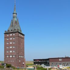
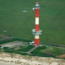
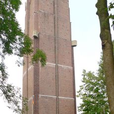
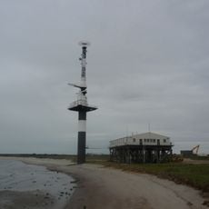
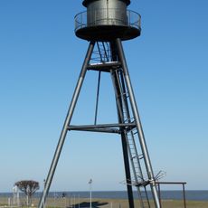
Daymark Wangerooge-East, Navigational daymark and architectural monument on Wangerooge island, Germany.

Description

Daymark Wangerooge-East is a 56-meter-tall navigation aid standing on the eastern coast of Wangerooge island and serves as a fixed reference point for ships in the North Sea. The structure rises above the flat island landscape and remains visible from far away to help seafarers safely navigate through the challenging tidal waters.

History

The current structure was built between 1932 and 1933 to replace an earlier lighthouse destroyed during a severe winter storm surge in 1854. The new construction provided a more reliable navigation aid and proved more resistant to the natural forces of the sea.

Culture

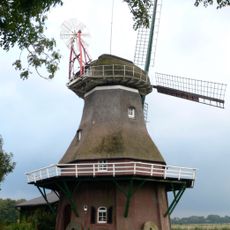
The daymark reflects the maritime traditions of the East Frisian Islands and shows how seafarers have navigated these waters for centuries. Visitors can see here a sign of the strong connection between island life and the sea that continues to shape the culture of this place today.

Practical

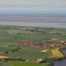
To reach the daymark, visitors take a ferry to Wangerooge island and then follow the eastern coastal path through the island landscape. The best time to visit is during good weather and low tide when the pathways are accessible and the terrain is easy to explore.

Did you know?

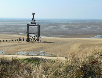
Despite its lighthouse-like appearance, this structure never operated as a working lighthouse but served only as a visual reference point for ships. This distinguishes it from other navigation aids in the region that actually operated active beacon lights.

Location
GPS coordinates
53.77758,7.96225
Latest update
December 14, 2025 14:24

AroundUs brings together thousands of curated places, local tips, and hidden gems, enriched daily by 60,000 contributors worldwide. Discover all places nearby (Wangerooge).

« Daymark Wangerooge-East - Navigational daymark and architectural monument on Wangerooge island, Germany » is provided by Around Us (aroundus.com). Images and texts are derived from Wikimedia project under a Creative Commons license. You are allowed to copy, distribute, and modify copies of this page, under the conditions set by the license, as long as this note is clearly visible.

Discover hidden gems everywhere you go!

From secret cafés to breathtaking viewpoints, skip the crowded tourist spots and find places that match your style. Our app makes it easy with voice search, smart filtering, route optimization, and insider tips from travelers worldwide. Download now for the complete mobile experience.

Around Us App Screenshot

A unique approach to discovering new places

Le Figaro

All the places worth exploring

France Info

A tailor-made excursion in just a few clicks

20 Minutes

Around Us
Travel Guide & Maps
Download

Send to your phone

QR Code
1

Open the camera app on your mobile.

2

Point at the QR code with your camera. A notification will appear.

3

Tap the notification to open the link.