白水の滝, Natural waterfall in Kanna, Gunma Prefecture, Japan.
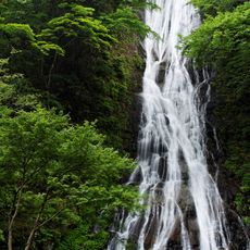
Shiromizu no Taki is a waterfall in the Kanna area of Gunma Prefecture that descends over moss-covered rocks within a limestone formation. The water flows gently in cascades framed by the pale stone formations surrounding the fall.
This waterfall sits on Mount Kano, whose limestone layers formed during the Carboniferous and Permian periods. The geological structures have shaped the waterfall's appearance for millions of years.
Local residents of Gunma Prefecture maintain the natural state of the waterfall, preventing commercial development to preserve its geological features.
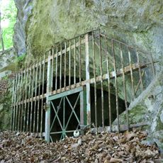
The waterfall is accessible from a small parking area near the mining tunnel entrance, with the Manyou no Sato rest area close by. The walk to the water is short and relatively easy to navigate.
The water seeps through underground passages before emerging at the surface, remaining clean and clear throughout. This gives the waterfall its characteristic bright appearance without the gray tint normally caused by sediment.
The community of curious travelers
AroundUs brings together thousands of curated places, local tips, and hidden gems, enriched daily by 60,000 contributors worldwide.