Enable Location

We need your location to show you interesting places around you

Discover nearby places

Find interesting locations and hidden gems around you

Precise directions

Get accurate directions and distances to places

Your location is never shared with other users. It's only used when you tap the location button.

Cai Rang Bridge

Log in to your account

Start exploring — it's free

Trusted by 61,867 travelers worldwide

Continue with Google
Continue with Apple
or

We will send you a code to connect

By continuing, you accept our Terms and Conditions and our Privacy Policy

Check your inbox

We've sent a pincode in your inbox. Please enter the code below.

Cai Rang Bridge

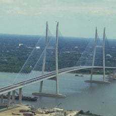
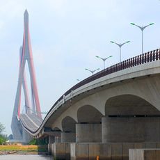
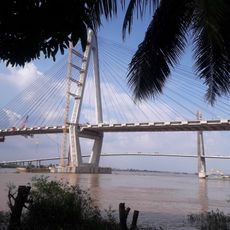
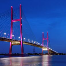
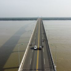
Cai Rang Bridge, Road bridge in Cai Rang District, Can Tho, Vietnam

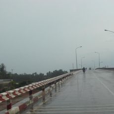
Cai Rang Bridge is a road bridge spanning the Hau River in Can Tho, connecting Cai Rang and Ninh Kieu districts. The steel and concrete structure accommodates six vehicle lanes plus two dedicated motorcycle paths for organized traffic flow.

The bridge was built to improve transportation links between districts in the Mekong region and facilitate trade access. It represented a major step forward in upgrading the city's infrastructure for faster regional connections.

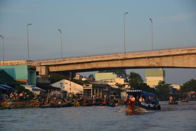
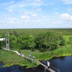
The floating market that operates near the bridge at dawn attracts both vendors and curious visitors who watch from the structure, making it a gathering point where commerce and tourism intersect throughout the morning hours.

The bridge offers excellent views across the river and surrounding area, especially during early morning hours when light conditions are favorable. The best time to visit is in the morning when river activity is at its peak.

The bridge features a specialized lighting system that activates at night, creating reflective effects on the water surface below. This nighttime illumination makes the structure a distinctive landmark for river traffic and transforms its appearance after sunset.

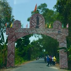
The community of curious travelers

AroundUs brings together thousands of curated places, local tips, and hidden gems, enriched daily by 60,000 contributors worldwide.

Start exploring
Location
Location
Location
GPS coordinates
10.00683,105.74998
Latest update
December 13, 2025 11:46
« Cai Rang Bridge - Road bridge in Cai Rang District, Can Tho, Vietnam » is provided by Around Us (aroundus.com). Images and texts are derived from Wikimedia project under a Creative Commons license. You are allowed to copy, distribute, and modify copies of this page, under the conditions set by the license, as long as this note is clearly visible.

Discover hidden gems everywhere you go!

From secret cafés to breathtaking viewpoints, skip the crowded tourist spots and find places that match your style. Our app makes it easy with voice search, smart filtering, route optimization, and insider tips from travelers worldwide. Download now for the complete mobile experience.

Around Us App Screenshot

A unique approach to discovering new places

Le Figaro

All the places worth exploring

France Info

A tailor-made excursion in just a few clicks

20 Minutes

Around Us
Travel Guide & Maps
Download

Send to your phone

QR Code
1

Open the camera app on your mobile.

2

Point at the QR code with your camera. A notification will appear.

3

Tap the notification to open the link.