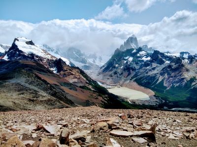
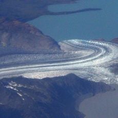
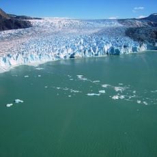
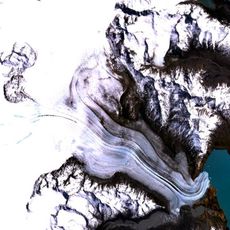
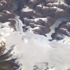
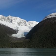
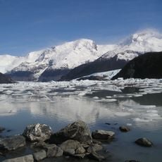
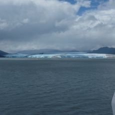
Loma Del Pliegue Tumbado, Mountain summit in Los Glaciares National Park, Argentina.
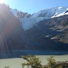
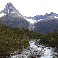
Loma del Pliegue Tumbado is a mountain summit in Los Glaciares National Park that sits at around 1500 meters elevation. The path climbs through grasslands and forests before reaching rocky terrain near the top.
This region was submerged beneath an ancient ocean roughly 100 million years ago, as shown by marine fossils found along the path. This geological past shaped the landscape visible to visitors today.
Local hiking guides incorporate traditional Patagonian navigation methods and environmental knowledge while leading groups through the mountain paths.
The full trek takes about 7 to 8 hours round trip with an elevation gain of roughly 1100 meters from the start. Visitors should begin early and bring plenty of water and sturdy footwear.
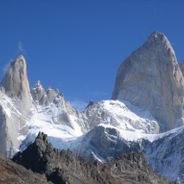
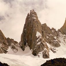
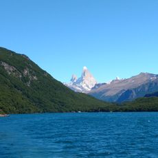
From the summit, visitors can see both Cerro Torre and Mount Fitz Roy at the same time, a view available from very few other locations. This double perspective makes the spot particularly rewarding for mountain enthusiasts.
Location: Lago Argentino Department
GPS coordinates: -49.35944,-72.96752
Latest update: December 6, 2025 19:06
Patagonia extends across the southern reaches of Chile and Argentina, encompassing a range of natural landscapes from active glaciers to volcanic peaks. The region presents a mixture of ice, stone and water, with national parks protecting thousands of square miles of undeveloped terrain. The land was shaped by glacial processes that left deep valleys, lakes and dramatic mountain formations. The collection includes prominent locations across both countries. In Argentina, Mount Fitz Roy and Cerro Torre rise above the valley of El Chaltén, while Perito Moreno Glacier is one of the few ice formations worldwide that continues to advance. Los Alerces National Park protects ancient alerce trees that have stood for millennia. On the Chilean side, the Marble Caves at General Carrera Lake form carved rock structures, Queulat Hanging Glacier feeds waterfalls, and the towers of Torres del Paine define one of South America's most recognizable mountain landscapes. San Rafael Lagoon provides access to tidewater glaciers, while remote protected areas such as Kawésqar National Park and Pumalín Douglas Tompkins National Park preserve extensive temperate rainforests. Historical sites like Cave of Hands display prehistoric rock art.
Los Glaciares National Park
71.3 km
Southern Patagonian Ice Field
26.6 km
Upsala Glacier
49.9 km
Villa O'Higgins
103.6 km
Viedma Glacier
19.9 km
Bernardo O'Higgins National Park
103 km
Spegazzini Glacier
103.5 km
Brüggen Glacier
76.6 km
Volcán Lautaro
54.4 km
O'Higgins Glacier
55.1 km
Aguja Poincenot
10.2 km
Viedma
25.2 km
Aguja Saint Exupery
9.5 km
Aguilera
114.6 km
Jorge Montt Glacier
117.2 km
Bernardo Glacier
101.2 km
Huemul Glacier
32.6 km
Lago del Desierto Provintial Reserve
30.5 km
Parque provincial Península de Magallanes
115.9 km
Puesto Arbilla
23.2 km
Seco Glacier
93.6 km
Onelli Glacier
91 km
Cerro Huemul
8.6 km
Chaltén Mountain Range Natural Site
13.4 km
Cerro Roma
75.5 km
Eyre Fjord
83.4 km
Cerro Mayo (verdadero Stokes)
111.5 km
Onelli glacier
76.6 kmReviews
Visited this place? Tap the stars to rate it and share your experience / photos with the community! Try now! You can cancel it anytime.
Discover hidden gems everywhere you go!
From secret cafés to breathtaking viewpoints, skip the crowded tourist spots and find places that match your style. Our app makes it easy with voice search, smart filtering, route optimization, and insider tips from travelers worldwide. Download now for the complete mobile experience.
A unique approach to discovering new places❞
— Le Figaro
All the places worth exploring❞
— France Info
A tailor-made excursion in just a few clicks❞
— 20 Minutes