Chest opened
+${chestReward.xp} XP
Explorer
NOUVEAU ×${chestReward.collectible.quantity}
tapez pour fermer

See the monuments around you in AR Open chests in the app

Around Us is built for your phone — point your camera at the streets and discover the monuments and places around you in augmented reality. Around Us is built for your phone — chests unlock when you walk, explore and capture nearby places.

•

Enable Location

We need your location to show you interesting places around you

Discover nearby places

Find interesting locations and hidden gems around you

Precise directions

Get accurate directions and distances to places

Your location is never shared with other users. It's only used when you tap the location button.

Třeboňsko Protected Landscape Area

Log in to your account

Start exploring — it's free

Trusted by 93,784 travelers worldwide

Continue with Google
Continue with Apple
or

We will send you a code to connect

By continuing, you accept our Terms and Conditions and our Privacy Policy

Check your inbox

We've sent a pincode in your inbox. Please enter the code below.

Třeboňsko Protected Landscape Area

Třeboňsko Protected Landscape Area, Protected landscape area in South Bohemia, Czech Republic

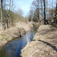
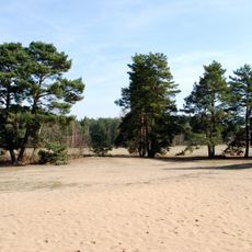
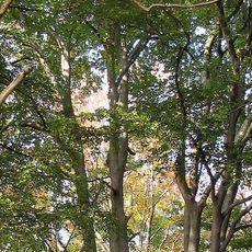
The Wittingauer Becken is a protected landscape in South Bohemia with wetlands, forests, and extensive fishponds watered by two main rivers. This landscape mosaic developed over centuries through the transformation of swamps into a system of water surfaces and cultivated land.

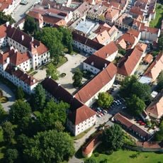
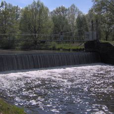
The first written record of settlement dates from the 12th century, when a small hamlet called Vítkův Luh, held by Vítek z Prčic, grew into the town of Třeboň. In the 14th century the Rožmberk family acquired Třeboň and the first fishponds were founded. Under Petr IV, Josef Štěpánek Netolický built the artificial Zlatá stoka canal, and in the 16th century Jakub Krčín z Jelčan added many more ponds for the last Rožmberks.

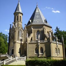
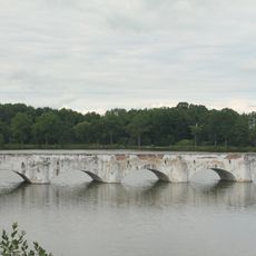
The name Třeboňsko comes from the town of Třeboň, which grew out of the 12th-century settlement Vítkův Luh. Fishing shaped the region: the Zlatá stoka canal, built by Josef Štěpánek Netolický, still feeds the ponds, and Jakub Krčín z Jelčan added many more under the Rožmberks. The Rosenberg tomb stands on the bank of a Třeboň pond.

The protected area covers 687 km² between 406 and 541 m above sea level, with its highest point east of Mirochov. The administration and the Dům přírody (House of Nature) are based in Třeboň, a useful starting point for orientation. Paths run along the artificial canals and fishponds, so expect wet ground in the peat-bog and wetland sections.

The area contains 16 sites of European importance and plays a surprising role as one of Europe's largest freshwater fish producers. This economic distinction is often invisible to visitors at first glance, yet shapes the entire region in subtle ways.

The community of curious travelers

AroundUs brings together thousands of curated places, local tips, and hidden gems, enriched daily by 93,784 contributors worldwide.

Start exploring
Location
GPS coordinates
48.99298,14.85307
Latest update
October 21, 2026 19:10
Reviews
Share your experience

No review yet

Discussions
Start a discussion...

No discussion yet

« Třeboňsko Protected Landscape Area - Protected landscape area in South Bohemia, Czech Republic » is provided by Around Us (aroundus.com). Images and texts are derived from Wikimedia project under a Creative Commons license. You are allowed to copy, distribute, and modify copies of this page, under the conditions set by the license, as long as this note is clearly visible.

Discover hidden gems everywhere you go!

From secret cafés to breathtaking viewpoints, skip the crowded tourist spots and find places that match your style. Our app makes it easy with voice search, smart filtering, route optimization, and insider tips from travelers worldwide. Download now for the complete mobile experience.

Around Us App Screenshot
❝

A unique approach to discovering new places❞

— Le Figaro

❝

All the places worth exploring❞

— France Info

❝

A tailor-made excursion in just a few clicks❞

— 20 Minutes

Around Us
Travel Guide & Maps
Download

Send to your phone

QR Code
1

Open the camera app on your mobile.

2

Point at the QR code with your camera. A notification will appear.

3

Tap the notification to open the link.