State Game Lands Number 12, Wildlife conservation area in Bradford County, Pennsylvania
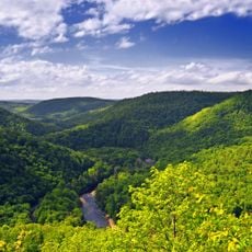
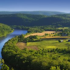
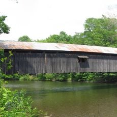
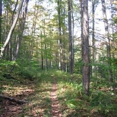
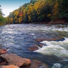
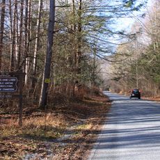
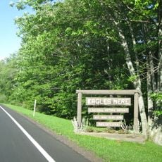
State Game Lands Number 12 is a wildlife conservation area in Bradford County covering about 24,500 acres of mountainous terrain with hardwood forests and streams. Multiple parking areas and access points provide entry to the game lands from Pennsylvania Route 54.
The Pennsylvania Game Commission established this area as a wildlife management zone after it had been used for timber harvesting and railroad operations. This transition marked a shift from resource extraction to conservation in the region.
Local hunters use these lands during regulated seasons, following Pennsylvania's approach to wildlife management and conservation. The activity reflects how surrounding communities have traditionally engaged with these forests.
The area is accessible from multiple entry points connected to Pennsylvania Route 54, with several parking areas throughout. Visitors should prepare for variable terrain and changing conditions across the different zones.
The elevation changes across the lands create layered ecosystems within the same area. Black bears, white-tailed deer, and eastern hemlock trees thrive at different heights, making it a site where these different communities coexist closely.
Location: Pennsylvania
Location: Bradford County
GPS coordinates: 41.60944,-76.68667
Latest update: December 14, 2025 13:05
Worlds End State Park
18.2 km
Sonestown Covered Bridge
31.3 km
French Azilum
33.7 km
Mt. Pisgah State Park
22.2 km
Forksville Covered Bridge
15.3 km
Hillsgrove Covered Bridge
16.6 km
Old Loggers Path
20 km
Loyalsock State Forest
11.3 km
Plunketts Creek Bridge No. 3
24.3 km
State Game Lands Number 13
38.2 km
Phillip Paul Bliss House
39.8 km
Troy Public High School
21.6 km
Eagles Mere Historic District
23.3 km
Buttonwood Covered Bridge
38.6 km
Bradford County Courthouse
27 km
Methodist Episcopal Church of Burlington
18.8 kmSullivan County Courthouse
26.2 km
Eagles Mere Air Museum
25 km
Bridge in Lewis Township
30.4 km
Sunbury Historic District
29.4 km
Athens Historic District
40.5 km
Towanda Historic District
26.9 km
Universalist Meeting House of Sheshequin
33.4 km
Ellen and Charles F. Welles House
36.2 km
Van Dyne Civic Building
21.4 km
Worlds End State Park Family Cabin District
18.4 km
Knapp's Covered Bridge
22.5 km
Loyalsock Trail
22.3 kmVisited this place? Tap the stars to rate it and share your experience / photos with the community! Try now! You can cancel it anytime.
Discover hidden gems everywhere you go!
From secret cafés to breathtaking viewpoints, skip the crowded tourist spots and find places that match your style. Our app makes it easy with voice search, smart filtering, route optimization, and insider tips from travelers worldwide. Download now for the complete mobile experience.
A unique approach to discovering new places❞
— Le Figaro
All the places worth exploring❞
— France Info
A tailor-made excursion in just a few clicks❞
— 20 Minutes