Chest opened
+${chestReward.xp} XP
Explorer
NOUVEAU ×${chestReward.collectible.quantity}
tapez pour fermer
Chest locked

Open chests in the app

Around Us is built for your phone — chests unlock when you walk, explore and capture nearby places.

Enable Location

We need your location to show you interesting places around you

Discover nearby places

Find interesting locations and hidden gems around you

Precise directions

Get accurate directions and distances to places

Your location is never shared with other users. It's only used when you tap the location button.

Log in to your account

Start exploring — it's free

Trusted by 73,087 travelers worldwide

Continue with Google
Continue with Apple
or

We will send you a code to connect

By continuing, you accept our Terms and Conditions and our Privacy Policy

Check your inbox

We've sent a pincode in your inbox. Please enter the code below.

Harbor Defenses of Boston
Discussion Reviews Photo
4.2k Popularity

Harbor Defenses of Boston, Military fortification network in Boston Harbor, Massachusetts.

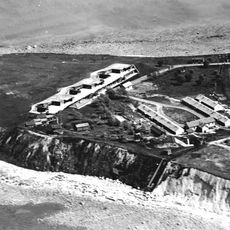
Harbor Defenses of Boston was a network of multiple forts, artillery positions, and underwater minefields that guarded the entrance to Boston Harbor. The system connected several islands and coastal points together, using the natural geography of the bay.

These defenses were built in the late 1800s to protect Boston from potential attacks and remained active until around 1950. During World War I, troops and guns were relocated to support military operations in other theaters.

The forts served as training grounds where officers and soldiers experienced military discipline for the first time in their careers. These installations shaped daily military life and brought together different generations of service members.

Visitors can explore several preserved forts among the Boston Harbor Islands, particularly Fort Warren on Georges Island. The islands are reached by ferry, and it helps to wear comfortable shoes and bring water.

The defenses featured special disappearing gun carriages that would lower themselves behind concrete walls after each shot, making them nearly invisible to attacking ships. This technology was groundbreaking for its time and made the forts extremely difficult to bombard.

The community of curious travelers

AroundUs brings together thousands of curated places, local tips, and hidden gems, enriched daily by 60,000 contributors worldwide.

Start exploring
GPS coordinates
42.38417,-70.98028
Latest update
December 11, 2025 11:06
Around this place
Revere Beach
United States of America

Revere Beach

2.8 km
Belle Isle Marsh Reservation
United States of America

Belle Isle Marsh Reservation

995 m
Cyclone
United States of America

Cyclone

4 km
Fort Heath
United States of America

Fort Heath

1.1 km
Chelsea Street Bridge
United States of America

Chelsea Street Bridge

3.5 km
Constitution Beach
United States of America

Constitution Beach

2.5 km
Lightning
United States of America

Lightning

4 km
Derby Racer
United States of America

Derby Racer

4 km
Deane Winthrop House
United States of America

Deane Winthrop House

245 m
Yirrell Beach
United States of America

Yirrell Beach

2.6 km
Rumney Marsh Burying Ground
United States of America

Rumney Marsh Burying Ground

3.4 km
Temple Ohabei Shalom Cemetery
United States of America

Temple Ohabei Shalom Cemetery

2.8 km
Mary Ellen Welch Greenway
United States of America

Mary Ellen Welch Greenway

4.2 km
Winthrop Shore Drive
United States of America

Winthrop Shore Drive

1.8 km
Christina and John Markey Memorial Pedestrian Bridge
United States of America

Christina and John Markey Memorial Pedestrian Bridge

3.4 km
Winthrop Parkway
United States of America

Winthrop Parkway

807 m
Church of Christ
United States of America

Church of Christ

3.5 km
Baker Congregational Church
United States of America

Baker Congregational Church

3 km
Bennington Street Burying Ground
United States of America

Bennington Street Burying Ground

3.4 km
Immaculate Conception Rectory
United States of America

Immaculate Conception Rectory

3.6 km
Columbus Monument
United States of America

Columbus Monument

4.1 km
Highland School
United States of America

Highland School

597 m
Bellingham-Cary House
United States of America

Bellingham-Cary House

4.2 km
James O. Conway Memorial
United States of America

James O. Conway Memorial

1.8 km
Edward B. Newton School
United States of America

Edward B. Newton School

955 m
Winthrop Center/Metcalf Square Historic District
United States of America

Winthrop Center/Metcalf Square Historic District

877 m
Orient Heights Beach
United States of America

Orient Heights Beach

2.5 km
Pico Beach
United States of America

Pico Beach

1.7 km
Show the full map
Reviews
Share your experience

No review yet

Discussions
Start a discussion...

No discussion yet

« Harbor Defenses of Boston - Military fortification network in Boston Harbor, Massachusetts » is provided by Around Us (aroundus.com). Images and texts are derived from Wikimedia project under a Creative Commons license. You are allowed to copy, distribute, and modify copies of this page, under the conditions set by the license, as long as this note is clearly visible.

Discover hidden gems everywhere you go!

From secret cafés to breathtaking viewpoints, skip the crowded tourist spots and find places that match your style. Our app makes it easy with voice search, smart filtering, route optimization, and insider tips from travelers worldwide. Download now for the complete mobile experience.

Around Us App Screenshot

A unique approach to discovering new places

Le Figaro

All the places worth exploring

France Info

A tailor-made excursion in just a few clicks

20 Minutes

Around Us
Travel Guide & Maps
Download

Send to your phone

QR Code
1

Open the camera app on your mobile.

2

Point at the QR code with your camera. A notification will appear.

3

Tap the notification to open the link.