Enable Location

We need your location to show you interesting places around you

Discover nearby places

Find interesting locations and hidden gems around you

Precise directions

Get accurate directions and distances to places

Your location is never shared with other users. It's only used when you tap the location button.

Christina and John Markey Memorial Pedestrian Bridge

Log in to your account

Start exploring — it's free

Trusted by 62,937 travelers worldwide

Continue with Google
Continue with Apple
or

We will send you a code to connect

By continuing, you accept our Terms and Conditions and our Privacy Policy

Check your inbox

We've sent a pincode in your inbox. Please enter the code below.

Christina and John Markey Memorial Pedestrian Bridge
Discussion Reviews 1 Photos
1.3k Popularity

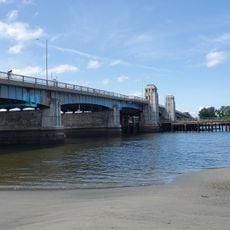
Christina and John Markey Memorial Pedestrian Bridge, Steel cable-stayed footbridge in Revere, Massachusetts.

The Christina and John Markey Memorial Pedestrian Bridge is a cable-stayed footbridge in Revere, Massachusetts. It crosses Ocean Avenue with distinctive outward-leaning towers and connects the Wonderland transit station directly to Revere Beach.

Construction of the bridge finished in 2011 after many years of planning and community discussions. Funding came from a 2009 federal stimulus bill and additional state grants that supported the project's completion.

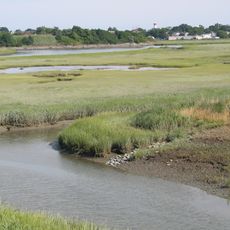
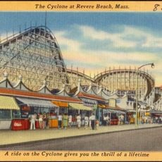
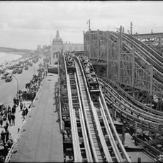
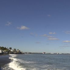
The bridge connects the Wonderland transit station to Revere Beach, which holds distinction as the first public beach established in the United States.

The walkway spans about 12 feet wide and is made of concrete designed to handle harsh coastal conditions. Visitors should expect wind and spray when weather is rough, especially during storms or high tides.

The design comes from Miguel Rosales, the architect behind Boston's well-known Zakim Bridge. The two towers lean outward at an unusual angle and create a dramatic gateway effect when approaching the ocean.

The community of curious travelers

AroundUs brings together thousands of curated places, local tips, and hidden gems, enriched daily by 60,000 contributors worldwide.

Start exploring
Location
GPS coordinates
42.41340,-70.99030
Latest update
December 14, 2025 18:14
Around this place
Revere Beach
United States of America

Revere Beach

621 m
United States of America

River Works

4.6 km
Belle Isle Marsh Reservation
United States of America

Belle Isle Marsh Reservation

2.7 km
Cyclone
United States of America

Cyclone

815 m
Fort Heath
United States of America

Fort Heath

3.2 km
Chelsea Street Bridge
United States of America

Chelsea Street Bridge

4 km
Lightning
United States of America

Lightning

815 m
Derby Racer
United States of America

Derby Racer

815 m
Deane Winthrop House
United States of America

Deane Winthrop House

3.6 km
Revere Beach Parkway
United States of America

Revere Beach Parkway

4.6 km
Franklin Park
United States of America

Franklin Park

3.3 km
Congregation Agudath Shalom
United States of America

Congregation Agudath Shalom

4.5 km
Rumney Marsh Burying Ground
United States of America

Rumney Marsh Burying Ground

1.4 km
Temple Ohabei Shalom Cemetery
United States of America

Temple Ohabei Shalom Cemetery

4 km
Bellingham Square Historic District
United States of America

Bellingham Square Historic District

4.2 km
C. Henry Kimball House
United States of America

C. Henry Kimball House

3.9 km
Winthrop Parkway
United States of America

Winthrop Parkway

2.6 km
Church of Christ
United States of America

Church of Christ

1.5 km
Baker Congregational Church
United States of America

Baker Congregational Church

4 km
Bennington Street Burying Ground
United States of America

Bennington Street Burying Ground

4.4 km
Immaculate Conception Rectory
United States of America

Immaculate Conception Rectory

1.9 km
Columbus Monument
United States of America

Columbus Monument

931 m
Highland School
United States of America

Highland School

3.5 km
Bellingham-Cary House
United States of America

Bellingham-Cary House

3.5 km
James O. Conway Memorial
United States of America

James O. Conway Memorial

3.5 km
Edward B. Newton School
United States of America

Edward B. Newton School

4.1 km
Winthrop Center/Metcalf Square Historic District
United States of America

Winthrop Center/Metcalf Square Historic District

4.1 km
General Edwards Bridge
United States of America

General Edwards Bridge

3.9 km
Show the full map
Reviews
Share your experience

No review yet

Discussions
Start a discussion...

No discussion yet

« Christina and John Markey Memorial Pedestrian Bridge - Steel cable-stayed footbridge in Revere, Massachusetts » is provided by Around Us (aroundus.com). Images and texts are derived from Wikimedia project under a Creative Commons license. You are allowed to copy, distribute, and modify copies of this page, under the conditions set by the license, as long as this note is clearly visible.

Discover hidden gems everywhere you go!

From secret cafés to breathtaking viewpoints, skip the crowded tourist spots and find places that match your style. Our app makes it easy with voice search, smart filtering, route optimization, and insider tips from travelers worldwide. Download now for the complete mobile experience.

Around Us App Screenshot

A unique approach to discovering new places

Le Figaro

All the places worth exploring

France Info

A tailor-made excursion in just a few clicks

20 Minutes

Around Us
Travel Guide & Maps
Download

Send to your phone

QR Code
1

Open the camera app on your mobile.

2

Point at the QR code with your camera. A notification will appear.

3

Tap the notification to open the link.