Chiribaya culture, Archaeological site in southern Peru
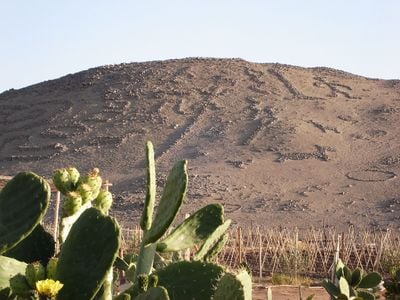
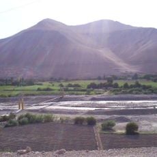
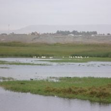
The Chiribaya culture was a coastal civilization in southern Peru that spread across hundreds of kilometers of Pacific coastline between the Osmore and Tambo river valleys. The remains show settlements with residential structures, burial grounds, and agricultural terraces that reveal how people managed life in this dry environment.
This civilization emerged around 700 CE and continued until about 1476 CE when the Inca Empire expanded into the region. During these centuries, people developed complex water systems to grow crops in the dry coastal environment and traded goods across the southern coast.
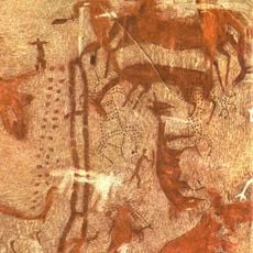
Archaeological excavations have revealed intricate pottery, textiles, and tools that demonstrate the technical capabilities and artistic expressions of the Chiribaya people.
Visitors encounter ruins, burial grounds, and ancient fields spread across a wide area and accessible via footpaths. The terrain is open and exposed to sun, so bring water and wear appropriate protection from the heat.
Archaeologists uncovered 43 mummified dogs in a burial ground here, each placed with blankets and food remains. This discovery shows that dogs held special value in this society and likely played important roles in managing herds.
GPS coordinates: -18.00000,-71.00000
Latest update: December 18, 2025 11:40
Toquepala Caves
83 km
Morro de Arica
89.3 km
Parabolic Arch of Tacna
79.3 km
Caplina River
89.2 km
St. Mark's Cathedral
89.4 km
Osmore River
55.6 km
Península del Alacrán
88.6 km
Tacna Ornamental Fountain
79.3 km
Casa Bolognesi
89.5 km
Estadio Jorge Basadre
79.1 km
Playa Chinchorro
89.7 km
Mosque Bab ul Islam
78.7 km
Arica House of Culture
89.3 km
Museo Histórico y de Armas del Morro de Arica
89.2 km
Playa La Lisera
90 km
Municipal Theatre of Tacna
79.5 km
Iglesia de San Jerónimo de Ilo
53.7 km
Casino de Juegos de Arica
89.6 km
House Yanulaque
89.9 km
Tacna Prefecture
79.2 km
Monumento al soldado desconocido, Arica
89.2 km
Playa Las Machas
88.8 km
Phare Concordia
78.2 km
Phare de la péninsule du Scorpion
88.5 km
Cristo de la Concordia, Arica
89.2 km
Settlement and Artificial Mummification of the Chinchorro Culture in the Arica and Parinacota Region
89.5 km
Humedal de la desembocadura del Río Lluta
85 km
Cuartel n.º 1 del Regimiento Reforzado n.º 4 “Rancagua” de Arica
89.9 kmVisited this place? Tap the stars to rate it and share your experience / photos with the community! Try now! You can cancel it anytime.
Discover hidden gems everywhere you go!
From secret cafés to breathtaking viewpoints, skip the crowded tourist spots and find places that match your style. Our app makes it easy with voice search, smart filtering, route optimization, and insider tips from travelers worldwide. Download now for the complete mobile experience.
A unique approach to discovering new places❞
— Le Figaro
All the places worth exploring❞
— France Info
A tailor-made excursion in just a few clicks❞
— 20 Minutes