Chest opened
+${chestReward.xp} XP
Explorer
NOUVEAU ×${chestReward.collectible.quantity}
tapez pour fermer

See the monuments around you in AR Open chests in the app

Around Us is built for your phone — point your camera at the streets and discover the monuments and places around you in augmented reality. Around Us is built for your phone — chests unlock when you walk, explore and capture nearby places.

•

Enable Location

We need your location to show you interesting places around you

Discover nearby places

Find interesting locations and hidden gems around you

Precise directions

Get accurate directions and distances to places

Your location is never shared with other users. It's only used when you tap the location button.

Las Cumbres

Log in to your account

Start exploring — it's free

Trusted by 92,783 travelers worldwide

Continue with Google
Continue with Apple
or

We will send you a code to connect

By continuing, you accept our Terms and Conditions and our Privacy Policy

Check your inbox

We've sent a pincode in your inbox. Please enter the code below.

Las Cumbres

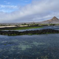
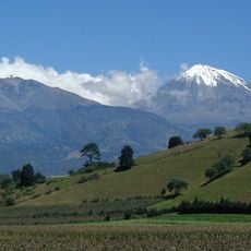
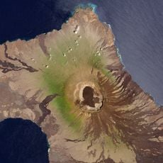
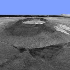
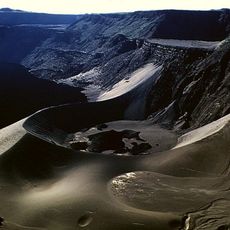
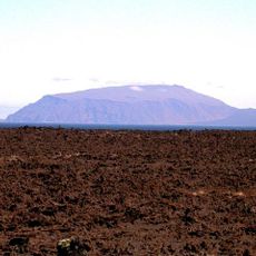
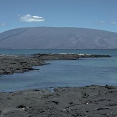
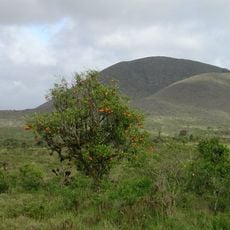
Las Cumbres, Shield volcano on Fernandina Island, Ecuador.

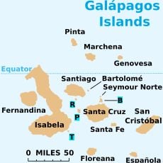
Las Cumbres is a shield volcano on Fernandina Island that rises to 1476 meters above sea level with a broad, gently sloping form. Its structure consists of many layers of basaltic lava flows stacked upon one another.

On 14 February 1825, Captain Benjamin Morrell, anchored in Banks Bay, recorded one of the largest eruptions in Galápagos history at Fernandina; his ship escaped and his account survived. The caldera floor has collapsed several times, often after explosive eruptions. Fissure eruptions struck the southern flank in April 2009 and the north-northeast flank on 16 June 2018, and the volcano erupted again in January 2020 and March 2024.

Because Fernandina has no human residents, La Cumbre's eruptions are often noticed late: park rangers and a passing tourist boat first sighted the April 2009 fissure eruption at 10:00 p.m. local time on April 10. The seismic station at Puerto Ayora on Santa Cruz recorded no earthquakes linked to that event.

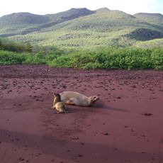
Fernandina has no human residents and no visitor sites on land, so La Cumbre is seen from the sea rather than climbed. Tour boats crossing the western archipelago pass Banks Bay, where Captain Benjamin Morrell anchored in 1825. Because the island is uninhabited, eruptions are sometimes first spotted from a passing boat or by park rangers, as happened at 10 p.m. local time on 10 April 2009.

The 1825 eruption witnessed by Captain Benjamin Morrell from Banks Bay is among the largest recorded in Galápagos history; his ship escaped and his written account survives. Fernandina has no human residents, so eruptions threaten only the island's wildlife, and the sparse western population means activity is not always reported at once.

The community of curious travelers

AroundUs brings together thousands of curated places, local tips, and hidden gems, enriched daily by 92,783 contributors worldwide.

Start exploring
Elevation above the sea
1,476 m
Made from material
basalt
Part of
Fernandina Island
GPS coordinates
-0.37000,-91.54333
Latest update
October 24, 2026 19:41
Reviews
Share your experience

No review yet

Discussions
Start a discussion...

No discussion yet

« Las Cumbres - Shield volcano on Fernandina Island, Ecuador » is provided by Around Us (aroundus.com). Images and texts are derived from Wikimedia project under a Creative Commons license. You are allowed to copy, distribute, and modify copies of this page, under the conditions set by the license, as long as this note is clearly visible.

Discover hidden gems everywhere you go!

From secret cafés to breathtaking viewpoints, skip the crowded tourist spots and find places that match your style. Our app makes it easy with voice search, smart filtering, route optimization, and insider tips from travelers worldwide. Download now for the complete mobile experience.
Around Us App Screenshot
❝

A unique approach to discovering new places❞

— Le Figaro

❝

All the places worth exploring❞

— France Info

❝

A tailor-made excursion in just a few clicks❞

— 20 Minutes

Around Us
Travel Guide & Maps
Download

Send to your phone

QR Code
1

Open the camera app on your mobile.

2

Point at the QR code with your camera. A notification will appear.

3

Tap the notification to open the link.