Chest opened
+${chestReward.xp} XP
Explorer
NOUVEAU ×${chestReward.collectible.quantity}
tapez pour fermer

See the monuments around you in AR Open chests in the app

Around Us is built for your phone — point your camera at the streets and discover the monuments and places around you in augmented reality. Around Us is built for your phone — chests unlock when you walk, explore and capture nearby places.

•

Enable Location

We need your location to show you interesting places around you

Discover nearby places

Find interesting locations and hidden gems around you

Precise directions

Get accurate directions and distances to places

Your location is never shared with other users. It's only used when you tap the location button.

Wādī Ghalīlah

Log in to your account

Start exploring — it's free

Trusted by 92,754 travelers worldwide

Continue with Google
Continue with Apple
or

We will send you a code to connect

By continuing, you accept our Terms and Conditions and our Privacy Policy

Check your inbox

We've sent a pincode in your inbox. Please enter the code below.

Wādī Ghalīlah

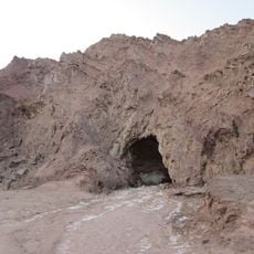
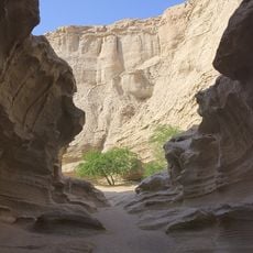
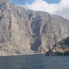
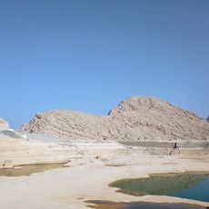
Wādī Ghalīlah, Valley system in Ras Al Khaimah, United Arab Emirates.

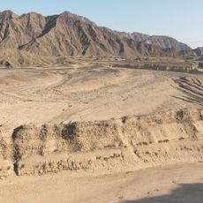
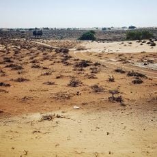
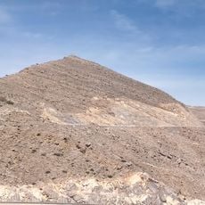
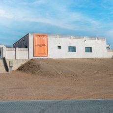
Wadi Ghalilah is a dry river valley in the Emirate of Ras Al Khaimah, formed where the Wadi Litibah and Wadi Barut meet. At that confluence stands the Wadi Ghalilah Dam, 420 metres wide and 6 metres high, built in 2001. From the dam the wadi runs east to west, dropping 140 metres over 10 km to its mouth on the Persian Gulf.

The wadi's name and those of its tributaries Wadi Litibah and Wadi Barut were recorded between 1950 and 1960 by the British Arabist and cartographer Julian F. Walker during border work between the Trucial States, later completed by the UK Ministry of Defence on 1:100,000 maps published in 1971. Earlier, John Gordon Lorimer (1870–1914) referred to Ghalilah in his encyclopedic work on the tribes of the Musandam Peninsula. The area was historically inhabited by the semi-nomadic Shihuh, notably the Bani Shatair and Bani Hadiyah sections.

The wadi and its tributaries were mapped between 1950 and 1960 by the British diplomat and cartographer Julian F. Walker during border work between the Trucial States. The semi-nomadic Shihuh tribe, section of Bani Shatair, lived in the tribal areas of Mahabib, Rahabah, Bani Sa'ad and Hammad, while Bani Hadiyah occupied Ahl Sayh. The name Ghalilah is also used for the whole drainage basin and for postal purposes, so tributaries such as Wadi Litibah and Wadi Barut are often wrongly called Wadi Ghalilah.

This valley is best explored with a sturdy vehicle, as the tracks are rough and can become impassable during rain. It helps to check weather forecasts before visiting and bring plenty of water, since shade is limited in the area.

The Wadi Ghalilah Dam, built in 2001 at the confluence of the Wadi Litibah and Wadi Barut, is 420 metres wide and 6 metres high. Its main purpose is to recharge groundwater and reduce flood damage. The wadi's drainage sub-basin covers 76.32 km², and the name is often wrongly applied to its tributaries, including Wadi Halhal and Wadi Khabb.

The community of curious travelers

AroundUs brings together thousands of curated places, local tips, and hidden gems, enriched daily by 92,754 contributors worldwide.

Start exploring
GPS coordinates
25.96917,56.09333
Latest update
October 24, 2026 19:52
Reviews
Share your experience

No review yet

Discussions
Start a discussion...

No discussion yet

« Wādī Ghalīlah - Valley system in Ras Al Khaimah, United Arab Emirates » is provided by Around Us (aroundus.com). Images and texts are derived from Wikimedia project under a Creative Commons license. You are allowed to copy, distribute, and modify copies of this page, under the conditions set by the license, as long as this note is clearly visible.

Discover hidden gems everywhere you go!

From secret cafés to breathtaking viewpoints, skip the crowded tourist spots and find places that match your style. Our app makes it easy with voice search, smart filtering, route optimization, and insider tips from travelers worldwide. Download now for the complete mobile experience.
Around Us App Screenshot
❝

A unique approach to discovering new places❞

— Le Figaro

❝

All the places worth exploring❞

— France Info

❝

A tailor-made excursion in just a few clicks❞

— 20 Minutes

Around Us
Travel Guide & Maps
Download

Send to your phone

QR Code
1

Open the camera app on your mobile.

2

Point at the QR code with your camera. A notification will appear.

3

Tap the notification to open the link.