
Maruf District, district of Afghanistan
Location: Kandahar
Elevation above the sea: 2,024 m
GPS coordinates: 31.43833,67.03681
Latest update: April 19, 2025 22:07
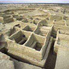
Mehrgarh
233 km
Quaid-e-Azam Residency
135 km
Shrine of the Cloak
127.7 km
Kandahar Bilingual Rock Inscription
131.8 km
Camp Rhino
262.1 km
Mundigak
152.3 km
Takht-e-Sulaiman
276.4 km
Tarnak Farms
115.2 km
Gomal Zam Dam
279.1 km
Ghazni Minarets
270.6 km
Kalat Kali Temple
271.6 km
Citadel of Ghazni
268.6 km
Pirak
235.2 km
Ziarat Juniper Forest
133.5 km
Tomb of Ahmad Shah Durrani
127.7 km
Palace of Sultan Mas'ud III
271.3 km
Main Operating Base Price
238.8 km
Chil Zena
131.8 km
Forward Operating Base Edinburgh
266.2 km
Band E Sardeh Dam
255.4 km
Quetta Cantonment
135.2 km
Mosque of the Hair of the Prophet
127.4 km
Forward Operating Base Arian
263.7 km
Quetta Fort
136.7 km
Lashkar Gah Mosque
253.6 km
Forward Operating Base Shawqat
266.2 km
Forward Operating Base Zeebrugge
218 km
Forward Operating Base Arnhem
252.8 kmReviews
Visited this place? Tap the stars to rate it and share your experience / photos with the community! Try now! You can cancel it anytime.
Discover hidden gems everywhere you go!
From secret cafés to breathtaking viewpoints, skip the crowded tourist spots and find places that match your style. Our app makes it easy with voice search, smart filtering, route optimization, and insider tips from travelers worldwide. Download now for the complete mobile experience.

A unique approach to discovering new places❞
— Le Figaro
All the places worth exploring❞
— France Info
A tailor-made excursion in just a few clicks❞
— 20 Minutes