Cojata District, Administrative district in Huancané Province, Puno Region, Peru
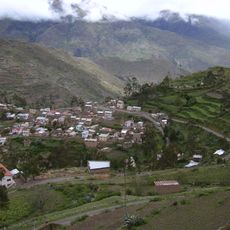
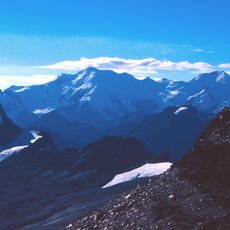
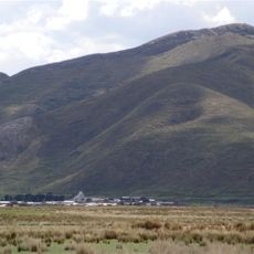
Cojata District covers approximately 881.18 square kilometers of high-altitude Andean terrain at an elevation of around 4,355 meters above sea level in the Puno region of southern Peru.
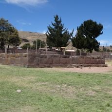
The district was officially established on October 1, 1857, during the early republican period of Peru and was historically known as Villa de las Nieves before adopting its current name.
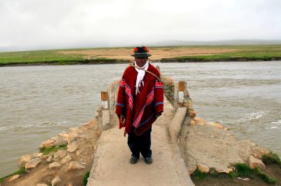
Local communities celebrate the Festivity of the Holy Cross each May with traditional activities including bullfighting events, while maintaining indigenous Quechua-speaking cultural practices that date back centuries.
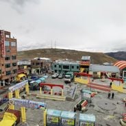
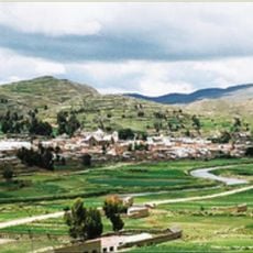
The district capital shares the name Cojata and uses postal code 21410, with access provided by local roads connecting to larger urban centers in Huancané and Puno provinces.
Cojata is recognized as the Capital of Alpaca Fiber Diversity, with local organizations producing alpaca fibers in up to 24 different natural shades for textile processing and economic development.
Location: Huancané
Address: Cojata, 21410, Peru
GPS coordinates: -15.01587,-69.35024
Latest update: November 27, 2025 07:31
This collection includes towns established above 3,000 meters altitude, mainly located in the Andes and on Asian highlands. These urban centers house several million inhabitants who live daily under conditions where oxygen is scarce. La Rinconada in Peru reaches 5,300 meters, making it the highest city in the world, while La Paz in Bolivia, at 3,639 meters, has over 1.6 million residents. Sites with historical significance such as Potosí in Bolivia, founded in the 16th century for its silver mines and now a UNESCO World Heritage site, and Lhasa in Tibet, the former capital of the Tibetan kingdom with dozens of Buddhist temples including the renowned Jokhang Temple, are included. Additionally, towns like Puno in Peru or Shigatse in China demonstrate human adaptation to extreme environments, creating communities of hundreds of thousands. These destinations offer a look into Andean and Himalayan cultures shaped by elevation and provide exceptional travel experiences.
Titicaca
90.1 km
Uros floating islands
111.4 km
Apachita
95.2 km
Titicaca National Reservation
101.2 km
Estadio Guillermo Briceño Rosamedina
99.1 km
Suches River
30.8 km
Apolobamba Integrated Management Natural Area
57.1 km
Chinkana
109.6 km
Iskanwaya
90.2 km
Santa Catalina de Siena
99.6 km
Templo de Santiago Apostol de Lampa
115.9 km
Inca Uyo
113.4 km
Qulu Qulu
79.3 km
Chaupi Orco
44.5 km
Pukarani
104 km
Intikancha
104.9 km
Puerto Acosta Municipality
57.4 km
Mocomoco Municipality
53 km
Puno Lighthouse
115.8 km
Jach'a Waracha
29.4 km
Machu Such'i Qhuchi
33.8 km
Chuma Municipality
71.2 km
Convento Franciscano de Juliaca
99.6 km
Monasterio Benedictino de la Resurrección de Chucuito
113.1 km
Bahía Kona
116.2 km
Palomani
35.3 km
Ch'uch'u
111.1 km
Jochihuata
110 kmReviews
Visited this place? Tap the stars to rate it and share your experience / photos with the community! Try now! You can cancel it anytime.
Discover hidden gems everywhere you go!
From secret cafés to breathtaking viewpoints, skip the crowded tourist spots and find places that match your style. Our app makes it easy with voice search, smart filtering, route optimization, and insider tips from travelers worldwide. Download now for the complete mobile experience.
A unique approach to discovering new places❞
— Le Figaro
All the places worth exploring❞
— France Info
A tailor-made excursion in just a few clicks❞
— 20 Minutes