Chest opened
+${chestReward.xp} XP
Explorer
NOUVEAU ×${chestReward.collectible.quantity}
tapez pour fermer
Chest locked

Open chests in the app

Around Us is built for your phone — chests unlock when you walk, explore and capture nearby places.

Enable Location

We need your location to show you interesting places around you

Discover nearby places

Find interesting locations and hidden gems around you

Precise directions

Get accurate directions and distances to places

Your location is never shared with other users. It's only used when you tap the location button.

Lurín River

Log in to your account

Start exploring — it's free

Trusted by 72,884 travelers worldwide

Continue with Google
Continue with Apple
or

We will send you a code to connect

By continuing, you accept our Terms and Conditions and our Privacy Policy

Check your inbox

We've sent a pincode in your inbox. Please enter the code below.

Lurín River
Discussion Reviews 1 Photos
8.9k Popularity

Lurín River, Andean river in Province of Huarochirí, Peru.

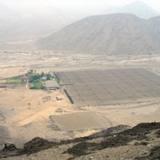
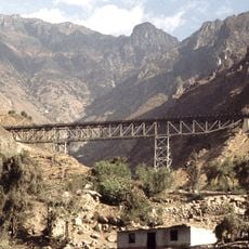
The Lurín River originates from glacial lagoons high in the western Andes and flows for about 108 kilometers through the Huarochirí Province. It travels through agricultural valleys before emptying into the Pacific Ocean.

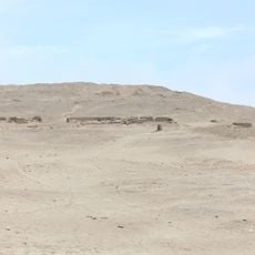
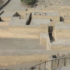
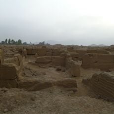
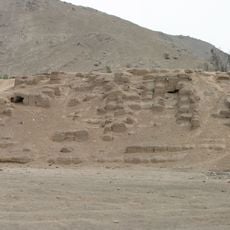
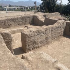
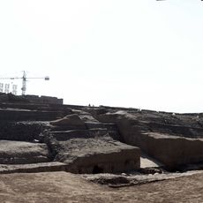
The Wari civilization built settlements along this river between 600 and 1100 AD and developed irrigation systems to harness its water. These early techniques shaped agricultural practices that would continue in the region for centuries.

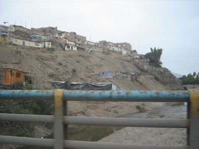
Local communities along the river rely on water management practices rooted in generations of agricultural knowledge. This waterway shapes how families cultivate their land and remains central to daily life in the region.

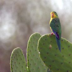
The river supplies irrigation water to farmland across multiple districts in the lowlands. Visitors can access the waterway at various points along its course to observe the agricultural areas that depend on its flow.

The waterway changes its name from Chalilla River to Lurín River at a specific junction where it merges with the Taquía creek. This naming boundary reflects how the river's character shifts as it joins with tributary water.

The community of curious travelers

AroundUs brings together thousands of curated places, local tips, and hidden gems, enriched daily by 60,000 contributors worldwide.

Start exploring
GPS coordinates
-12.03166,-76.62841
Latest update
December 10, 2025 16:00
Reviews
Share your experience

No review yet

Discussions
Start a discussion...

No discussion yet

« Lurín River - Andean river in Province of Huarochirí, Peru » is provided by Around Us (aroundus.com). Images and texts are derived from Wikimedia project under a Creative Commons license. You are allowed to copy, distribute, and modify copies of this page, under the conditions set by the license, as long as this note is clearly visible.

Discover hidden gems everywhere you go!

From secret cafés to breathtaking viewpoints, skip the crowded tourist spots and find places that match your style. Our app makes it easy with voice search, smart filtering, route optimization, and insider tips from travelers worldwide. Download now for the complete mobile experience.

Around Us App Screenshot

A unique approach to discovering new places

Le Figaro

All the places worth exploring

France Info

A tailor-made excursion in just a few clicks

20 Minutes

Around Us
Travel Guide & Maps
Download

Send to your phone

QR Code
1

Open the camera app on your mobile.

2

Point at the QR code with your camera. A notification will appear.

3

Tap the notification to open the link.