Enable Location

We need your location to show you interesting places around you

Discover nearby places

Find interesting locations and hidden gems around you

Precise directions

Get accurate directions and distances to places

Your location is never shared with other users. It's only used when you tap the location button.

Log in to your account

Start exploring — it's free

Trusted by 62,869 travelers worldwide

Continue with Google
Continue with Apple
or

We will send you a code to connect

By continuing, you accept our Terms and Conditions and our Privacy Policy

Check your inbox

We've sent a pincode in your inbox. Please enter the code below.

Pichari District

Pichari District, Administrative district in La Convención Province, Peru.

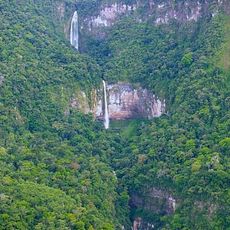
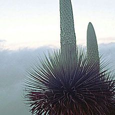
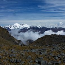
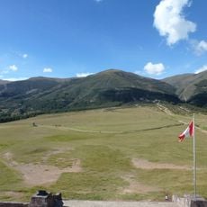
Pichari District is an administrative division in La Convención Province that encompasses varied terrain stretching from higher elevations to forested lowlands. The landscape transitions from mountain features characteristic of the Andes to zones approaching the Amazon basin.

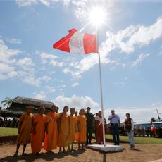
The district was established in 1995 as a separate administrative unit following broader reorganization efforts in La Convención Province. This administrative change reshaped local governance structures in the region.

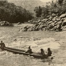
Asháninka, Machiguenga, Yine, and Quechua communities live in the district and use their traditional languages alongside Spanish in daily life. This language diversity shapes social interactions and reflects the area's cultural layers.

The area is accessible from Cusco via multiple routes passing through different elevations and terrain types. The dry season offers better road conditions for travel within and around the district.

The district straddles an ecological boundary where coffee cultivation thrives in upper zones while tropical forest resources exist in lower elevations. This geographic position creates a meeting point of two distinctly different ecosystems.

The community of curious travelers

AroundUs brings together thousands of curated places, local tips, and hidden gems, enriched daily by 60,000 contributors worldwide.

Start exploring
Capital city
Pichari
Elevation above the sea
614 m
Shares border with
Río Tambo District, Kimbiri District, Ayna District, Sivia District, Llochegua District, Canayre
GPS coordinates
-12.51973,-73.82949
Latest update
December 7, 2025 19:25
« Pichari District - Administrative district in La Convención Province, Peru » is provided by Around Us (aroundus.com). Images and texts are derived from Wikimedia project under a Creative Commons license. You are allowed to copy, distribute, and modify copies of this page, under the conditions set by the license, as long as this note is clearly visible.

Discover hidden gems everywhere you go!

From secret cafés to breathtaking viewpoints, skip the crowded tourist spots and find places that match your style. Our app makes it easy with voice search, smart filtering, route optimization, and insider tips from travelers worldwide. Download now for the complete mobile experience.

Around Us App Screenshot

A unique approach to discovering new places

Le Figaro

All the places worth exploring

France Info

A tailor-made excursion in just a few clicks

20 Minutes

Around Us
Travel Guide & Maps
Download

Send to your phone

QR Code
1

Open the camera app on your mobile.

2

Point at the QR code with your camera. A notification will appear.

3

Tap the notification to open the link.