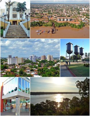
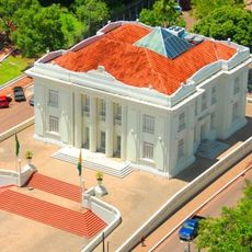
Porto Velho, Capital city in Rondônia, Brazil
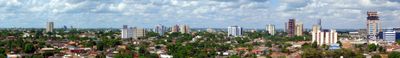
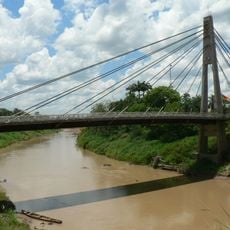
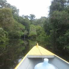
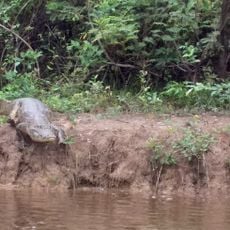
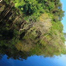
Porto Velho is a capital city in Rondônia state, Brazil, stretching along the eastern bank of the Madeira River. The city spreads across a wide area in the western part of the country and sits at an elevation of 122 meters (400 feet).
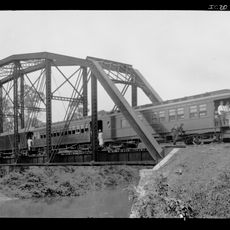
The city was founded in 1914 during the Amazon rubber boom as a base for building the Madeira-Mamoré railway. This rail line was intended to connect Brazil with Bolivia and facilitate trade between the two countries.
The name refers to an old port that once served as a stopping point for steamships traveling along the river. Today the city connects Brazilian and Bolivian influences visible in local markets and daily trade.
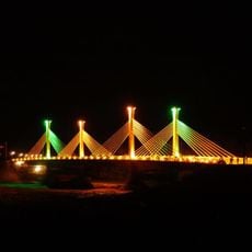
The city connects by road to Manaus, Rio Branco, and São Paulo, while the airport offers flights within the Amazon region. Most services and commerce concentrate in the central area along main streets near the river.
The city serves as an extraction point for cassiterite and gold from the Madeira River, supporting regional mining activity. Some sections of the riverbank still show traces of old railway infrastructure from the founding era.
Location: Rondônia
Inception: 1914
Elevation above the sea: 122 m
Shares border with: Lábrea, Nova Mamoré, Buritis, Acrelândia, Alto Paraíso, Candeias do Jamari, Canutama, Cujubim, Humaitá, Itapuã do Oeste, Machadinho d'Oeste
Website: http://portovelho.ro.gov.br
GPS coordinates: -8.76194,-63.90389
Latest update: December 4, 2025 19:03
Madeira-Mamoré Railroad
882 m
Tambopata National Reserve
748.2 km
Fort Prince of Beira
411.9 km
Noel Kempff Mercado National Park
694 km
Chalalan
766.5 km
Palácio Rio Branco
449.7 km
President Guillermo Billinghurst Bridge
716.8 km
Pacaás Novos National Park
272 km
Manuripi-Heath Amazonian Wildlife National Reserve
576.8 km
Catarata Arco Iris
645.2 km
Wilson Pinheiro Binational Bridge
587.8 km
Iturralde Crater
592.8 km
Museu da Borracha Governador Geraldo Mesquita
449.5 km
Acre geoglyphs
729 km
Juruena National Park
642.3 km
Chico Mendes' house
448.2 km
Campos Amazônicos National Park
267.5 km
Estádio José de Melo
449.3 km
Ríos Blanco y Negro Wildlife Reserve
683.9 km
Mapinguari National Park
61.3 km
Brazil-Peru Integration Bridge
667.8 km
Municipal Protected Area Pampas of the Yacuma River
653.1 km
Casarabe culture
682.9 km
Estádio Antônio Aquino Lopes
454.7 km
Chandless State Park
722.8 km
Juma Sustainable Development Reserve
499.4 km
Médio Juruá Extractive Reserve
551 km
Bajo Paraguá Municipal Protected Area
683.3 kmReviews
Visited this place? Tap the stars to rate it and share your experience / photos with the community! Try now! You can cancel it anytime.
Discover hidden gems everywhere you go!
From secret cafés to breathtaking viewpoints, skip the crowded tourist spots and find places that match your style. Our app makes it easy with voice search, smart filtering, route optimization, and insider tips from travelers worldwide. Download now for the complete mobile experience.
A unique approach to discovering new places❞
— Le Figaro
All the places worth exploring❞
— France Info
A tailor-made excursion in just a few clicks❞
— 20 Minutes