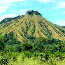
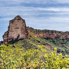
Serra das Andorinhas, Mountain range in São Geraldo do Araguaia, Brazil.
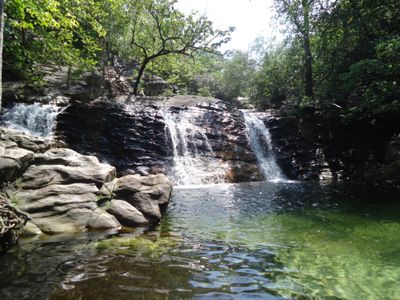
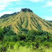
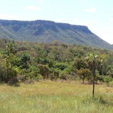
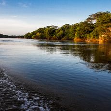
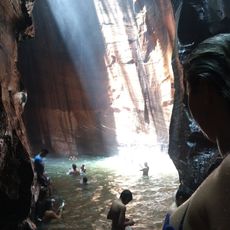
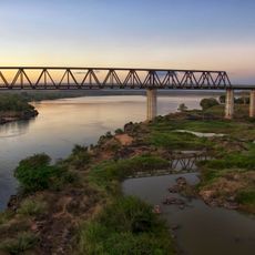
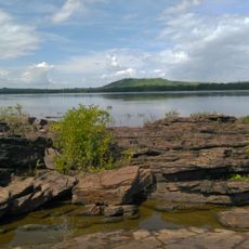
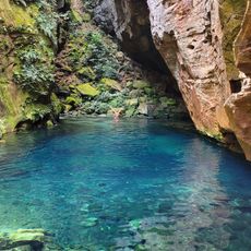
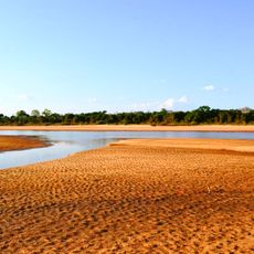
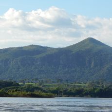
Serra das Andorinhas is a mountain range in southern Pará that runs along the Araguaia River with varied geological formations. The area contains numerous caves, grottoes, and rock formations that visitors can explore through established hiking trails.
The area has been inhabited since ancient times, as shown by archaeological finds in its caves including cave paintings and pottery. These traces point to early cultures that used and settled this rock landscape.
Local people pass down stories and beliefs tied to this place, especially the tale of the legendary Martírios gold mines that still shapes how communities understand their land.
The area is accessible via marked trails that lead to various caves and rock formations. Visitors should bring plenty of water and wear sturdy shoes, as paths are uneven and sometimes steep.
The area is a nesting ground for many bird species that breed in the rock crevices and caves, which inspired the region's name. The name refers to the swallows that are especially present here and shape the landscape's character.
Location: Pará
GPS coordinates: -6.15194,-48.55222
Latest update: December 6, 2025 19:07
Northern Brazil holds a range of natural areas and historical sites away from the usual tourist paths. The region stretches from the Amazon basin to the wide plateaus of the Cerrado, offering waterfalls, clear springs, sand dunes, canyons, and caves. Protected areas such as Jalapão State Park and...
Jalapão
485.9 km
Chapada das Mesas National Park
182.3 km
Marabá Combined Bridge
109.9 km
Nascentes do Rio Parnaíba National Park
485.2 km
Poço Azul
260.9 km
Cantão State Park
427.8 km
Araguaia Palace
449.6 km
Pedra Caida
157.9 km
Carajás National Forest
179.7 km
Estádio Municipal Zinho de Oliveira
110.2 km
Museu Histórico do Tocantins
449.1 km
Monumento das Castanheiras Mortas
85.1 km
Lajeado State Park
440.9 km
Gurupi Biological Reserve
332.9 km
Serra do Pardo National Park
484.6 km
Ponte Juscelino Kubitschek de Oliveira
129.1 km
Puente Ferroviario de Estreito MA
129.1 km
São Geraldo do Araguaia Environmental Protection Area
21.4 km
Cathedral of the Divine Holy Spirit in Palmas
449.7 km
Tapirapé Biological Reserve
236.4 km
Encanto Azul
265.4 km
Ilha do Bananal / Cantão Environmental Protection Area
404.6 km
Serra dos Martírios/Andorinhas State Park
2.8 km
St. Therese Cathedral, Bacabal
470.3 km
Biblioteca Pública Municipal Orlando Lima Lobo
110.3 km
Cajàzeira River
172.4 km
Cachoeira da Velha
493 km
Serra da Catedral do Jalapão
479.8 kmVisited this place? Tap the stars to rate it and share your experience / photos with the community! Try now! You can cancel it anytime.
Discover hidden gems everywhere you go!
From secret cafés to breathtaking viewpoints, skip the crowded tourist spots and find places that match your style. Our app makes it easy with voice search, smart filtering, route optimization, and insider tips from travelers worldwide. Download now for the complete mobile experience.
A unique approach to discovering new places❞
— Le Figaro
All the places worth exploring❞
— France Info
A tailor-made excursion in just a few clicks❞
— 20 Minutes