·

Enable Location

We need your location to show you interesting places around you

Discover nearby places

Find interesting locations and hidden gems around you

Precise directions

Get accurate directions and distances to places

Your location is never shared with other users. It's only used when you tap the location button.

West Rand District Municipality

Log in to your account

Start exploring — it's free

Trusted by 62,658 travelers worldwide

Continue with Google
Continue with Apple
or

We will send you a code to connect

By continuing, you accept our Terms and Conditions and our Privacy Policy

Check your inbox

We've sent a pincode in your inbox. Please enter the code below.

West Rand District Municipality, District municipality in Gauteng, South Africa

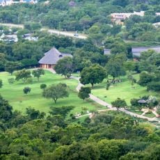
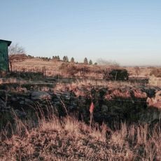
West Rand District Municipality is an administrative area in western Gauteng encompassing three local municipalities: Mogale City, Rand West City, and Merafong City. The district covers approximately 4,087 square kilometers with a mix of urban and rural communities.

The district was established in 2000 as part of South Africa's restructuring of local government systems. This reorganization aimed to improve regional administration and make service delivery more efficient.

The district is home to speakers of Tswana, Afrikaans, Xhosa, and Sotho languages, representing different communities across the region. This linguistic diversity shapes daily life and local traditions throughout the area.

National roads N12 and N14 provide good connections to major economic centers from the district. Randfontein serves as the main administrative hub for the area.

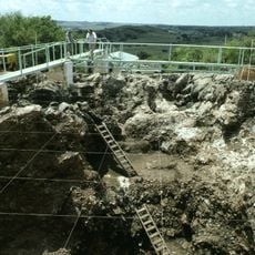
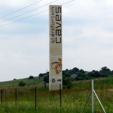
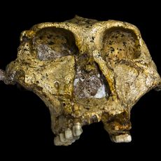
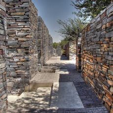
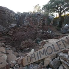
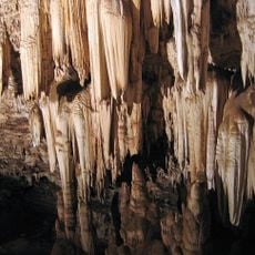
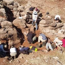
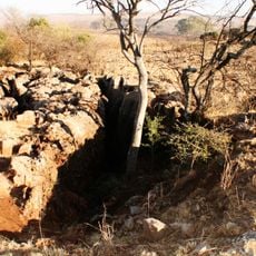
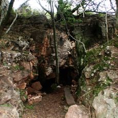
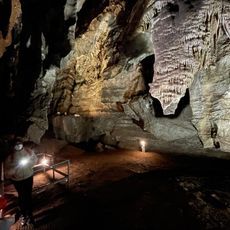
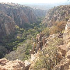
The district contains portions of the Cradle of Humankind World Heritage Site, which holds major archaeological discoveries. Fossil remains spanning millions of years are found particularly within Mogale City's territory.

The community of curious travelers

AroundUs brings together thousands of curated places, local tips, and hidden gems, enriched daily by 60,000 contributors worldwide.

Start exploring
Location
Inception
December 5, 2000
Capital city
Randfontein
Elevation above the sea
1,681 m
Shares border with
City of Tshwane Metropolitan Municipality, City of Johannesburg Metropolitan Municipality, Sedibeng District Municipality, Dr Kenneth Kaunda District Municipality, Bojanala Platinum District Municipality
GPS coordinates
-26.25000,27.50000
Latest update
December 7, 2025 19:28
« West Rand District Municipality - District municipality in Gauteng, South Africa » is provided by Around Us (aroundus.com). Images and texts are derived from Wikimedia project under a Creative Commons license. You are allowed to copy, distribute, and modify copies of this page, under the conditions set by the license, as long as this note is clearly visible.

Discover hidden gems everywhere you go!

From secret cafés to breathtaking viewpoints, skip the crowded tourist spots and find places that match your style. Our app makes it easy with voice search, smart filtering, route optimization, and insider tips from travelers worldwide. Download now for the complete mobile experience.

Around Us App Screenshot

A unique approach to discovering new places

Le Figaro

All the places worth exploring

France Info

A tailor-made excursion in just a few clicks

20 Minutes

Around Us
Travel Guide & Maps
Download

Send to your phone

QR Code
1

Open the camera app on your mobile.

2

Point at the QR code with your camera. A notification will appear.

3

Tap the notification to open the link.